Armería | |
|---|---|
 Río Armería | |
 Coat of arms | |
| Motto: La tierra fertil con el esfuerzo firme | |
 Municipality of Armería in Colima | |
| Country | |
| State | Colima |
| Municipal seat | Ciudad de Armería |
| Municipality created | 1967 |
| Government | |
| • Municipal president | Diana Zepeda Figueroa |
| Area | |
| • Total | 341.6 km2 (131.9 sq mi) |
| Population (2010) | |
| • Municipality | 28,695 |
| • Seat | 15,923 |
| Time zone | UTC-6 (CST) |
| • Summer (DST) | UTC-5 (CDT) |
| INEGI code | 001 |
| Website | (in Spanish) Ayuntamiento de Armería |
| Source: Enciclopedia de los Municipios de México | |
Armería is a municipality in the south-central part of the Mexican state of Colima. Ciudad de Armería is a city and the seat of Armería municipality. The municipality reported 29,599 inhabitants in the 2015 census and has an area of 341.60 km² (131.89 sq mi).[1] Its municipal seat is Ciudad de Armería.[2]
Geography
Climate
| Climate data for Ciudad de Armería | |||||||||||||
|---|---|---|---|---|---|---|---|---|---|---|---|---|---|
| Month | Jan | Feb | Mar | Apr | May | Jun | Jul | Aug | Sep | Oct | Nov | Dec | Year |
| Mean daily maximum °C (°F) | 32.3 (90.1) |
32.4 (90.3) |
32.6 (90.7) |
33.0 (91.4) |
33.8 (92.8) |
34.2 (93.6) |
34.1 (93.4) |
34.3 (93.7) |
33.7 (92.7) |
33.8 (92.8) |
33.5 (92.3) |
32.9 (91.2) |
33.4 (92.1) |
| Mean daily minimum °C (°F) | 17.3 (63.1) |
16.5 (61.7) |
16.4 (61.5) |
17.3 (63.1) |
19.7 (67.5) |
22.3 (72.1) |
23 (73) |
22.5 (72.5) |
22.4 (72.3) |
22.1 (71.8) |
20.5 (68.9) |
18.7 (65.7) |
19.9 (67.8) |
| Average precipitation cm (inches) | 2.5 (1) |
0.51 (0.2) |
0.51 (0.2) |
0.25 (0.1) |
0.51 (0.2) |
9.7 (3.8) |
15 (5.9) |
14 (5.6) |
19 (7.4) |
9.4 (3.7) |
2.5 (1) |
1.3 (0.5) |
75 (29.7) |
| Source: Weatherbase[3] | |||||||||||||
Ciudad de Armería
Ciudad de Armería (Armería) is a city in the south-central part of the Mexican state of Colima. It serves as the municipal seat for the surrounding Armería Municipality. With a 2005 census population of 14,091, Ciudad de Armería is the fifth-largest community in the state in terms of population.[4][5]
Communities
Armeria has the following communities:[6]
- Los Reyes Zorrillos
- Cofradia de Juarez
- El Paraiso Balneario
- Cuyutlan
- Ninguno Rastro Municipal
- El Bajio
- San Jose
- Rincon de Lopez
- Gerardo Chavez
- Ninguno Club Cinegetico
- Augusto Gomez Villanueva Coalatilla
- El Manguito
Demographics
Although only around 100 Indigenous people, they speak Purepecha and Nahuatl.[6]
| Year | Pop. | ±% |
|---|---|---|
| 1910 | — | |
| 1921 | — | |
| 1930 | — | |
| 1940 | — | |
| 1950 | — | |
| 1960 | — | |
| 1970 | — | |
| 1980 | 21,847 | — |
| 1990 | 27,782 | +27.2% |
| 2000 | 28,574 | +2.9% |
| 2010 | 28,695 | +0.4% |
| 2015 | 29,599 | +3.2% |
| Source: INEGI, [6] | ||
Government
Municipal presidents
References
- ↑ "Número de habitantes". INEGI. Retrieved 2017-07-15.
- ↑ "Armería". Enciclopedia de los Municipios de México (in Spanish). INAFED. Archived from the original on 2007-09-30. Retrieved 2007-12-28.
- ↑ "Weatherbase: Historical Weather for Ciudad de Armería, Colima". Weatherbase. 2011. Retrieved on November 24, 2011.
- ↑ (in Spanish) Link to tables of population data from Census of 2005 Archived 2007-03-16 at the Wayback Machine, Instituto Nacional de Estadística, Geografía e Informática (INEGI). Accessed on line December 28, 2007.
- ↑ (in Spanish) Armería Archived September 30, 2007, at the Wayback Machine in the Enciclopedia de los Municipios de México. Accessed on line December 28, 2007.
- 1 2 3 "Municipios de Colima México" (in Spanish). Municipios de México. Retrieved 2017-07-28.
External links
- (in Spanish) H. Ayuntamiento de Armería, Col. municipal government web site.
- (in Spanish) Armería in the Enciclopedia de los Municipios de México.
18°56′10″N 103°57′54″W / 18.936°N 103.965°W
Colima (capital) | ||
| Municipalities (municipal seats) | 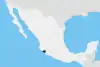 | |