| Babase | |
|---|---|
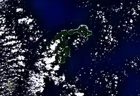 Feni Islands seen from space, with Ambitle (left) and Babase (right). | |
| Highest point | |
| Elevation | 200 m (660 ft) |
| Prominence | 200 m (660 ft) |
| Listing | |
| Coordinates | 4°2′S 153°43′E / 4.033°S 153.717°E |
| Dimensions | |
| Length | 10 km (6.2 mi) |
| Width | 5 km (3.1 mi) |
| Area | 23 km2 (8.9 sq mi) |
| Geography | |
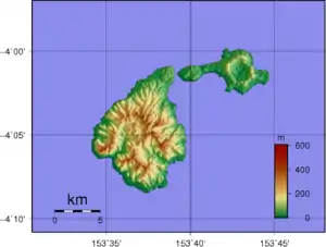 Topographic map of Feni Islands. Babase is on the right.
| |
| Location | Bismarck Archipelago, Papua New Guinea |
| Geology | |
| Mountain type | Stratovolcano |
| Last eruption | Unknown |
Babase Island is an island of the Feni Islands in Papua New Guinea, located east of New Ireland. It consists of a stratovolcano and a lava dome, joined by an isthmus.
References
This article is issued from Wikipedia. The text is licensed under Creative Commons - Attribution - Sharealike. Additional terms may apply for the media files.