| Bolshoye Toko | |
|---|---|
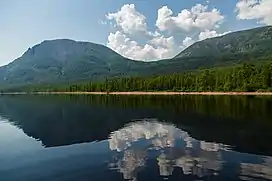 | |
 Bolshoye Toko 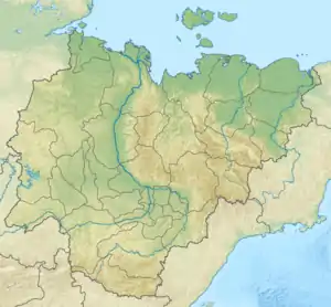 Bolshoye Toko | |
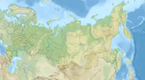
| Location | Sakha |
| Coordinates | 56°16′N 130°32′E / 56.267°N 130.533°E |
| Primary inflows | Utuk |
| Primary outflows | Mulam |
| Basin countries | Russia |
| Surface area | 82.6 km2 (31.9 sq mi) |
| Average depth | 42 m (138 ft) |
| Max. depth | 80 m (260 ft) |
| Surface elevation | 903 m (2,963 ft) |
The Bolshoye Toko (Russian: Большое Токо) is a lake in Sakha, Russia. It has a surface of 82.6 square kilometres (31+7⁄8 square miles) and a catchment area of 919 square kilometres (355 square miles). Its outflow is the Mulam river, part the Uchur River basin.[1] The lake is located in the Aldan Highlands, on the border of Sakha Republic and Khabarovsk Krai. River Utuk flows into the lake from the Toko-Stanovik subrange of the Stanovoy Highlands. It is the deepest lake in Yakutia.[2]
See also
References
- ↑ "Озеро Бол. Токо in the State Water Register of Russia". textual.ru (in Russian).
- ↑ Озеро Большое Токо и Хребет Токинский
External links
- Article in the Great Soviet Encyclopedia
This article is issued from Wikipedia. The text is licensed under Creative Commons - Attribution - Sharealike. Additional terms may apply for the media files.