Dobrush District
| |
|---|---|
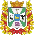
 Flag  Coat of arms | |
 Dobrush | |
| Coordinates: 52°25′N 31°19′E / 52.417°N 31.317°E | |
| Country | Belarus |
| Region | Gomel Region |
| Administrative center | Dobrush |
| Area | |
| • Total | 1,452.72 km2 (560.90 sq mi) |
| Population (2023)[1] | |
| • Total | 35,087 |
| • Density | 24/km2 (63/sq mi) |
| Time zone | UTC+3 (MSK) |
| Postal code | 247050 |
| Area code | +375 2333 |
| License plate | 3 |
Dobrush District or Dobruš District[2] (Belarusian: Добрушскі раён, romanized: Dobrušski rajon; Russian: Добрушский район) is a district (raion) of Gomel Region in Belarus. Its administrative center is Dobrush.[1]
The uninhabited Russian exclave Sankovo-Medvezhye is situated in the district.[3]
Administrative divisions
The Dobrush District is divided into 14 village council regions (Selsovets).
- Borschovsky
- Ivakovsky
- Kormyansky
- Krugovets-Kalininsky
- Krupetsky
- Kuzminichsky
- Leninist
- Nosovichsky
- Pererostovsky
- Rassvetovsky
- Terekhovsky
- Usoho-Budsky
- Utevsky
- Zhgunsky
Notable residents
- Cimoch Vostrykaǔ (in Belarusian Цімох Вострыкаў) (1922, Barščoŭka village - 2007), member of the anti-Soviet resistance, representative of the Rada of the Belarusian Democratic Republic, a Gulag prisoner [4][5]
References
- 1 2 "Численность населения на 1 января 2023 г. и среднегодовая численность населения за 2022 год по Республике Беларусь в разрезе областей, районов, городов, поселков городского типа". belsat.gov.by. Archived from the original on 17 April 2023. Retrieved 5 August 2023.
- ↑ Official transliteration from Belarusian language (2007)
- ↑ The Atlas of Unusual Borders by Zoran Nikolič. ISBN 978-0-00-835177-9.p. 48
- ↑ Цімох Вострыкаў — чалавек, якога не зламалі 23 гады савецкіх лягераў (Cimoch Vostrykaǔ - the man who was not broken by 23 years of Soviet prison camps) (in Belarusian)
- ↑ Цімох Вострыкаў (Cimoch Vostrykaǔ)(in Belarusian)(
External links
Wikimedia Commons has media related to Dobruš District.
52°25′N 31°19′E / 52.417°N 31.317°E
This article is issued from Wikipedia. The text is licensed under Creative Commons - Attribution - Sharealike. Additional terms may apply for the media files.
