Hofkirchen Airfield Flugplatz Hofkirchen | |||||||||||
|---|---|---|---|---|---|---|---|---|---|---|---|
 | |||||||||||
| Summary | |||||||||||
| Airport type | Private | ||||||||||
| Serves | Hofkirchen im Traunkreis | ||||||||||
| Location | Austria | ||||||||||
| Elevation AMSL | 1,171 ft / 357 m | ||||||||||
| Coordinates | 48°8′20.7″N 014°20′8.9″E / 48.139083°N 14.335806°E | ||||||||||
| Map | |||||||||||
 LOLH Location of Hofkirchen in Austria | |||||||||||
| Runways | |||||||||||
| |||||||||||
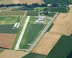
Hofkirchen Airfield (German: Flugplatz Hofkirchen, ICAO: LOLH) is a recreational aerodrome, 3 kilometres (2 mi) west of Hofkirchen im Traunkreis, Oberösterreich, Austria.
See also
References
- ↑ Airport record for Hofkirchen im Traunkreis Airport at Landings.com. Retrieved 1 September 2013
- ↑ Google (1 September 2013). "location of Hofkirchen Airport" (Map). Google Maps. Google. Retrieved 1 September 2013.
External links
- Airport record for Hofkirchen Airport at Landings.com
This article is issued from Wikipedia. The text is licensed under Creative Commons - Attribution - Sharealike. Additional terms may apply for the media files.