Königsfeld | |
|---|---|
_COA.svg.png.webp) Coat of arms | |
Location of Königsfeld within Ahrweiler district 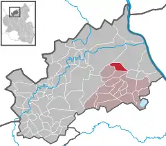 | |
 Königsfeld 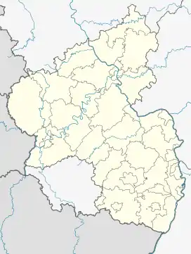 Königsfeld | |
| Coordinates: 50°29′55″N 7°10′35″E / 50.49861°N 7.17639°E | |
| Country | Germany |
| State | Rhineland-Palatinate |
| District | Ahrweiler |
| Municipal assoc. | Brohltal |
| Government | |
| • Mayor (2019–24) | Werner Breuer[1] |
| Area | |
| • Total | 7.20 km2 (2.78 sq mi) |
| Elevation | 272 m (892 ft) |
| Population (2021-12-31)[2] | |
| • Total | 685 |
| • Density | 95/km2 (250/sq mi) |
| Time zone | UTC+01:00 (CET) |
| • Summer (DST) | UTC+02:00 (CEST) |
| Postal codes | 53426 |
| Dialling codes | 02646 |
| Vehicle registration | AW |
Königsfeld is a municipality in the district of Ahrweiler, in Rhineland-Palatinate, Germany. Its located in Ahrweiler
References
- ↑ Direktwahlen 2019, Landkreis Ahrweiler, Landeswahlleiter Rheinland-Pfalz, accessed 3 August 2021.
- ↑ "Bevölkerungsstand 2021, Kreise, Gemeinden, Verbandsgemeinden" (in German). Statistisches Landesamt Rheinland-Pfalz. 2022.
This article is issued from Wikipedia. The text is licensed under Creative Commons - Attribution - Sharealike. Additional terms may apply for the media files.