Körner | |
|---|---|
_01.jpg.webp) Körner seen from the north | |
 Coat of arms | |
Location of Körner within Unstrut-Hainich-Kreis district 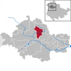 | |
 Körner 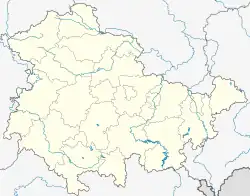 Körner | |
| Coordinates: 51°13′52″N 10°35′15″E / 51.23111°N 10.58750°E | |
| Country | Germany |
| State | Thuringia |
| District | Unstrut-Hainich-Kreis |
| Government | |
| • Mayor (2018–24) | Matthias Niebuhr[1] (Ind.) |
| Area | |
| • Total | 30.64 km2 (11.83 sq mi) |
| Elevation | 208 m (682 ft) |
| Population (2022-12-31)[2] | |
| • Total | 1,621 |
| • Density | 53/km2 (140/sq mi) |
| Time zone | UTC+01:00 (CET) |
| • Summer (DST) | UTC+02:00 (CEST) |
| Postal codes | 99998 |
| Dialling codes | 036025 |
| Vehicle registration | UH |
| Website | www.koerner-volkenroda.de |
Körner is a municipality in the Unstrut-Hainich-Kreis district of Thuringia, Germany.
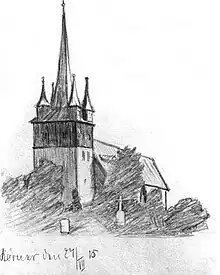
Church St. Wigberti at Körner (1915)
History
Within the German Empire (1871-1945), Körner was part of the Duchy of Saxe-Coburg and Gotha.
Körner is the place with the highest postal code number in Germany - 99998.
References
- ↑ Gewählte Bürgermeister - aktuelle Landesübersicht, Freistaat Thüringen, accessed 14 July 2021.
- ↑ "Bevölkerung der Gemeinden, erfüllenden Gemeinden und Verwaltungsgemeinschaften in Thüringen Gebietsstand: 31.12.2022" (in German). Thüringer Landesamt für Statistik. June 2023.
This article is issued from Wikipedia. The text is licensed under Creative Commons - Attribution - Sharealike. Additional terms may apply for the media files.