Highway 17A | ||||
|---|---|---|---|---|
| Kenora By-Pass | ||||
| Route information | ||||
| Auxiliary route of Highway 17 | ||||
| Maintained by the Ministry of Transportation of Ontario | ||||
| Length | 33.3 km[1] (20.7 mi) | |||
| Existed | November 16, 1990[2]–present | |||
| Major junctions | ||||
| Beltway around Kenora | ||||
| West end | ||||
| East end | ||||
| Location | ||||
| Country | Canada | |||
| Province | Ontario | |||
| Counties | Kenora District | |||
| Major cities | Kenora, Kenora Airport | |||
| Highway system | ||||
| ||||
King's Highway 17A, commonly referred to as Highway 17A or as the Kenora By-Pass, is an alternate route of Highway 17 around the city of Kenora, in the Canadian province of Ontario. It was built along a former Canadian Pacific Railway right-of-way, and has two westbound passing lanes in separate parts, and one eastbound passing lane.
Route description
Although it is not an official part of the Trans-Canada Highway, Highway 17A is designated as the through route when travelling into Kenora on the Trans-Canada.[3][4] The road also provides access to Kenora Airport, but otherwise avoids the built-up areas of the city.[5] The highway passes through a heavily forested area dominated by large granite rock outcroppings, geography typical of the Canadian Shield.[6] On an average day approximately 3,200–5,200 vehicles travel along the road, varying by season.[1]
History
Construction of Highway 17A began in 1981 in response to traffic congestion within the city of Kenora, which created a severe bottleneck for cross-national traffic. The bypass opened in stages as it was constructed from west to east.[7] The first 8.4 kilometres (5.2 mi), from Highway 17 to Highway 596 opened in September 1983. Following this, contracts were tendered for construction of the Winnipeg River bridge.[8] The section between Highway 596 and Highway 658 opened several years later in the autumn of 1988.[7] The final section, linking Highway 658 with Highway 17, was opened on November 16, 1990, at which point the Kenora Bypass was designated Highway 17A.[2]
Major intersections
The following table lists the major junctions along Highway 17A, as noted by the Ministry of Transportation of Ontario.[9] The entire route is located in Kenora District.[5]
| Location | km[9] | mi | Destinations | Notes | |
|---|---|---|---|---|---|
| Unorganized Kenora | 0.0 | 0.0 | Through traffic follows Highway 17 west | ||
| 7.0 | 4.3 | Darlington Drive | |||
| Kenora | 12.5 | 7.8 | Winnipeg River Bridge | ||
| 14.8 | 9.2 | ||||
| 21.0 | 13.0 | East Melick Road | Formerly Highway 659 north | ||
| 25.3 | 15.7 | ||||
| Unorganized Kenora | 33.3 | 20.7 | Through traffic follows Highway 17 east | ||
| 1.000 mi = 1.609 km; 1.000 km = 0.621 mi | |||||
References
- 1 2 Ministry of Transportation of Ontario (2007). "Annual Average Daily Traffic (AADT) counts". Government of Ontario. Archived from the original on July 6, 2011. Retrieved August 29, 2011.
- 1 2 "Highway 17A in Kenora". Hansard Transcripts (Report). Legislative Assembly of Ontario. November 21, 1990. Retrieved February 2, 2021.
- ↑ Google (August 31, 2021). "Highway 17 westbound approaching 17/17A split" (Map). Google Maps. Google. Retrieved August 31, 2021.
- ↑ Google (August 31, 2021). "Highway 17 eastbound approaching 17/17A split" (Map). Google Maps. Google. Retrieved August 31, 2021.
- 1 2 Mapart (2010). Ontario Back Road Atlas (Map). Peter Heiler Ltd. p. 106. § G3. ISBN 978-1-55198-226-7.
- ↑ "Farming on the Canadian Shield". Lake of the Woods Museum. Archived from the original on March 28, 2012. Retrieved September 9, 2011.
- 1 2 Ministry of Northern Development and Mines (May 1989). Northern Transportation Construction Projects 1989–90 (Report). Transportation Capital Branch, Ministry of Transportation of Ontario. p. 6. ISSN 0822-1480.
- ↑ Ministry of Northern Development and Mines (April 1988). Northern Transportation Construction Projects 1988–89 (Report). Transportation Capital Branch, Ministry of Transportation of Ontario. p. VII. ISSN 0822-1480.
- 1 2 Ministry of Transportation of Ontario (2016). "Annual Average Daily Traffic (AADT) counts". Retrieved January 1, 2021.
External links
Portions of the Trans-Canada Highway system | ||
|---|---|---|
| British Columbia | 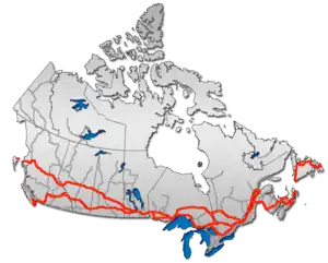 | |
| Alberta | ||
| Saskatchewan | ||
| Manitoba | ||
| Ontario | ||
| Quebec | ||
| New Brunswick | ||
| Prince Edward Island | ||
| Nova Scotia | ||
| Newfoundland | ||
| ||