La Bastide-d'Engras | |
|---|---|
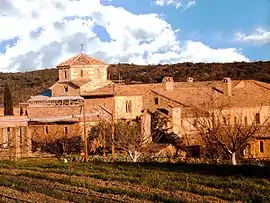 The Solan Monastery in La Bastide-d'Engras | |
.svg.png.webp) Coat of arms | |
Location of La Bastide-d'Engras | |
 La Bastide-d'Engras  La Bastide-d'Engras | |
| Coordinates: 44°05′44″N 4°28′45″E / 44.0956°N 4.4792°E | |
| Country | France |
| Region | Occitania |
| Department | Gard |
| Arrondissement | Nîmes |
| Canton | Uzès |
| Government | |
| • Mayor (2020–2026) | Pascal Gisbert[1] |
| Area 1 | 9.85 km2 (3.80 sq mi) |
| Population | 203 |
| • Density | 21/km2 (53/sq mi) |
| Time zone | UTC+01:00 (CET) |
| • Summer (DST) | UTC+02:00 (CEST) |
| INSEE/Postal code | 30031 /30330 |
| Elevation | 154–260 m (505–853 ft) (avg. 250 m or 820 ft) |
| 1 French Land Register data, which excludes lakes, ponds, glaciers > 1 km2 (0.386 sq mi or 247 acres) and river estuaries. | |
La Bastide-d'Engras is a commune in the Gard department in southern France.
Population
| Year | Pop. | ±% |
|---|---|---|
| 1962 | 196 | — |
| 1968 | 201 | +2.6% |
| 1975 | 179 | −10.9% |
| 1982 | 178 | −0.6% |
| 1990 | 177 | −0.6% |
| 1999 | 191 | +7.9% |
| 2008 | 219 | +14.7% |
See also
References
- ↑ "Répertoire national des élus: les maires" (in French). data.gouv.fr, Plateforme ouverte des données publiques françaises. 4 May 2022.
- ↑ "Populations légales 2021". The National Institute of Statistics and Economic Studies. 28 December 2023.
Wikimedia Commons has media related to La Bastide-d'Engras.
This article is issued from Wikipedia. The text is licensed under Creative Commons - Attribution - Sharealike. Additional terms may apply for the media files.