This is a list of historic places in Central Ontario, containing heritage sites listed on the Canadian Register of Historic Places (CRHP), all of which are designated as historic places either locally, provincially, territorially, nationally, or by more than one level of government.
List of historic places
Dufferin County
| Name | Address | Coordinates | Government recognition (CRHP №) | Image | |
|---|---|---|---|---|---|
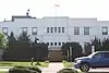
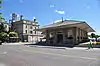
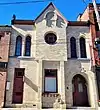
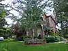
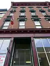
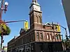
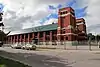
| Dufferin County Court House | 51 Zina Street Orangeville ON |
43°55′21″N 80°39′48″W / 43.9224°N 80.6633°W | Ontario (10426) | 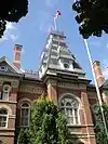 More images |
Haliburton County
| Name | Address | Coordinates | Government recognition (CRHP №) | Image | |
|---|---|---|---|---|---|
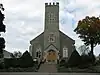
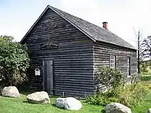
| Wilberforce Red Cross Outpost National Historic Site of Canada | 2314 Loop Road (Highway 648) Highlands East ON |
45°02′17″N 78°13′24″W / 45.038°N 78.2232°W | Federal (7740) |  |
Hastings County


Kawartha Lakes
| Name | Address | Coordinates | Government recognition (CRHP №) | Image | |
|---|---|---|---|---|---|
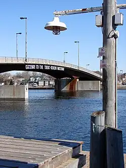
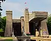
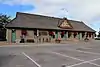
| Canal Lake Concrete Arch Bridge National Historic Site of Canada | Centennial Park Road over the Trent-Severn Waterway Kawartha Lakes ON |
44°33′29″N 79°02′45″W / 44.558°N 79.0459°W | Federal (13085) |  More images |
District Municipality of Muskoka
| Name | Address | Coordinates | Government recognition (CRHP №) | Image | |
|---|---|---|---|---|---|
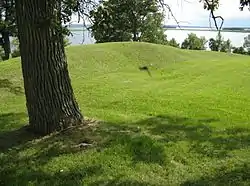
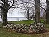
| Beausoleil Island National Historic Site of Canada | Georgian Bay Honey Harbour ON |
44°51′58″N 79°52′14″W / 44.8660°N 79.8705°W | Federal (19642) | 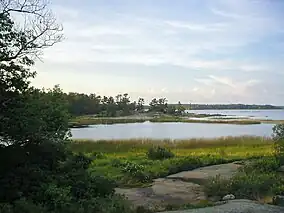 More images | |
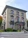
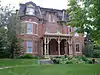
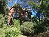
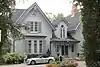
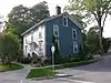
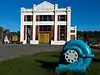
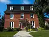
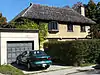
| Woodchester Villa | 15 King Street Bracebridge ON |
45°02′22″N 79°18′19″W / 45.0394°N 79.3052°W | Ontario (8206), Bracebridge municipality (8568) |
 More images | |
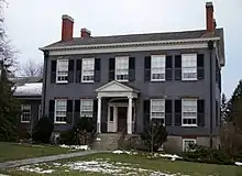
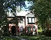
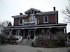
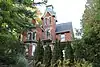
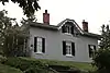
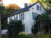
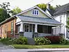
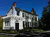
| Bethune House | 235 John Street Gravenhurst ON |
44°55′14″N 79°22′34″W / 44.9205°N 79.376°W | Federal (9727) | 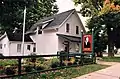 More images | |
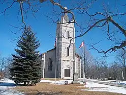
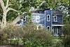
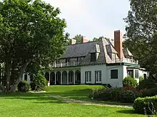
| Bethune Memorial House National Historic Site of Canada | 235 John Street North Gravenhurst ON |
44°55′14″N 79°22′34″W / 44.9205°N 79.3761°W | Federal (7765) | More images | |
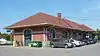
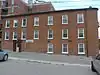
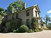
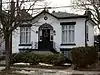
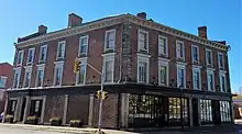
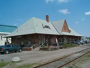
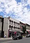
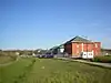
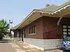
| Huntsville CNR Station | 1 Station Road Huntsville ON |
45°19′25″N 79°13′34″W / 45.3237°N 79.2262°W | Federal (6811), Ontario (10507) |
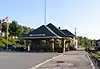 More images | |
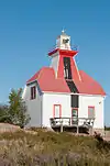
| Western Islands Lighthouse | Double Top Island District Municipality of Muskoka ON |
45°02′12″N 80°21′16″W / 45.0367°N 80.3544°W | Federal (21074) |  |
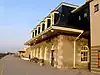
Northumberland County


.jpg.webp)


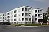
Parry Sound District

.JPG.webp)
Peterborough County


Prince Edward County
| Name | Address | Coordinates | Government recognition (CRHP №) | Image | |
|---|---|---|---|---|---|
| Carrying Place of the Bay of Quinte National Historic Site of Canada | Intersection of the Trenton and Carrying Place Roads Prince Edward (Carrying Place) ON |
44°02′55″N 77°34′57″W / 44.0485°N 77.5825°W | Federal (13814) |  | |
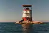
| Lighthouse | Main Duck Island Prince Edward ON |
43°55′52″N 76°38′18″W / 43.9311°N 76.6384°W | Federal (4747) |  Upload Photo | |
| Scotch Bonnet Island Lighthouse | Egg Island aka Scotch Bonnet Island Prince Edward ON |
43°53′57″N 77°32′32″W / 43.8993°N 77.5422°W | Federal (20774) | Upload Photo | |
| False Duck Island Lighttower | False Duck Island aka Swetman Island Prince Edward ON |
43°56′52″N 76°47′55″W / 43.9478°N 76.7986°W | Federal (21073) | Upload Photo |
Simcoe County


See also
References
This article is issued from Wikipedia. The text is licensed under Creative Commons - Attribution - Sharealike. Additional terms may apply for the media files.