Tadef Subdistrict
ناحية تادف | |
|---|---|
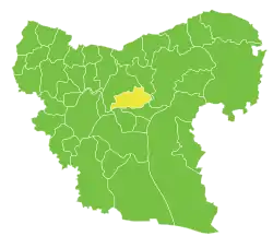 Location of Tadef Subdistrict within Aleppo Governorate | |
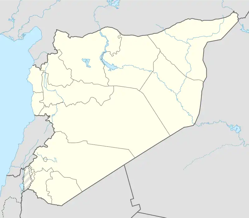 Tadef Subdistrict Location in Syria | |
| Coordinates (Tadef): 36°18′26″N 37°34′23″E / 36.3071°N 37.57298°E | |
| Country | |
| Governorate | Aleppo |
| District | al-Bab |
| Seat | Tadef |
| Area | |
| • Total | 321.24 km2 (124.03 sq mi) |
| Population (2004)[1] | 41,951 |
| Geocode | SY020201 |
Tadef Subdistrict (Arabic: ناحية تادف, romanized: Nāḩiyat Tādif) is a subdistrict of al-Bab District in northern Aleppo Governorate, northwestern Syria. Administrative centre is Tadef. At the 2004 census, the subdistrict had a population of 41,951.[1]
Cities, towns and villages
| PCode | Name | Population |
|---|---|---|
| C1219 | Tadef | 12,360 |
| C1215 | Arran | 4,135 |
| C1216 | Abu Jabbar | 2,821 |
| C1230 | Barlahin | 2,367 |
| C1226 | Oweishiyeh | 2,218 |
| C1223 | Kherbet Kiyar | 2,059 |
| C1220 | Big Amya | 1,674 |
| C1227 | Sarhan | 1,604 |
| C1218 | Abu Taltal | 1,582 |
| C1235 | Big Fikha | 1,473 |
| C1228 | Eisheh | 1,332 |
| C1233 | Qasr Elbreij | 1,287 |
| C1217 | Kita | 1,227 |
| C1224 | Um Khorzet Elbab | 1,128 |
| C1221 | Deir Qaq | 1,042 |
| C1234 | Magharet Abu Jabbar | 1,039 |
| — | Ein Eldahab | 669 |
| C1222 | Toman | 516 |
| C1225 | Biret Elbab | 447 |
| C1229 | Sheikh Dan | 391 |
| C1232 | Qatar | 307 |
| C1231 | Btoshiyet Elbab | 108 |
References
- 1 2 "2004 Census Data for Nahiya Tedef" (in Arabic). Syrian Central Bureau of Statistics. Retrieved 15 October 2015. Also available in English: "2004 Census Data". UN OCHA. Retrieved 15 October 2015.
Capital: Aleppo | ||||||||||||||||||||
|   | |||||||||||||||||||
|
| ||||||||||||||||||||
| ||||||||||||||||||||
| ||||||||||||||||||||
| ||||||||||||||||||||
| ||||||||||||||||||||
| ||||||||||||||||||||
| ||||||||||||||||||||
| ||||||||||||||||||||
This article is issued from Wikipedia. The text is licensed under Creative Commons - Attribution - Sharealike. Additional terms may apply for the media files.