Namsai district | |
|---|---|
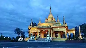 Golden pagoda in Namsai | |
Location in Arunachal Pradesh | |
| Coordinates (Namsai, India|Namsai): 27°40′08″N 95°52′17″E / 27.6689°N 95.8714°E | |
| Country | India |
| State | Arunachal Pradesh |
| Established | 25 November 2014 |
| Headquarters | Namsai |
| Government | |
| • Lok Sabha constituencies | Arunachal East |
| • Vidhan Sabha constituencies |
|
| Area | |
| • Total | 1,587 km2 (613 sq mi) |
| Population (2011)[1] | |
| • Total | 95,950 |
| • Density | 60/km2 (160/sq mi) |
| Demographics | |
| • Literacy | 54.24%[1] |
| • Sex ratio | 984.49[1] |
| Time zone | UTC+05:30 (IST) |
| Average annual precipitation | 3500-4000[1] mm |
| Website | namsai |
Namsai district is an administrative district in the state of Arunachal Pradesh in north-east India.It was carved out of Lohit district in November 2014.[2]
History
The creation of Namsai district was approved by the Arunachal Pradesh government of Nabam Tuki on 21 March 2013.[3]
On 25 November 2014, the Namsai subdivision of Lohit district was declared to be a new district of Arunachal Pradesh, the 18th district of the state.[2]
Demographics
Religion
Religion in Namsai (2011)[4]
Others (5.81%)
References
- 1 2 3 4 "Namsai at a Glance". Retrieved 26 December 2018.
- 1 2 "Namsai became the 18th district of Arunachal Pradesh in November 2014". India Today. 18 December 2014. Retrieved 26 October 2015.
- ↑ "Arunachal clears bill for four new districts". The Times of India. 22 March 2013.
- ↑ "Population by religion community – 2011". Census of India, 2011. The Registrar General & Census Commissioner, India. Archived from the original on 25 August 2015.
External links
Places adjacent to Namsai district | ||||||||||||||||
|---|---|---|---|---|---|---|---|---|---|---|---|---|---|---|---|---|
| ||||||||||||||||
This article is issued from Wikipedia. The text is licensed under Creative Commons - Attribution - Sharealike. Additional terms may apply for the media files.