Niederursel | |
|---|---|
 Coat of arms | |
Location of Niederursel (red) and the Ortsbezirk Nord-West (light red) within Frankfurt am Main 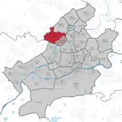 | |
 Niederursel 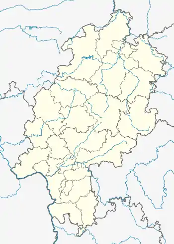 Niederursel | |
| Coordinates: 50°10′01″N 08°37′12″E / 50.16694°N 8.62000°E | |
| Country | Germany |
| State | Hesse |
| Admin. region | Darmstadt |
| District | Urban district |
| City | Frankfurt am Main |
| Area | |
| • Total | 8.023 km2 (3.098 sq mi) |
| Population (2020-12-31)[1] | |
| • Total | 16,611 |
| • Density | 2,100/km2 (5,400/sq mi) |
| Time zone | UTC+01:00 (CET) |
| • Summer (DST) | UTC+02:00 (CEST) |
| Postal codes | 60439 |
| Dialling codes | 069 |
| Vehicle registration | F |
| Website | www.niederursel.de |
Niederursel is a quarter of Frankfurt am Main, Germany. It is part of the Ortsbezirk Nord-West and is subdivided into the Stadtbezirke Niederursel-Ost and Niederursel-West.
References
- ↑ "Frankfurt Statsitik Aktuell 07/2021". Stadt Frankfurt am Main. July 2021.
This article is issued from Wikipedia. The text is licensed under Creative Commons - Attribution - Sharealike. Additional terms may apply for the media files.