Nirmsdorf | |
|---|---|
Location of Nirmsdorf | |
 Nirmsdorf 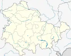 Nirmsdorf | |
| Coordinates: 51°5′40″N 11°28′13″E / 51.09444°N 11.47028°E | |
| Country | Germany |
| State | Thuringia |
| District | Weimarer Land |
| Municipality | Ilmtal-Weinstraße |
| Area | |
| • Total | 2.72 km2 (1.05 sq mi) |
| Elevation | 200 m (700 ft) |
| Population (2012-12-31) | |
| • Total | 88 |
| • Density | 32/km2 (84/sq mi) |
| Time zone | UTC+01:00 (CET) |
| • Summer (DST) | UTC+02:00 (CEST) |
| Postal codes | 99510 |
| Dialling codes | 036463 |
| Vehicle registration | AP |
| Website | www.vg-ilmtal-weinstrasse.de |
Nirmsdorf is a village and a former municipality in the Weimarer Land district of Thuringia, Germany. Since 31 December 2013, it is part of the municipality Ilmtal-Weinstraße.
References
This article is issued from Wikipedia. The text is licensed under Creative Commons - Attribution - Sharealike. Additional terms may apply for the media files.