Pabra | |
|---|---|
Village | |
| Pabra | |
| Nickname: Pabra city | |
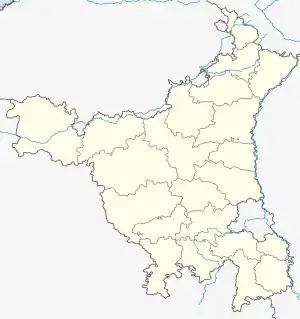 Pabra Location in Haryana, India  Pabra Pabra (India) | |
| Coordinates: 29°24′51″N 75°47′13″E / 29.41417°N 75.78694°E | |
| Country | |
| State | Haryana |
| District | Hisar district |
| Tehsil | Uklana |
| Government | |
| • Type | Govt sn sec school pabra |
| • Body | Primary Hospital |
| Elevation | 210 m (690 ft) |
| Languages | |
| • Official | Hindi |
| Time zone | UTC+5:30 (IST) |
| 125112 | 125112[1] |
| ISO 3166 code | IN-HR |
| Vehicle registration | HR 80 |
| Website | haryana |
Pabra, is a village and administrative unit with a democratically elected panchayat samiti (local council) in Uklana Tehsil of Hisar district under Hisar Lok Sabha constituency and Hisar Division of Haryana state.[2]
Administration
It has own unreserved Gram Panchayat under Gram Panchayat Smiti.[3] There is a Patwari (government land record officer), an ADO (Agriculture Development Officer), a Rural Health Officer (RHO), and an Anganbadi Worker.[4] Pabra is 35 km from Hisar bus stand.
Jat gotras
See also
References
- ↑ India Pincodes
- ↑ Panchayats of Siwani, Bhiwani, Haryana. Archived from the original on 10 November 2011. Retrieved 22 September 2010.
- ↑ Haryana Panchayats Archived 21 October 2014 at the Wayback Machine
- ↑ "Child Welfare, Harayana" (PDF). Archived from the original (PDF) on 4 March 2016. Retrieved 24 May 2016.
External links
- Google location map
- Hisar District Website
| State governments | |
|---|---|
| Union territories | |
This article is issued from Wikipedia. The text is licensed under Creative Commons - Attribution - Sharealike. Additional terms may apply for the media files.