Wise River, Montana | |
|---|---|
| Country | United States |
| State | Montana |
| County | Beaverhead |
| Area | |
| • Total | 0.74 sq mi (1.91 km2) |
| • Land | 0.74 sq mi (1.91 km2) |
| • Water | 0.00 sq mi (0.00 km2) |
| Population (2020) | |
| • Total | 42 |
| • Density | 56.83/sq mi (21.95/km2) |
| FIPS code | 30-07300 |
| GNIS feature ID | 793434[2] |
Wise River is an unincorporated community in northern Beaverhead County, Montana, United States.[3] State Highway 43 runs through the town.
This community takes its name from the Wise River, which flows into the Big Hole River nearby. A post office was established in 1913.[4]
Demographics
| Census | Pop. | Note | %± |
|---|---|---|---|
| 2020 | 42 | — | |
| U.S. Decennial Census[5] | |||
Climate
Wise River has a subarctic climate (Köppen Dfc).
| Climate data for Wise River, Montana, 1991–2020 normals, 1943-2020 extremes: 5730ft (1747m) | |||||||||||||
|---|---|---|---|---|---|---|---|---|---|---|---|---|---|
| Month | Jan | Feb | Mar | Apr | May | Jun | Jul | Aug | Sep | Oct | Nov | Dec | Year |
| Record high °F (°C) | 56 (13) |
59 (15) |
70 (21) |
77 (25) |
87 (31) |
95 (35) |
94 (34) |
94 (34) |
93 (34) |
84 (29) |
69 (21) |
54 (12) |
95 (35) |
| Mean maximum °F (°C) | 45.0 (7.2) |
47.5 (8.6) |
56.5 (13.6) |
69.1 (20.6) |
76.4 (24.7) |
84.0 (28.9) |
89.2 (31.8) |
89.3 (31.8) |
85.3 (29.6) |
73.4 (23.0) |
58.0 (14.4) |
45.7 (7.6) |
90.9 (32.7) |
| Mean daily maximum °F (°C) | 31.4 (−0.3) |
33.3 (0.7) |
43.0 (6.1) |
51.3 (10.7) |
61.2 (16.2) |
68.8 (20.4) |
78.8 (26.0) |
78.9 (26.1) |
69.9 (21.1) |
55.7 (13.2) |
38.9 (3.8) |
30.0 (−1.1) |
53.4 (11.9) |
| Daily mean °F (°C) | 19.6 (−6.9) |
21.5 (−5.8) |
28.9 (−1.7) |
36.7 (2.6) |
44.7 (7.1) |
52.0 (11.1) |
58.4 (14.7) |
57.4 (14.1) |
49.7 (9.8) |
39.2 (4.0) |
26.4 (−3.1) |
18.2 (−7.7) |
37.7 (3.2) |
| Mean daily minimum °F (°C) | 7.8 (−13.4) |
9.6 (−12.4) |
14.9 (−9.5) |
22.1 (−5.5) |
28.3 (−2.1) |
35.3 (1.8) |
38.0 (3.3) |
36.0 (2.2) |
29.5 (−1.4) |
22.7 (−5.2) |
14.0 (−10.0) |
6.5 (−14.2) |
22.1 (−5.5) |
| Mean minimum °F (°C) | −21.6 (−29.8) |
−17.9 (−27.7) |
−5.4 (−20.8) |
9.3 (−12.6) |
15.2 (−9.3) |
24.8 (−4.0) |
29.8 (−1.2) |
26.7 (−2.9) |
18.1 (−7.7) |
5.8 (−14.6) |
−6.3 (−21.3) |
−18.3 (−27.9) |
−28.3 (−33.5) |
| Record low °F (°C) | −38 (−39) |
−41 (−41) |
−26 (−32) |
−6 (−21) |
7 (−14) |
20 (−7) |
24 (−4) |
19 (−7) |
6 (−14) |
−13 (−25) |
−23 (−31) |
−38 (−39) |
−41 (−41) |
| Average precipitation inches (mm) | 0.55 (14) |
0.53 (13) |
0.64 (16) |
0.98 (25) |
1.90 (48) |
1.98 (50) |
1.36 (35) |
0.99 (25) |
1.21 (31) |
1.12 (28) |
0.94 (24) |
0.73 (19) |
12.93 (328) |
| Source 1: NOAA[6] | |||||||||||||
| Source 2: XMACIS2 (records & monthly max/mins)[7] | |||||||||||||
Education
Wise River provides elementary education.[8] High school is at Beaverhead County High School.
Notes
- ↑ "ArcGIS REST Services Directory". United States Census Bureau. Retrieved September 18, 2022.
- ↑ U.S. Geological Survey Geographic Names Information System: Wise River, Montana
- ↑ "Wise River, Montana". Geographic Names Information System. United States Geological Survey, United States Department of the Interior.
- ↑ "Wise River". Montana Place Names Companion. Montana Historical Society. Retrieved April 11, 2021.
- ↑ "Census of Population and Housing". Census.gov. Retrieved June 4, 2016.
- ↑ "Wise River 3 WNW, Montana 1991-2020 Monthly Normals". Retrieved November 21, 2023.
- ↑ "xmACIS". National Oceanic and Atmospheric Administration. Retrieved November 21, 2023.
- ↑ "Schools Beaverhead County". Beaverhead County. Retrieved April 14, 2021.
Municipalities and communities of Beaverhead County, Montana, United States | ||
|---|---|---|
| City | 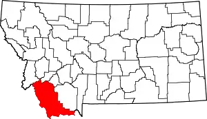 Beaverhead County map | |
| Town | ||
| CDPs | ||
| Other communities | ||
| Ghost towns | ||
45°47′29″N 112°56′58″W / 45.79139°N 112.94944°W
This article is issued from Wikipedia. The text is licensed under Creative Commons - Attribution - Sharealike. Additional terms may apply for the media files.