< Portal:U.S. roads < Did you know < Recommend


| This page is an archive. Do not edit the contents of this page. Please direct any additional comments to the current main page. |
January 2009
- ...that Washington State Route 531's bridge over Cougar Creek had a collapsed culvert that was discovered and fixed during October 2008?
- ...that Wyoming Highway 789 was part of a proposed border-to-border U.S. Highway 789 that would have run from Sweetgrass, Montana to Nogales, Arizona? After the US 789 proposal was rejected by AASHTO, Highway 789 became part of a series of state highways numbered "789" running along the proposed route. However, Wyoming was the only state that actually renumbered an existing highway (the other states simply added a concurrent SR-789 over existing highways). And that as a result, all the states except Wyoming deleted the designation and removed the signs?Ngs61 (talk) 15:42, 8 December 2008 (UTC)
- ...that U.S. Route 62 runs "backwards", bearing west for several miles before ending at its northern terminus at New York State Route 104 near the Rainbow Bridge?Ngs61 (talk) 15:42, 8 December 2008 (UTC)
- ... the routing of U.S. Route 191 has changed so many times that Yellowstone National Park is the only place that has been continuously served by the highway?
- ... the modern U.S. Route 91 is only about 1/10 of the historical length of the highway? Dave (talk) 18:59, 6 December 2008 (UTC)
- ... that Interstate 990 is the highest numbered Interstate in actual use.Ngs61 (talk) 15:42, 8 December 2008 (UTC)
- ... that the Robert Moses State Parkway was originally was one continuous road; however, due to low usage, a portion of the parkway near Niagara Falls was removed, separating the parkway into two sections. The two sections are still connected via New York State Route 384.Ngs61 (talk) 16:20, 8 December 2008 (UTC)
- ... the 1971 road movie Duel was filmed near Acton, California along an old alignment of U.S. Route 6, that was signed California State Route 14 at the time and is now known as Sierra Highway? Dave (talk) 22:43, 22 December 2008 (UTC)
February 2009
- ...that Washington State Route 531's bridge over Cougar Creek had a collapsed culvert that was discovered and fixed during October 2008?
- ... the routing of U.S. Route 191 has changed so many times that Yellowstone National Park is the only place that has been continuously served by the highway?
- ... that the Robert Moses State Parkway was originally was one continuous road; however, due to low usage, a portion of the parkway near Niagara Falls was removed, separating the parkway into two sections. The two sections are still connected via New York State Route 384.Ngs61 (talk) 16:20, 8 December 2008 (UTC)
- .... that the Newhall Pass interchange has collapsed from earthquakes twice and burned from trucks colliding in a tunnel once?
March 2009
- ...that New York State Route 17 is currently the longest New York State Highway? It stretches 397 miles (639 km). When it becomes fully transformed into Interstate 86, the title of longest New York State Route will be passed down to New York State Route 5 which is 370.87 miles (596.86 km) long.
- ...that New York State Route 437 is the shortest signed state highway in New York, located entirely within the vicinity of Melrose Park in Cayuga County? It connects NY 38 and NY 38A.
- ...that Florida State Road 9336 is the only signed four digit state route in Florida?
- ...that California State Route 49 is so numbered to honor the California gold rush of 1849, that occurred along the areas served by the highway? Dave (talk) 00:10, 3 March 2009 (UTC)
April 2009
starting a theme =-)
- ...the highest road in the California state route system is California State Route 120 over Tioga Pass (elevation 9943 ft.)?
- ...the highest road in the Nevada state route system is Nevada State Route 431 over Mount Rose Summit (elevation 8,911 ft.)?
- ...the highest road in the Utah state route system is Utah State Route 150 over Bald Mountain Pass (elevation 10,715 ft.)?
- ...the highest road in the Colorado state highway system and U.S. Highway system is U.S. Route 34 over Trail Ridge Road inside Rocky Mountain National Park (12,183 ft.)?
Dave (talk) 19:45, 4 March 2009 (UTC)
Amazing these haven't appeared yet:
- ...Interstate 99 is so numbered because it was written into law by Congressman Bud Shuster, not per the usual numbering scheme for Interstate highways?
- ...Interstate 238 exists even though there is no I-38, as all x80 numbers were in use in the state of California at the time? Dave (talk) 00:07, 5 March 2009 (UTC)
May 2009
starting a theme =-)
- ...the highest road in the Nevada state route system is Nevada State Route 431 over Mount Rose Summit (elevation 8,911 ft.)?
- ...the highest road in the Colorado state highway system and U.S. Highway system is U.S. Route 34 over Trail Ridge Road inside Rocky Mountain National Park (12,183 ft.)?
Dave (talk) 19:45, 4 March 2009 (UTC)
- ...that Interstate 90 is the only Interstate having a complete set of nine spur routes in a single state? (190, 290, 390, 490, 590, 690, 790, 890, 990 in the State of New York). Ngs61 (talk) 19:09, 30 March 2009 (UTC)
- Suggested revision: "...that Interstate 90 has a complete set (190 through 990) of spur routes in New York and is the only Interstate Highway that has a complete set within any state?" – TMF 15:01, 22 April 2009 (UTC)
- "...that the portion of U.S. Route 209 in New York once had five different designations over a span of 10 years?" The information on this is currently in US 209; I'll see if I can include it or move it into US 209 (NY) by next month. The hook may also need a bit of tweaking as well. – TMF 01:13, 2 April 2009 (UTC)
- ... that New York State Route 990V is the highest numbered signed New York State route that is actually a reference route? Ngs61 (talk) 18:46, 3 April 2009 (UTC)
- Suggested revision: "...that New York State Route 990V, the highest-numbered signed state highway in New York, is actually a reference route?" – TMF 15:01, 22 April 2009 (UTC)
June 2009
- ...that the Peace Bridge that crosses the Niagara River and links Buffalo, New York, United States and Fort Erie, Ontario, Canada was opened June 1st, 1927? Ngs61 (talk) 01:38, 29 May 2009 (UTC)
- Not sure if this is DYK-worthy as it's not really an interesting fact. – TMF 09:23, 31 May 2009 (UTC)
- ...that the Governor Thomas E. Dewey Thruway is 496 miles in length? Ngs61 (talk) 16:59, 29 May 2009 (UTC)
- Not sure if this is DYK-worthy as it's not really an interesting fact. – TMF 09:23, 31 May 2009 (UTC)
- ...that a short portion of New York State Route 17 (less than a mile) is actually in Pennsylvania?
(At Waverly the highway dips south across the border into South Waverly, Pennsylvania, where it intersects with U.S. Route 220. The section in Pennsylvania is maintained by New York). Ngs61 (talk) 16:59, 29 May 2009 (UTC)- The explanation isn't necessary, since it's explained in the article and the point of DYK is to make the reader want to go to the article to read more. As for the hook itself, "...that a one-mile portion of New York State Route 17 is actually in Pennsylvania?" – TMF 09:23, 31 May 2009 (UTC)
- ...that U.S. Route 40 Scenic and U.S. Route 412 Scenic are the only two routes in the United States that remain with the official scenic designation? Ngs61 (talk) 16:59, 29 May 2009 (UTC)
- revised: "...that U.S. Route 40 Scenic and U.S. Route 412 Scenic are the only two scenic special routes that remain in the U.S. Highway System?" – TMF 09:23, 31 May 2009 (UTC)
- "...that most of New York State Route 37B's original alignment was destroyed as part of the St. Lawrence Seaway's construction? – TMF 09:23, 31 May 2009 (UTC)
July 2009
- ...that Idaho State Highway 41 runs along the Washington–Idaho state line, where one half is in Washington; the Washington half was signed as State Highway 41 until 1997, when it was renumbered to Washington State Route 41? –CG 12:08, 1 June 2009 (UTC)
- The article indicates that less than a mile is in Washington. That's far less than half. – TMF 00:46, 2 June 2009 (UTC)
- Half the roadway, not half the distance. You're thinking too literal =-)Dave (talk) 01:01, 2 June 2009 (UTC)
- How about this to be more clear: ..that the southbound lane of Idaho State Highway 41 through Oldtown is actually in Newport, Washington with an unsigned designation of Washington State Route 41? CG, is that still accurate, or did I mess that up?Dave (talk) 01:11, 2 June 2009 (UTC)
- Perfect Dave, Perfect. –CG 17:12, 21 June 2009 (UTC)
- How about this to be more clear: ..that the southbound lane of Idaho State Highway 41 through Oldtown is actually in Newport, Washington with an unsigned designation of Washington State Route 41? CG, is that still accurate, or did I mess that up?Dave (talk) 01:11, 2 June 2009 (UTC)
- ... Utah State Route 276 includes the only auto ferry in the landlocked western United States?( source until the article is updated to state this fact)
- How about Washington's Keller Ferry? –CG 17:12, 21 June 2009 (UTC)
- Washington state is not landlocked.Dave (talk) 21:49, 21 June 2009 (UTC)
- How about this (to be more clear): Utah State Route 276 includes the only auto ferry in a landlocked western state?
- Washington state is not landlocked.Dave (talk) 21:49, 21 June 2009 (UTC)
- How about Washington's Keller Ferry? –CG 17:12, 21 June 2009 (UTC)
- ... the completion of Interstate 17, shortened the distance of the truck route between Phoenix and Flagstaff, Arizona by approximately 80 miles (130 km) (verses the former route of U.S. Route 89 between those two cities)?
Dave (talk) 18:01, 1 June 2009 (UTC)
- ... though the Utah portion of the Colorado River is over 400 miles (640 km) long, their are only 3 bridges in the state that cross it, Dewey Bridge, unnamed bridge carrying US 191 and Hite Crossing Bridge
- Suggested revision: "...that although the Utah portion of the Colorado River is over 400 miles (640 km) long, there are only three bridges in the state that cross it: the Dewey Bridge, an unnamed bridge carrying US 191 and the Hite Crossing Bridge?" – TMF 11:53, 22 June 2009 (UTC)
- ...that New York State Route 338 went from being a county road to a state highway, then back to a county road during a span of 16 years? – TMF 22:07, 28 April 2009 (UTC)
August 2009
- ...that Interstate 190 (New York) was originally numbered Interstate 90N? Ngs61 (talk) 01:38, 29 May 2009 (UTC)
- revised: "...that Interstate 190 in New York was originally designated as "Interstate 90N"? – TMF 09:23, 31 May 2009 (UTC)
- ...that Washington State Route 211 was originally Washington State Route 311, renumbered in 1975? –CG 12:08, 1 June 2009 (UTC)
- Not sure if this is DYK-worthy as it's not really an interesting fact. – TMF 00:46, 2 June 2009 (UTC)
The two nominations above were held over from July. – TMF 17:10, 1 July 2009 (UTC)
- ...that the Peshekee River Bridge that later carried US 41 was the first bridge designed and built by the Michigan State Highway Department in 1914? Imzadi1979 (talk) 06:02, 3 July 2009 (UTC)
- ...that even though Washington State Route 131 is only 2.07 miles (3.33 km) long, the road's continuation south stretches past Mount St. Helens? –CG 18:30, 3 July 2009 (UTC)
- This probably isn't DYK-worthy as currently written. No one outside of Washington knows where SR 131 is in relation to Mt. St. Helens, and even then it might not be interesting enough to be a hook. – TMF 21:39, 17 July 2009 (UTC)
- How about ...that Washington State Route 131 was moved to a new route across the Cascade Mountains in 1991? –CG 17:15, 18 July 2009 (UTC)
- Based on what I'm reading, the pre-1991 SR 131 was something totally different from the current one, in which case it should be covered somewhere else. See New York State Route 215 (disambiguation). – TMF 22:01, 19 July 2009 (UTC)
- It was replaced by U.S. Route 97 in Washington and is covered there. –CG 22:51, 19 July 2009 (UTC)
- OK. However, then the only mention of the former route should be in a hatnote similar to that on New York State Route 113. – TMF 22:53, 19 July 2009 (UTC)
- Hatnote added. –CG 02:02, 20 July 2009 (UTC)
- OK. However, then the only mention of the former route should be in a hatnote similar to that on New York State Route 113. – TMF 22:53, 19 July 2009 (UTC)
- It was replaced by U.S. Route 97 in Washington and is covered there. –CG 22:51, 19 July 2009 (UTC)
- Based on what I'm reading, the pre-1991 SR 131 was something totally different from the current one, in which case it should be covered somewhere else. See New York State Route 215 (disambiguation). – TMF 22:01, 19 July 2009 (UTC)
- How about ...that Washington State Route 131 was moved to a new route across the Cascade Mountains in 1991? –CG 17:15, 18 July 2009 (UTC)
- (outdent) Well, the hatnote reads "This article is about the current alignment of SR 131" yet the article still covers the old alignment. – TMF 02:40, 20 July 2009 (UTC)
- This probably isn't DYK-worthy as currently written. No one outside of Washington knows where SR 131 is in relation to Mt. St. Helens, and even then it might not be interesting enough to be a hook. – TMF 21:39, 17 July 2009 (UTC)
- ...that Arizona State Route 101, Arizona State Route 202 and Arizona State Route 303 are Metropolitan Phoenix freeways that are or will be built to Interstate Highway standards but financed with local taxes?Dave (talk) 20:34, 3 July 2009 (UTC)
- ...that Washington State Route 231 is 8.97 miles (14.44 km) longer than its parent route? –CG 01:23, 11 July 2009 (UTC)
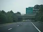
- ...that Washington State Route 508 (pictured in Morton) in Bear Canyon was reconstructed twice, in 2007 and 2009? –CG 22:56, 19 July 2009 (UTC)
- After reading the article, I think you could actually make this hook more interesting by including that both of the reconstruction projects were enacted to fix areas destroyed by weather-related events. Two washouts/landslides in a two-year span is fairly unusual. – TMF 23:04, 19 July 2009 (UTC)
- How about ...that two washouts in 2007 and 2009 caused Washington State Route 508 (pictured in Morton) through Bear Canyon to be reconstructed twice? –CG 01:59, 20 July 2009 (UTC)
- It's getting there. I like the essence of it but the wording could probably be tweaked a bit. But, for now it works. – TMF 02:40, 20 July 2009 (UTC)
- How about ...that two washouts in 2007 and 2009 caused Washington State Route 508 (pictured in Morton) through Bear Canyon to be reconstructed twice? –CG 01:59, 20 July 2009 (UTC)
- After reading the article, I think you could actually make this hook more interesting by including that both of the reconstruction projects were enacted to fix areas destroyed by weather-related events. Two washouts/landslides in a two-year span is fairly unusual. – TMF 23:04, 19 July 2009 (UTC)
September 2009
- ...that Washington State Route 213 was proposed for 35 years before a small, 0.35-mile (0.56 km) long segment was added to the state highways system in 2008? –CG 16:02, 17 August 2009 (UTC)
- ...that the Maryland Route 33 drawbridge onto Tilghman Island (pictured) is among the busiest in the United States and the world in terms of drawbridge openings? Dough4872 (talk) 23:50, 22 August 2009 (UTC)
- ... that Utah State Route 127 extended along a causeway to an island in the Great Salt Lake, before flooding submerged the causeway? Dave (talk) 21:14, 23 August 2009 (UTC)
October 2009
- ...much of the current alignment of Maryland Route 413 follows a former Pennsylvania Railroad line into Crisfield? Dough4872 (talk) 00:52, 30 August 2009 (UTC)
- ...that when New Jersey Route 55 (pictured) was built through Deptford Township in the 1980s, it was discovered that it ran through Indian burial grounds and bad fate fell upon many construction workers as it was believed the highway was cursed? Dough4872 (talk) 00:27, 11 September 2009 (UTC)
- ... one of the landmarks along Interstate 84 in Utah is the 1000 mile tree, planted by Union Pacific Railroad workers to celebrate the first transcontinental railroad reaching 1000 miles from it's origin in Omaha, Nebraska?
- ...New Jersey Route 47 received the name Delsea Drive by the New Jersey Legislature in 1933 after a reporter for the Woodbury Times joked how the road connected the DELaware River with the Atlantic SEA? Dough4872 (talk) 02:52, 16 September 2009 (UTC)
November 2009
- ...that the New Jersey Route 70 bridge over the Manasquan River is known as the September 11th Memorial Bridge in honor of residents of Monmouth and Ocean counties who lost their lives in the September 11 attacks? Dough4872 (talk) 18:17, 30 September 2009 (UTC)
- ...that the Baltimore–Washington Parkway was once planned to be a part of Interstate 295, but never did because not enough funds were available to upgrade the road to Interstate Highway standards? Dough4872 (talk) 18:29, 30 September 2009 (UTC)
- "... that New York State Route 434 was designated as NY 188 for less than a year?" – TMF 04:36, 7 October 2009 (UTC)
- ".... that the Mousetrap is a freeway interchange that was completely re-designed after a truck hauling torpedoes overturned, paralyzing the transportation network in Denver for a day?Dave (talk) 09:37, 15 October 2009 (UTC)
- ...that the first cloverleaf interchange in the United States was built in 1929 at what is now New Jersey Route 35 and U.S. Route 1/9 in Woodbridge? Dough4872 (talk) 22:30, 27 October 2009 (UTC)
December 2009
- ...that New Jersey Route 37 is named "Little League World Champions Boulevard" in honor of Toms River East Little League's victory in the 1998 Little League World Series? ---Dough4872 03:26, 7 November 2009 (UTC)
- ...that the business route of Maryland Route 5 in Hughesville (pictured) is internally designated as Maryland Route 625? ---Dough4872 17:34, 15 November 2009 (UTC)
- This really isn't DYK-worthy. Every business route in New York except for US 62 Business has at least one segment that carries an internal designation, so this really isn't that unique or unusual. – TMF 19:46, 18 November 2009 (UTC)
- ...that the business route of Maryland Route 5 in Hughesville (pictured) uses green shields with the word "business" in place of "Maryland"? ---Dough4872 19:50, 18 November 2009 (UTC)
- This really isn't DYK-worthy. Every business route in New York except for US 62 Business has at least one segment that carries an internal designation, so this really isn't that unique or unusual. – TMF 19:46, 18 November 2009 (UTC)
- ...that the Interstate 695 beltway around Baltimore was initially planned as a county project in 1949 before being taken over by the state by 1953? ---Dough4872 19:55, 18 November 2009 (UTC)
- ...that New Jersey Route 88 was referred to in the Bruce Springsteen song "Spirit in the Night"? ---Dough4872 17:00, 20 November 2009 (UTC)
- ...that Washington State Route 231 is almost 9 miles (14 km) longer than its "parent" route, Washington State Route 23? – ĈĠ, Super Sounders Fan (help line|§|sign here) 20:50, 20 November 2009 (UTC)
This article is issued from Wikipedia. The text is licensed under Creative Commons - Attribution - Sharealike. Additional terms may apply for the media files.