< Portal:Austria < WD
This list is automatically generated from data in Wikidata and is periodically updated by Listeriabot.
Edits made within the list area will be removed on the next update!
Wikimedia list article
architectural ensemble
| # | WD item | article | description | is a | municipality | commons category | picture | coordinates | position map |
|---|---|---|---|---|---|---|---|---|---|
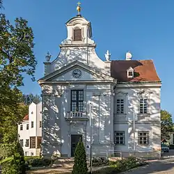
| 1 | Q1344561 | Franz-Keim-Gasse Brunn am Gebirge | architectural structure | architectural ensemble | Brunn am Gebirge | Jugendstilensemble Franz-Keim-Gasse | 48°06′06″N 16°16′45″E / 48.1017°N 16.2793°E | ||
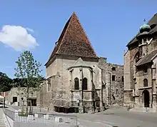
| 2 | Q1641577 | Waisenhaus | Ensemble of buildings in Lower Austria, Austria | architectural ensemble school building church building |
Mödling | Waisenhaus (Mödling) |  |
48°05′11″N 16°17′58″E / 48.0863°N 16.2994°E | |
| 3 | Q61043817 | Wassergspreng-BZW | architectural ensemble educational institution |
Hinterbrühl | Wassergspreng-BZW |  |
48°05′23″N 16°12′44″E / 48.0897°N 16.212278°E |
architectural heritage monument
| # | WD item | article | description | is a | municipality | commons category | picture | coordinates | position map |
|---|---|---|---|---|---|---|---|---|---|
| 1 | Q32827534 | Auferstehungssäule Perchtoldsdorf | architectural heritage monument cultural property |
Perchtoldsdorf | Auferstehungssäule Perchtoldsdorf |  |
48°07′17″N 16°15′42″E / 48.12147°N 16.26179°E | ||
| 2 | Q31847224 | Dreifaltigkeitssäule Perchtoldsdorf | architectural heritage monument cultural property |
Perchtoldsdorf | Dreifaltigkeitssäule Perchtoldsdorf |  |
48°07′09″N 16°15′54″E / 48.11923°N 16.26508°E |
architectural structure
| # | WD item | article | description | is a | municipality | commons category | picture | coordinates | position map |
|---|---|---|---|---|---|---|---|---|---|
| 1 | Q54639962 | Alte Aufbahrungshalle | architectural structure | Perchtoldsdorf | |||||
| 2 | Q22810395 | Arnold Schönberg-Villa, Mödling | building in Mödling, Austria | architectural structure villa museum |
Mödling | Arnold Schönberg-Villa, Mödling |  |
48°04′45″N 16°17′04″E / 48.07929°N 16.28447°E | |
| 3 | Q2270072 | Sender Anninger | architectural structure | Gaaden | Sender Anninger |  |
48°03′09″N 16°15′10″E / 48.05245°N 16.25264°E | ||
| 4 | Q667591 | Shopping City Süd | architectural structure in Lower Austria | architectural structure shopping center |
Vösendorf | Shopping City Süd |  |
48°06′30″N 16°19′01″E / 48.108333333333°N 16.316944444444°E |
artificial pond
| # | WD item | article | description | is a | municipality | commons category | picture | coordinates | position map |
|---|---|---|---|---|---|---|---|---|---|
| 1 | Q21875139 | Birkensee | pond in Lower Austria | artificial pond | Münchendorf | 48°01′57″N 16°24′09″E / 48.0325°N 16.4025°E | |||
| 2 | Q21875141 | Dürrsee | pond in Lower Austria | artificial pond | Münchendorf | 48°02′08″N 16°24′46″E / 48.035555555556°N 16.412777777778°E | |||
| 3 | Q21875142 | Großer Gemeindesee | pond in Lower Austria | artificial pond | Münchendorf | 48°01′30″N 16°24′10″E / 48.025°N 16.402777777778°E | |||
| 4 | Q106043621 | Heideteich | lake in Lower Austria, Austria | artificial pond | Brunn am Gebirge | 48°06′54″N 16°18′27″E / 48.11505384498531°N 16.30744255993519°E | |||
| 5 | Q21875144 | Kleiner Gemeindesee | pond in Lower Austria | artificial pond | Münchendorf | 48°01′26″N 16°24′26″E / 48.02389°N 16.40722°E | |||
| 6 | Q106043622 | Wienerbergerteich | lake at the border of Vienna/Lower Austria, Austria | artificial pond | Liesing Brunn am Gebirge Vienna |
Ziegelteich Brunn |  |
48°07′06″N 16°18′32″E / 48.11847046693414°N 16.30877293548882°E |
artificial ruin


bridge
| # | WD item | article | description | is a | municipality | commons category | picture | coordinates | position map |
|---|---|---|---|---|---|---|---|---|---|
| 1 | Q106650899 | Fischerdörflbrücke | bridge in Laxenburg, Austria | bridge | Laxenburg |  |
48°03′33″N 16°21′45″E / 48.059199°N 16.362574°E | ||
| 2 | Q38084533 | Histor. Inschrifttafel an der Brücke über den Krottenbach | bridge in Austria | bridge | Biedermannsdorf |  |
48°05′34″N 16°20′49″E / 48.09271376388593°N 16.346884164733346°E | ||
| 3 | Q37867693 | Nepomukbrücke Achau | bridge in Austria | bridge | Achau | Nepomukbrücke Achau |  |
48°04′48″N 16°23′12″E / 48.0800833°N 16.3867222°E | |
| 4 | Q38108958 | Schlossbrücke Achau | bridge in Austria | bridge | Achau | Schlossbrücke Achau |  |
48°04′47″N 16°23′00″E / 48.079722°N 16.383333°E |
building


cadastral municipality of Austria


castle
.JPG.webp)
.JPG.webp)
.JPG.webp)

.JPG.webp)
castle ruin
| # | WD item | article | description | is a | municipality | commons category | picture | coordinates | position map |
|---|---|---|---|---|---|---|---|---|---|
| 1 | Q1015366 | Burgruine Kammerstein | castle ruin | castle ruin cultural property |
Perchtoldsdorf | Burgruine Kammerstein (Perchtoldsdorf) |  |
48°07′31″N 16°13′58″E / 48.1253°N 16.2328°E | |
| 2 | Q520105 | Johannstein castle ruins | Johannstein castle ruins in Sparbach, Lower Austria | castle ruin | Lower Austria Hinterbrühl Sparbach |
Ruine Johannstein |  |
48°05′08″N 16°11′06″E / 48.08543°N 16.18487°E |
cemetery


cemetery chapel
| # | WD item | article | description | is a | municipality | commons category | picture | coordinates | position map |
|---|---|---|---|---|---|---|---|---|---|
| 1 | Q37721331 | Cemetery in Münchendorf | cemetery in Münchendorf, Austria | cemetery chapel | Münchendorf | Cemetery in Münchendorf |  |
48°02′08″N 16°23′03″E / 48.03554°N 16.38426°E | |
| 2 | Q37789136 | Schöffel-Kapelle | church building in Mödling, Austria | cemetery chapel | Mödling | Mödlinger Friedhof |  |
48°04′11″N 16°17′59″E / 48.0696°N 16.29981°E |
chapel


chapel-shrine
| # | WD item | article | description | is a | municipality | commons category | picture | coordinates | position map |
|---|---|---|---|---|---|---|---|---|---|
| 1 | Q112152582 | Hubertuskapelle Münchendorf | wayside chapel near Münchendorf, Lower Austria, Austria | chapel-shrine | Münchendorf | 48°01′04″N 16°22′36″E / 48.0178722218746°N 16.376802855502778°E | |||
| 2 | Q56695790 | John of Nepomuk Chapel | wayside chapel in Laxenburg | chapel-shrine | Laxenburg | Johannes-Nepomuk-Kapelle, Laxenburg |  |
48°04′11″N 16°21′27″E / 48.069855°N 16.357385°E | |
| 3 | Q112066687 | Marienkapelle | chapel near Biedermannsdorf, Lower Austria, Austria | chapel-shrine | Biedermannsdorf | Biedermannsdorf - Marienkapelle | 48°04′56″N 16°21′32″E / 48.08223535487621°N 16.358878599056734°E |
church building


.JPG.webp)


.JPG.webp)
château
| # | WD item | article | description | is a | municipality | commons category | picture | coordinates | position map |
|---|---|---|---|---|---|---|---|---|---|
| 1 | Q2047033 | Palais Kaunitz-Wittgenstein | palace in Laxenburg | château | Laxenburg | Palais Kaunitz, Laxenburg | 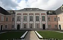 |
48°03′57″N 16°21′21″E / 48.0659°N 16.3557°E | |
| 2 | Q1418782 | Schloss Achau | château | château | Achau | Schloss Achau |  |
48°04′46″N 16°23′06″E / 48.0794°N 16.385°E | |
| 3 | Q1795110 | Schloss Hunyadi | building in Lower Austria, Austria | château cultural property |
Maria Enzersdorf | Schloss Hunyadi |  |
48°05′55″N 16°16′57″E / 48.0986°N 16.2824°E | |
| 4 | Q1726817 | Schloss Liechtenstein | building in Lower Austria, Austria | château cultural property |
Maria Enzersdorf | Schloss Liechtenstein |  |
48°05′31″N 16°16′19″E / 48.092°N 16.272°E | |
| 5 | Q107469771 | Schloss Sparbach | Palace in Sparbach, Lower Austria | château | Hinterbrühl | 48°04′32″N 16°11′20″E / 48.07564°N 16.18878°E | |||
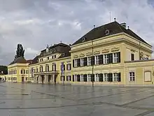
| 6 | Q2243894 | Schloss Vösendorf | museum in Austria | château museum cultural property |
Vösendorf | Schloss Vösendorf |  |
48°07′15″N 16°20′34″E / 48.1208°N 16.3427°E |
clergy house
| # | WD item | article | description | is a | municipality | commons category | picture | coordinates | position map |
|---|---|---|---|---|---|---|---|---|---|
| 1 | Q38038207 | Laxenburg Rectory | building in Laxenburg, Austria | clergy house | Laxenburg | Laxenburg Rectory |  |
48°04′08″N 16°21′25″E / 48.06879°N 16.35686°E | |
| 2 | Q38109076 | Pfarrhof Hennersdorf | clergy house | Hennersdorf | Pfarrhof Hennersdorf |  |
48°06′47″N 16°21′43″E / 48.1129444°N 16.3619722°E |
concentration camp
| # | WD item | article | description | is a | municipality | commons category | picture | coordinates | position map |
|---|---|---|---|---|---|---|---|---|---|
| 1 | Q53866400 | Wien-Guntramsdorf concentration camp | concentration camp | Guntramsdorf | |||||
| 2 | Q53866403 | Wien-Hennersdorf concentration camp | concentration camp | Hennersdorf | |||||
| 3 | Q45478797 | Wien-Hinterbrühl concentration camp | concentration camp | Hinterbrühl | 48°05′23″N 16°15′37″E / 48.089797°N 16.260403°E | ||||
| 4 | Q53866409 | Wien-Laxenburg concentration camp | concentration camp | Laxenburg | |||||
| 5 | Q53866418 | Wien-Münchendorf concentration camp | concentration camp | Münchendorf | |||||
| 6 | Q53866429 | Wien-Vösendorf concentration camp | concentration camp | Vösendorf | |||||
| 7 | Q1310009 | Wiener Neudorf concentration camp | building in Lower Austria, Austria | concentration camp | Wiener Neudorf |  |
48°04′00″N 16°19′39″E / 48.0667°N 16.3274°E |
cultural heritage ensemble
| # | WD item | article | description | is a | municipality | commons category | picture | coordinates | position map |
|---|---|---|---|---|---|---|---|---|---|
| 1 | Q64765105 | Gesamtanlage Schlosspark Laxenburg | cultural heritage ensemble | Achau |  |
||||
| 2 | Q64765106 | Gesamtanlage Schlosspark Laxenburg | cultural heritage ensemble | Münchendorf | Laxenburg castles | |
cultural property


.JPG.webp)


destroyed building or structure
| # | WD item | article | description | is a | municipality | commons category | picture | coordinates | position map |
|---|---|---|---|---|---|---|---|---|---|
| 1 | Q99383946 | Saint Martins Church, Mödling | destroyed building or structure | Mödling | Saint Martins Church, Mödling | 48°05′10″N 16°17′58″E / 48.08623°N 16.29942°E | |||
| 2 | Q106588385 | Synagoge Mödling | destroyed building or structure synagogue |
Mödling |  |
48°05′14″N 16°17′03″E / 48.0871°N 16.28417°E |
factory
| # | WD item | article | description | is a | municipality | commons category | picture | coordinates | position map |
|---|---|---|---|---|---|---|---|---|---|
| 1 | Q73415275 | Lackfabrik Ludwig Marx | factory | Gaaden | Lackfabrik Ludwig Marx |  |
48°04′14″N 16°13′05″E / 48.070522°N 16.218053°E | ||
| 2 | Q1213342 | Mödlinger Lokomotivfabrik | factory | Mödling | 48°04′55″N 16°17′57″E / 48.08194444°N 16.29916667°E |
filial church
| # | WD item | article | description | is a | municipality | commons category | picture | coordinates | position map |
|---|---|---|---|---|---|---|---|---|---|
| 1 | Q38041080 | Church Sparbach | church in Sparbach (Hinterbrühl), Austria | filial church | Hinterbrühl | Church Sparbach |  |
48°04′29″N 16°11′24″E / 48.074814°N 16.189915°E | |
| 2 | Q119231391 | Kath. Filialkirche Maria Königin | filial church | Perchtoldsdorf | Marienkirche, Perchtoldsdorf |  |
48°07′32″N 16°16′50″E / 48.12563°N 16.28066°E | ||
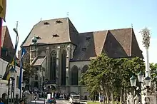
| 3 | Q64512859 | Waisenhauskirche | filial church | Mödling | Waisenhauskirche (Mödling) |  |
48°05′10″N 16°17′58″E / 48.08623°N 16.29942°E |
fire engine
| # | WD item | article | description | is a | municipality | commons category | picture | coordinates | position map |
|---|---|---|---|---|---|---|---|---|---|
| 1 | Q109610735 | Dodge Canada-FF Maria Enzersdorf | fire engine | Maria Enzersdorf | Dodge Canada-FF Maria Enzersdorf |  |
|||
| 2 | Q109585098 | Steyr 380-Fire engine, Perchtodsdorf | fire engine Steyr 380 |
Perchtoldsdorf | Steyr 380-Fire engine, Perchtodsdorf |  |
fire station


forest
| # | WD item | article | description | is a | municipality | commons category | picture | coordinates | position map |
|---|---|---|---|---|---|---|---|---|---|
| 1 | Q21873389 | Anninger Forst | forest area | forest | Mödling District | 48°04′00″N 16°15′00″E / 48.066666666667°N 16.25°E | |||
| 2 | Q21859776 | Leopoldsdorfer Wald | forest | Breitenfurt bei Wien | 48°07′58″N 16°13′32″E / 48.132777777777775°N 16.225555555555555°E | ||||
| 3 | Q21859673 | Schlösslwald | forest | Gaaden | 48°02′59″N 16°10′56″E / 48.04974°N 16.18226°E |
gate
| # | WD item | article | description | is a | municipality | commons category | picture | coordinates | position map |
|---|---|---|---|---|---|---|---|---|---|
| 1 | Q107653885 | Altes Dianator | gate of Lainzer Tiergarten, Vienna | gate | Hietzing Auhof Laab im Walde |
Altes Dianator |  |
48°09′58″N 16°11′38″E / 48.16618°N 16.19394°E | |
| 2 | Q107672656 | Laaber Tor | gate of Lainzer Tiergarten, Austria | gate | Laab im Walde | Laaber Tor |  |
48°09′45″N 16°11′02″E / 48.16247°N 16.18393°E |
grave field
| # | WD item | article | description | is a | municipality | commons category | picture | coordinates | position map |
|---|---|---|---|---|---|---|---|---|---|
| 1 | Q38023209 | Gräberfeld An der Goldenen Stiege | building in Mödling, Austria | grave field | Mödling | 48°04′55″N 16°16′52″E / 48.08205°N 16.28109°E | |||
| 2 | Q37829739 | Gräberfeld Drei Mahden | building in Münchendorf, Austria | grave field | Münchendorf | 48°00′39″N 16°23′23″E / 48.0108°N 16.38967°E | |||
| 3 | Q38025025 | Römisches Gräberfeld Aspetten | grave field in Perchtoldsdorf, Austria | grave field | Perchtoldsdorf | 48°07′49″N 16°16′47″E / 48.13024°N 16.27971°E |
gymnasium
| # | WD item | article | description | is a | municipality | commons category | picture | coordinates | position map |
|---|---|---|---|---|---|---|---|---|---|
| 1 | Q795916 | BG Bachgasse Mödling | gymnasium | gymnasium | Mödling | BG Bachgasse Mödling |  |
48°05′05″N 16°17′59″E / 48.0846°N 16.2997°E | |
| 2 | Q1006142 | BRG Keimgasse, Mödling | school in Lower Austria | gymnasium | Mödling | BRG Keimgasse, Mödling | 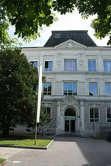 |
48°05′06″N 16°17′32″E / 48.0851°N 16.2922°E |
heritage site


hospital
| # | WD item | article | description | is a | municipality | commons category | picture | coordinates | position map |
|---|---|---|---|---|---|---|---|---|---|
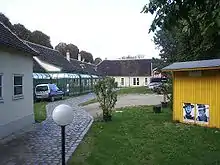
| 1 | Q64555004 | NÖ HPZ Hinterbrühl | hospital | hospital | Hinterbrühl | NÖ HPZ HInterbrühl | |||
| 2 | Q1802296 | Thermenklinikum Mödling | hospital in Austria | hospital | Mödling | Thermenklinikum Mödling |  |
48°05′22″N 16°17′50″E / 48.0894°N 16.2972°E |
hotel
house
| # | WD item | article | description | is a | municipality | commons category | picture | coordinates | position map |
|---|---|---|---|---|---|---|---|---|---|
| 1 | Q54666764 | Brunner Gasse 58 | building in Perchtoldsdorf, Austria | house | Perchtoldsdorf |  |
48°06′52″N 16°16′20″E / 48.114491°N 16.27219°E | ||
| 2 | Q59647449 | Hochstraße 98, Perchtoldsdorf | building in Perchtoldsdorf, Austria | house | Perchtoldsdorf | Hochstraße 98, Perchtoldsdorf | 48°07′44″N 16°15′29″E / 48.128813°N 16.258189°E | ||
| 3 | Q54637832 | Mathias-Lang-Gasse 3 | building in Perchtoldsdorf, Austria | house | Perchtoldsdorf | 48°07′09″N 16°16′09″E / 48.119175°N 16.269213°E | |||
| 4 | Q54637828 | Siebzehn-Föhren-Gasse 4 | building in Perchtoldsdorf, Austria | house | Perchtoldsdorf |  |
48°07′11″N 16°15′16″E / 48.119816°N 16.254464°E |
human settlement


local museum
| # | WD item | article | description | is a | municipality | commons category | picture | coordinates | position map |
|---|---|---|---|---|---|---|---|---|---|
| 1 | Q38109415 | Heimatmuseum | museum in Austria | local museum | Gaaden |  |
48°03′11″N 16°12′02″E / 48.0531111°N 16.2005278°E | ||
| 2 | Q38138110 | Heimatmuseum Guntramsdorf | museum in Austria | local museum | Guntramsdorf | Heimatmuseum Guntramsdorf |  |
48°02′57″N 16°18′40″E / 48.0492222°N 16.3111944°E |
locality
| # | WD item | article | description | is a | municipality | commons category | picture | coordinates | position map |
|---|---|---|---|---|---|---|---|---|---|
| 1 | Q61747787 | Gruberau | locality in Mödling District | locality | Wienerwald | 48°06′54″N 16°06′04″E / 48.11502013°N 16.10102284°E | |||
| 2 | Q1305667 | Sparbach | locality and cadastral community in Mödling District | locality cadastral municipality of Austria municipality |
Hinterbrühl | Sparbach (Gemeinde Hinterbrühl) | 48°04′26″N 16°11′25″E / 48.07398°N 16.19023°E | ||
| 3 | Q110728050 | Stangau | locality in Mödling District | locality | Wienerwald | ||||
| 4 | Q1465652 | Wassergspreng | locality in Mödling District | locality | Hinterbrühl | 48°05′27″N 16°12′41″E / 48.0908°N 16.2114°E | |||
| 5 | Q2556506 | Weissenbach bei Mödling | locality in Mödling District | locality municipality |
Hinterbrühl Mödling District |
Weissenbach bei Mödling |  |
48°04′51″N 16°13′16″E / 48.0808°N 16.2212°E | |
| 6 | Q110964498 | Wöglerin | locality in Mödling District | locality | Wienerwald |
mansion


market municipality


.JPG.webp)


mill
| # | WD item | article | description | is a | municipality | commons category | picture | coordinates | position map |
|---|---|---|---|---|---|---|---|---|---|
| 1 | Q115051709 | Höldrichsmühle | mill inn |
Hinterbrühl | Höldrichsmühle Hinterbrühl |  |
48°04′52″N 16°14′06″E / 48.08099894937983°N 16.234979322444744°E | ||
| 2 | Q38039015 | Putschermühle | building in Mödling, Austria | mill | Mödling | Putschermühle |  |
48°04′58″N 16°17′42″E / 48.08279°N 16.29489°E | |
| 3 | Q37959743 | Scharingerhof, Knochenhof, Mühle am Holzertor | building in Perchtoldsdorf, Austria | mill | Perchtoldsdorf |  |
48°07′05″N 16°15′53″E / 48.11803°N 16.26477°E | ||
| 4 | Q37962975 | Schlossmühle | building in Wiener Neudorf, Austria | mill | Wiener Neudorf |  |
48°05′01″N 16°19′35″E / 48.08363°N 16.3265°E | ||
| 5 | Q38038994 | Sog. Fischermühle | building in Mödling, Austria | mill | Mödling |  |
48°05′04″N 16°17′08″E / 48.08431°N 16.28569°E | ||
| 6 | Q38131814 | Spitalsmühle | building in Mödling, Austria | mill | Mödling | Spitalsmühle (Mödling) |  |
48°05′01″N 16°16′41″E / 48.0837°N 16.27798°E |
monastery

.JPG.webp)


monument
| # | WD item | article | description | is a | municipality | commons category | picture | coordinates | position map |
|---|---|---|---|---|---|---|---|---|---|
| 1 | Q120197862 | Cholerakreuz | monument wayside shrine |
Kaltenleutgeben | 48°06′51″N 16°12′00″E / 48.11407°N 16.199996°E | ||||
| 2 | Q106646877 | Ernest von Koerber-Denkmal Mödling | monument in Mödling, Austria | monument | Mödling | Ernest von Koerber-Denkmal Mödling |  |
48°05′09″N 16°17′59″E / 48.08576°N 16.29959°E | |
| 3 | Q21859764 | Kaiserstein | monument in Lower Austria | monument | Breitenfurt bei Wien |  |
48°07′45″N 16°06′37″E / 48.12906°N 16.11033°E | ||
| 4 | Q94693731 | Türkengedenkstein Perchtoldsdorf | monument in Perchtoldsdorf, Austria | monument | Perchtoldsdorf |  |
48°07′08″N 16°15′55″E / 48.118855°N 16.265301°E |
mountain


mountain hut
| # | WD item | article | description | is a | municipality | commons category | picture | coordinates | position map |
|---|---|---|---|---|---|---|---|---|---|
| 1 | Q567197 | Anningerhaus | building in Lower Austria | mountain hut | Gaaden | Anningerhaus | .JPG.webp) |
48°03′17″N 16°14′45″E / 48.05464°N 16.24592°E | |
| 2 | Q94579671 | Höllensteinhaus | mountain hut observation tower |
Kaltenleutgeben | Höllensteinhaus |  |
48°05′46″N 16°11′16″E / 48.09623°N 16.18772°E | ||
| 3 | Q55188560 | Kammersteiner Hütte, Perchtoldsdorf | building in Perchtoldsdorf, Austria | mountain hut | Perchtoldsdorf | Kammersteiner Hütte, Perchtoldsdorf |  |
48°07′00″N 16°13′41″E / 48.11677°N 16.22806°E | |
| 4 | Q102188851 | Teufelsteinhütte | mountain hut | Perchtoldsdorf | Teufelsteinhütte |  |
48°07′05″N 16°13′30″E / 48.117933°N 16.224883°E | ||
| 5 | Q109317740 | Wiener Hütte | mountain hut | mountain hut restaurant human settlement |
Kaltenleutgeben | 48°07′40″N 16°12′29″E / 48.12772242458149°N 16.208132429621006°E |
multiple-vehicle collision
| # | WD item | article | description | is a | municipality | commons category | picture | coordinates | position map |
|---|---|---|---|---|---|---|---|---|---|
| 1 | Q105620047 | Massenkarambolage auf der Südautobahn 1982 | multiple-vehicle collision | Mödling District | 48°06′06″N 16°19′15″E / 48.101658°N 16.320798°E | ||||
| 2 | Q105622097 | Massenkarambolage auf der Südautobahn 1989 | multiple-vehicle collision | Mödling District Baden District |
48°03′23″N 16°20′27″E / 48.056492°N 16.340863°E |
museum


nature reserve
| # | WD item | article | description | is a | municipality | commons category | picture | coordinates | position map |
|---|---|---|---|---|---|---|---|---|---|
| 1 | Q21877771 | Naturschutzgebiet Eichkogel | nature reserve in Austria | nature reserve | Guntramsdorf Mödling |
 |
48°03′45″N 16°17′32″E / 48.06255°N 16.29227°E | ||
| 2 | Q55108349 | Naturschutzgebiet Teufelstein-Fischerwiesen | nature reserve in Lower Austria | nature reserve | Kaltenleutgeben Perchtoldsdorf |
Naturschutzgebiet Teufelstein-Fischerwiesen |  |
48°07′11″N 16°13′16″E / 48.11986°N 16.22104°E |
observation tower
| # | WD item | article | description | is a | municipality | commons category | picture | coordinates | position map |
|---|---|---|---|---|---|---|---|---|---|
| 1 | Q30117910 | Jubiläumswarte | Observation tower on the Anninger, Lower Austria | observation tower | Gaaden | Jubiläumswarte (Anninger) |  |
48°03′19″N 16°14′29″E / 48.05521°N 16.24143°E | |
| 2 | Q111495435 | Sittnerwarte | Observation tower in Hinterbrühl, Lower Austria | observation tower | Hinterbrühl | Sittner-Warte |  |
48°05′31″N 16°14′24″E / 48.09208°N 16.24001°E |
parish church


.JPG.webp)


park
| # | WD item | article | description | is a | municipality | commons category | picture | coordinates | position map |
|---|---|---|---|---|---|---|---|---|---|
| 1 | Q91102925 | Jubiläumspark Mödling | park | Mödling Maria Enzersdorf |
Jubiläumspark Mödling | 48°05′10″N 16°16′42″E / 48.08599°N 16.27824°E | |||
| 2 | Q21875133 | Laxenburg Castle Park | park in Laxenburg | park English garden |
Laxenburg |  |
48°03′47″N 16°21′54″E / 48.063°N 16.365°E | ||
| 3 | Q56696032 | Ökopark Rolling Hills | park in Laxenburg | park | Laxenburg | 48°03′45″N 16°20′35″E / 48.0624°N 16.3431°E |
pharmacy
| # | WD item | article | description | is a | municipality | commons category | picture | coordinates | position map |
|---|---|---|---|---|---|---|---|---|---|
| 1 | Q37957606 | Apothekerhaus | building in Laxenburg, Austria | pharmacy | Laxenburg |  |
48°04′03″N 16°21′24″E / 48.06758°N 16.35664°E | ||
| 2 | Q38039756 | Apothekerhaus | building in Perchtoldsdorf, Austria | pharmacy | Perchtoldsdorf |  |
48°07′08″N 16°15′54″E / 48.11882°N 16.26509°E | ||
| 3 | Q38038273 | Wohnhaus, Marien-Apotheke | building in Laxenburg, Austria | pharmacy residential building |
Laxenburg |  |
48°04′05″N 16°21′26″E / 48.06802°N 16.35713°E |
pipe organ
| # | WD item | article | description | is a | municipality | commons category | picture | coordinates | position map |
|---|---|---|---|---|---|---|---|---|---|
| 1 | Q113087894 | Walcker Mayer (Guntramsdorf), op. 5782 | pipe organ | pipe organ | Guntramsdorf | 48°03′49″N 16°19′09″E / 48.063719°N 16.31923°E | |||
| 2 | Q113087895 | Walcker-Mayer/Guntramsdorf, op. 4271 | pipe organ | pipe organ | Guntramsdorf | 48°02′50″N 16°18′48″E / 48.047333°N 16.313389°E | |||
| 3 | Q113087893 | Walcker-Mayer/Guntramsdorf, op. 5638 | pipe organ | pipe organ | Guntramsdorf | 48°03′15″N 16°18′55″E / 48.054071°N 16.315291°E |
plague column
| # | WD item | article | description | is a | municipality | commons category | picture | coordinates | position map |
|---|---|---|---|---|---|---|---|---|---|
| 1 | Q38123685 | Pestsäule | plague column | Münchendorf |  |
48°01′47″N 16°22′46″E / 48.0298°N 16.37931°E | |||
| 2 | Q38138091 | Pestsäule Guntramsdorf | plague column | Guntramsdorf | Pestsäule Guntramsdorf |  |
48°02′50″N 16°18′50″E / 48.04732493482689°N 16.31384390081353°E |
public bookcase
_9689.jpg.webp)

_9800.jpg.webp)
_9778.jpg.webp)
_0428.jpg.webp)
_9775.jpg.webp)
_9789.jpg.webp)
_9713.jpg.webp)
public library

railway station


rathaus
.JPG.webp)


residential building


restaurant
| # | WD item | article | description | is a | municipality | commons category | picture | coordinates | position map |
|---|---|---|---|---|---|---|---|---|---|
| 1 | Q56696412 | Laxenburgerhof | restaurant in Laxenburg | restaurant | Laxenburg | Restaurant Laxenburger Hof | .jpg.webp) |
48°04′03″N 16°21′26″E / 48.06754°N 16.35715°E | |
| 2 | Q56696329 | Rathausstüberl | restaurant in Laxenburg | restaurant | Laxenburg | .jpg.webp) |
48°04′05″N 16°21′27″E / 48.06819°N 16.35738°E |
river
| # | WD item | article | description | is a | municipality | commons category | picture | coordinates | position map |
|---|---|---|---|---|---|---|---|---|---|
| 1 | Q80778205 | Grenzgraben | river in Vienna and Lower Austria | river | Breitenfurt bei Wien Liesing |
Grenzgraben (Liesing) |  |
48°08′10″N 16°13′18″E / 48.136138°N 16.221763°E 48°08′51″N 16°12′39″E / 48.147419°N 16.210942°E |
|
| 2 | Q21864786 | Petersbach | river in Lower Austria and Vienna | river | Hennersdorf Leopoldsdorf Liesing Maria Lanzendorf Perchtoldsdorf Vösendorf |
Petersbach (Schwechat) | 48°05′40″N 16°25′20″E / 48.094504°N 16.42218°E 48°07′20″N 16°16′00″E / 48.1223°N 16.2667°E |
rural municipality of Austria


school
| # | WD item | article | description | is a | municipality | commons category | picture | coordinates | position map |
|---|---|---|---|---|---|---|---|---|---|
| 1 | Q54800646 | Bundesgymnasium und Bundesrealgymnasium Perchtoldsdorf | school in Perchtoldsdorf, Austria | school | Perchtoldsdorf | 48°07′16″N 16°15′28″E / 48.120996°N 16.257906°E | |||
| 2 | Q65911682 | Gendarmeriezentralschule Mödling | school in Mödling, Austria | school | Mödling | Gendarmeriezentralschule Mödling |  |
48°04′32″N 16°17′20″E / 48.075572°N 16.289015°E | |
| 3 | Q1350372 | HLM-HLP Mödling | shool in Austria | school | Mödling | HLM-HLP Mödling |  |
48°05′09″N 16°17′58″E / 48.0859°N 16.2995°E | |
| 4 | Q2523345 | VBS Mödling | school in Mödling, Austria | school | Mödling | VBS Mödling |  |
48°05′23″N 16°18′05″E / 48.0896°N 16.3015°E |
school building
| # | WD item | article | description | is a | municipality | commons category | picture | coordinates | position map |
|---|---|---|---|---|---|---|---|---|---|
| 1 | Q37756640 | BRG und BORG, ehemaliges Waisenhaus | school building | Maria Enzersdorf | Gymnasium Maria Enzersdorf |  |
48°05′56″N 16°16′12″E / 48.09884°N 16.27004°E | ||
| 2 | Q37801272 | Elementary school in Gumpoldskirchen | building in Gumpoldskirchen, Austria | school building | Gumpoldskirchen | Elementary school in Gumpoldskirchen |  |
48°02′45″N 16°16′48″E / 48.045944°N 16.280027°E | |
| 3 | Q38039057 | Jakob-Thoma-Mittelschule Mödling | building in Mödling, Austria | school building | Mödling | Jakob-Thoma-Mittelschule Mödling |  |
48°05′21″N 16°17′25″E / 48.08925°N 16.29035°E | |
| 4 | Q38124953 | Mittel- und Volksschule | building in Perchtoldsdorf, Austria | school building | Perchtoldsdorf | 48°07′14″N 16°15′37″E / 48.12069°N 16.26035°E | |||
| 5 | Q37864440 | Pfarrhof und ehemalige Volksschule, Gaaden | building in Gaaden, Austria | school building | Gaaden | Pfarrhof und ehemalige Volksschule, Gaaden |  |
48°03′14″N 16°11′47″E / 48.0538056°N 16.1964444°E |
sculpture


ship canal
| # | WD item | article | description | is a | municipality | commons category | picture | coordinates | position map |
|---|---|---|---|---|---|---|---|---|---|
| 1 | Q64485509 | Wiener Neustädter Kanal | ship canal | Gumpoldskirchen | Wiener Neustädter Kanal |  |
|||
| 2 | Q64485490 | Wiener Neustädter Kanal in Guntramsdorf | ship canal | Guntramsdorf | Wiener Neustädter Kanal in Guntramsdorf |  |
spring
| # | WD item | article | description | is a | municipality | commons category | picture | coordinates | position map |
|---|---|---|---|---|---|---|---|---|---|
| 1 | Q21880652 | Buchbrunnen | spring in Lower Austria, Austria | spring | Perchtoldsdorf | 48°06′56″N 16°13′28″E / 48.11544°N 16.22437°E | |||
| 2 | Q107470069 | Dianaquelle Sparbach | spring | Hinterbrühl | Dianaquelle Sparbach |  |
48°05′13″N 16°11′27″E / 48.0868524°N 16.1909492°E | ||
| 3 | Q21880651 | Rebekkaquelle | spring | Kaltenleutgeben | Rebekkaquelle Kaltenleutgeben |  |
48°06′55″N 16°12′00″E / 48.11526°N 16.19992°E |
square
| # | WD item | article | description | is a | municipality | commons category | picture | coordinates | position map |
|---|---|---|---|---|---|---|---|---|---|
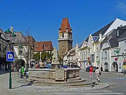
| 1 | Q106635705 | Bahnhofsplatz | square in Mödling | square | Mödling | Bahnhofsplatz (Mödling) | |||
| 2 | Q106635713 | Freiheitsplatz | square in Mödling | square | Mödling | Freiheitsplatz (Mödling) | |||
| 3 | Q106635722 | Schrannenplatz | square in Mödling | square | Mödling | Schrannenplatz (Mödling) |
street
stumbling stone
| # | WD item | article | description | is a | municipality | commons category | picture | coordinates | position map |
|---|---|---|---|---|---|---|---|---|---|
| 1 | Q44200432 | Stolperstein dedicated to Eduard Göth | stumbling stone | Hinterbrühl |  |
48°05′12″N 16°14′47″E / 48.086755°N 16.246388°E | |||
| 2 | Q44200465 | Stolperstein dedicated to Hedy Blum | stumbling stone | Mödling |  |
48°05′09″N 16°17′08″E / 48.085719°N 16.285549°E | |||
| 3 | Q43675234 | Stolperstein dedicated to Karl Motesiczky | stumbling stone | Hinterbrühl |  |
48°05′03″N 16°14′03″E / 48.0841°N 16.234057°E | |||
| 4 | Q43650674 | Stolperstein dedicated to Maria Restituta Kafka | stumbling stone | Mödling | .jpg.webp) |
theatre
| # | WD item | article | description | is a | municipality | commons category | picture | coordinates | position map |
|---|---|---|---|---|---|---|---|---|---|
| 1 | Q46844808 | Laxenburg Palace Theatre | theatre in the Blauer Hof palace of Laxenburg, Austria | theatre palace theatre |
Laxenburg | Schlosstheater Laxenburg |  |
||
| 2 | Q61465869 | Sommertheater Mödling | former theatre in Mödling, Austria | theatre destroyed building or structure |
Mödling | 48°05′00″N 16°16′42″E / 48.08337°N 16.27832°E | |||
| 3 | Q2328268 | Stadttheater Mödling | theatre in Mödling, Austria | theatre | Mödling | Stadttheater Mödling |  |
48°05′03″N 16°17′02″E / 48.0842°N 16.2839°E | |
| 4 | Q2416113 | Theater im Bunker | theatre | theatre | Mödling |  |
48°05′04″N 16°16′36″E / 48.0844°N 16.2767°E |
theatre festival
| # | WD item | article | description | is a | municipality | commons category | picture | coordinates | position map |
|---|---|---|---|---|---|---|---|---|---|
| 1 | Q55182221 | Sommerspiele Perchtoldsdorf | theatre festival | Perchtoldsdorf | |||||
| 2 | Q61465892 | Sommertheater Mödling | open-air summer theatre festival in Mödling, Austria | theatre festival open-air theatre |
Mödling |
villa


war grave
| # | WD item | article | description | is a | municipality | commons category | picture | coordinates | position map |
|---|---|---|---|---|---|---|---|---|---|
| 1 | Q90730388 | war grave Vösendorf | WW I war grave on the cemetery in Vösendorf, Austria | war grave | Vösendorf | Soldatenfriedhof Vösendorf (Erster Weltkrieg, Österreich-Ungarn) |  |
48°07′34″N 16°20′32″E / 48.126133°N 16.342325°E | |
| 2 | Q90730716 | war grave Vösendorf | WW II war grave on the cemetery in Vösendorf, Austria | war grave | Vösendorf | Soldatenfriedhof Vösendorf (Zweiter Weltkrieg, russisch) | 48°07′33″N 16°20′33″E / 48.125748°N 16.342423°E |
war memorial


water pipeline
| # | WD item | article | description | is a | municipality | commons category | picture | coordinates | position map |
|---|---|---|---|---|---|---|---|---|---|
| 1 | Q64691982 | Teil der 1. Wiener Hochquellenleitung | water pipeline | Mödling | Aquädukt Mödling |  |
|||
| 2 | Q64765568 | Teil der 1. Wiener Hochquellenleitung | water pipeline | Perchtoldsdorf | Aquädukt Liesing |  |
|||
| 3 | Q64765583 | Teil der 1. Wiener Hochquellenleitung | water pipeline | Guntramsdorf |  |
||||
| 4 | Q64765584 | Teil der 1. Wiener Hochquellenleitung | water pipeline | Gumpoldskirchen |  |
||||
| 5 | Q64765590 | Teil der 1. Wiener Hochquellenleitung | water pipeline | Brunn am Gebirge |  |
water well


watercourse
| # | WD item | article | description | is a | municipality | commons category | picture | coordinates | position map |
|---|---|---|---|---|---|---|---|---|---|
| 1 | Q21859741 | Hochleitenbach | watercourse in Lower Austria | watercourse | Biedermannsdorf | Hochleitenbach |  |
48°05′20″N 16°21′26″E / 48.08902°N 16.35732°E 48°05′42″N 16°20′45″E / 48.09501°N 16.34582°E |
|
| 2 | Q21859758 | Schirgengraben | watercourse in Austria | watercourse | Perchtoldsdorf | Schirgengraben |  |
48°06′35″N 16°14′46″E / 48.10978°N 16.24603°E |
wayside shrine


.jpg.webp)


Misc


_-_Bundesstadion_S%C3%BCdstadt_(02).jpg.webp)


.JPG.webp)


.JPG.webp)


End of auto-generated list.
This article is issued from Wikipedia. The text is licensed under Creative Commons - Attribution - Sharealike. Additional terms may apply for the media files.