| Voire | |
|---|---|
%252C_vue_du_pont_sur_la_Voire.JPG.webp) | |
 | |
| Location | |
| Country | France |
| Physical characteristics | |
| Mouth | |
• location | Aube |
• coordinates | 48°26′39″N 4°24′25″E / 48.44417°N 4.40694°E |
| Length | 56.2 km (34.9 mi) |
| Basin size | 896 km2 (346 sq mi) |
| Discharge | |
| • average | 7.07 m3/s (250 cu ft/s) |
| Basin features | |
| Progression | Aube→ Seine→ English Channel |
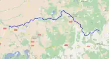
The Voire (French pronunciation: [vwaʁ]) is a small river in France, in the drainage basin of the Seine. It is 56.2 km (34.9 mi) long.[1] Its source is in Mertrud, in the Haute-Marne department. It flows through Montier-en-Der and Puellemontier, and empties into the river Aube at Chalette-sur-Voire, in the Aube department.
References
This article is issued from Wikipedia. The text is licensed under Creative Commons - Attribution - Sharealike. Additional terms may apply for the media files.