Sachkhere Municipality
საჩხერის მუნიციპალიტეტი | |
|---|---|
.jpg.webp) Modinakhe fortress | |
 Flag  Seal | |
 Location of the municipality within Georgia | |
| Country | |
| Region | Imereti |
| Capital | Sachkhere |
| Government | |
| • Type | Mayor–Council |
| • Mayor | Levan Ivanashvili (GD) |
| • Municipal Assembly | 33 members |
| Area | |
| • Total | 973 km2 (376 sq mi) |
| Population (2014) | |
| • Total | 37.775 |
| Population by ethnicity[1] | |
| • Georgians | 99.8 % |
| • Russians | 0.1 % |
| • Others | 0.1 % |
| Time zone | UTC+4 (Georgian Standard Time) |
Sachkhere (Georgian: საჩხერის მუნიციპალიტეტი, Saçxeris municiṗaliṫeṫi) is a district of Georgia, in the region of Imereti. Its main town is Sachkhere. From the north, the municipality of Sachkhere is boarded by Oni and Ambrolauri Municipality, from the east – java and Kareli, from south – Khashuri and Kharagauli and from the west by Chiatura Municipality.
Settlements
| Rank | Settlement | Population |
|---|---|---|
| 1 | Sachkhere | 6,140 |
| 2 | Chorvila | 1,451 |
| 3 | Gorisa | 1,087 |
| 4 | Perevi | 564 |
Politics
Sachkhere Municipal Assembly (Georgian: საჩხერის საკრებულო, Sachkheris Sakrebulo) is a representative body in Sachkhere Municipality, consisting of 33 members and elected every four years. The last election was held in October 2021.
| Party | 2017[2] | 2021[3] | Current Municipal Assembly | |||||||||||||||||||||||||||||||||||||||||||||
|---|---|---|---|---|---|---|---|---|---|---|---|---|---|---|---|---|---|---|---|---|---|---|---|---|---|---|---|---|---|---|---|---|---|---|---|---|---|---|---|---|---|---|---|---|---|---|---|---|
| Georgian Dream | 26 | 30 | ||||||||||||||||||||||||||||||||||||||||||||||
| United National Movement | 1 | 2 | ||||||||||||||||||||||||||||||||||||||||||||||
| For Georgia | 1 | |||||||||||||||||||||||||||||||||||||||||||||||
| European Georgia | 1 | |||||||||||||||||||||||||||||||||||||||||||||||
| Alliance of Patriots | 1 | |||||||||||||||||||||||||||||||||||||||||||||||
| Total | 29 | 33 | ||||||||||||||||||||||||||||||||||||||||||||||
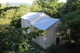
Gallery
.jpg.webp)
See also
References
- ↑ "Ethnic composition of Georgia 2014". Pop Stat. 2014. Retrieved 2022-08-22.
- ↑ "Protocol elected municipal council members and mayors 2017" (PDF) (in Georgian). CESKO Central Election Commission. pp. 76–78. Retrieved 2021-01-06.
- ↑ "Protocol elected municipal council members and mayors 2021" (PDF) (in Georgian). CESKO Central Election Commission. pp. 94–96. Retrieved 2021-01-06.
External links
- Districts of Georgia, Statoids.com
| Autonomous Republic of Abkhazia | |
|---|---|
| Autonomous Republic of Adjara | |
| Guria | |
| Imereti | |
| Kakheti | |
| Mtskheta-Mtianeti | |
| Racha-Lechkhumi and Kvemo Svaneti | |
| Samegrelo-Zemo Svaneti | |
| Samtskhe-Javakheti | |
| Kvemo Kartli | |
| Shida Kartli | |
42°20′43″N 43°25′10″E / 42.34528°N 43.41944°E
This article is issued from Wikipedia. The text is licensed under Creative Commons - Attribution - Sharealike. Additional terms may apply for the media files.