Saint-Alphonse-Rodriguez | |
|---|---|
 | |
 Location within Matawinie RCM | |
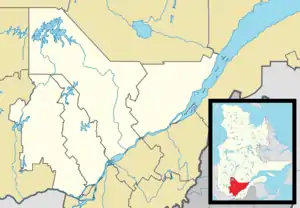 Saint-Alphonse-Rodriguez Location in central Quebec. | |
| Coordinates: 46°11′N 73°42′W / 46.183°N 73.700°W[1] | |
| Country | |
| Province | |
| Region | Lanaudière |
| RCM | Matawinie |
| Constituted | July 1, 1855 |
| Government | |
| • Mayor | Isabelle Perreault |
| • Federal riding | Joliette |
| • Prov. riding | Berthier |
| Area | |
| • Total | 104.60 km2 (40.39 sq mi) |
| • Land | 97.79 km2 (37.76 sq mi) |
| Population (2021)[3] | |
| • Total | 3,339 |
| • Density | 34.2/km2 (89/sq mi) |
| • Pop 2006-2021 | |
| • Dwellings | 2,363 |
| Time zone | UTC−5 (EST) |
| • Summer (DST) | UTC−4 (EDT) |
| Postal code(s) | |
| Area code(s) | 450 and 579 |
| Highways | |
| Website | www |
Saint-Alphonse-Rodriguez is a municipality in the Lanaudière region of Quebec, Canada, part of the Matawinie Regional County Municipality.
Demographics
Population
|
|
|
Private dwellings occupied by usual residents: 1529 (total dwellings: 2363)
Language
Mother tongue:[5]
- English as first language: 1.9%
- French as first language: 95.7%
- English and French as first language: 1.1%
- Other as first language: 1.3%
Education
Commission scolaire des Samares operates Francophone public schools:
- École de Saint-Alphonse[6]
Sir Wilfrid Laurier School Board operates Anglophone public schools:
- Rawdon Elementary School in Rawdon[7]
- Joliette High School in Joliette[8]
See also
References
- ↑ "Banque de noms de lieux du Québec: Reference number 268104". toponymie.gouv.qc.ca (in French). Commission de toponymie du Québec.
- 1 2 "Répertoire des municipalités: Geographic code 62025". www.mamh.gouv.qc.ca (in French). Ministère des Affaires municipales et de l'Habitation.
- 1 2 Statistics Canada 2021 Census -
- ↑ Statistics Canada: 1996, 2001, 2006, 2011, 2016, 2021 census
- ↑ Statistics Canada 2006 Census - Saint-Alphonse-Rodriguez community profile
- ↑ "de Saint-Alphonse." Commission scolaire des Samares. Retrieved on September 23, 2017.
- ↑ "Rawdon Elementary" Zone Map. Sir Wilfrid Laurier School Board. Retrieved on September 17, 2017.
- ↑ "Joliette High School Zone Sec 1-5." Sir Wilfrid Laurier School Board. Retrieved on September 5, 2017.
Adjacent Municipal Subdivisions | ||||||||||||||||
|---|---|---|---|---|---|---|---|---|---|---|---|---|---|---|---|---|
| ||||||||||||||||
| Municipalities | |
|---|---|
| Parishes | |
| Unorganized Territories | |
| |
This article is issued from Wikipedia. The text is licensed under Creative Commons - Attribution - Sharealike. Additional terms may apply for the media files.