Saint-Benoît-Labre | |
|---|---|
 | |
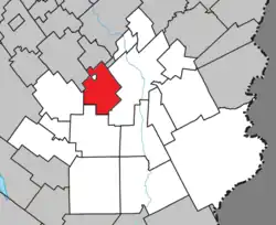 Location within Beauce-Sartigan RCM. | |
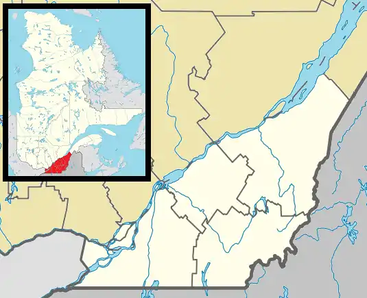 Saint-Benoît-Labre Location in southern Quebec. | |
| Coordinates: 46°04′N 70°48′W / 46.067°N 70.800°W[1] | |
| Country | |
| Province | |
| Region | Chaudière-Appalaches |
| RCM | Beauce-Sartigan |
| Constituted | January 4, 1894 |
| Government | |
| • Mayor | Marco Marois |
| • Federal riding | Beauce |
| • Prov. riding | Beauce-Sud |
| Area | |
| • Total | 86.90 km2 (33.55 sq mi) |
| • Land | 84.99 km2 (32.81 sq mi) |
| Population (2011)[3] | |
| • Total | 1,612 |
| • Density | 19.0/km2 (49/sq mi) |
| • Pop 2006-2011 | |
| • Dwellings | 735 |
| Time zone | UTC−5 (EST) |
| • Summer (DST) | UTC−4 (EDT) |
| Postal code(s) | |
| Area code(s) | 418 and 581 |
| Highways | |
| Website | www.saint benoitlabre.qc.ca |
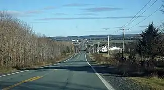
Saint-Benoît-Labre is a municipality in the Municipalité régionale de comté de Beauce-Sartigan in Quebec, Canada. It is part of the Chaudière-Appalaches region and the population is 1,630 as of 2009. It is named after Benedict Joseph Labre.
In 2001 a group of Cistercian nuns moved from Saint-Romuald, Quebec to a newly constructed abbey in Saint-Benoît-Labre, where they make chocolate.
The territory of Saint-Benoît-Labre surrounds the village of Lac-Poulin.
References
- ↑ "Banque de noms de lieux du Québec: Reference number 285906". toponymie.gouv.qc.ca (in French). Commission de toponymie du Québec.
- 1 2 "Répertoire des municipalités: Geographic code 29100". www.mamh.gouv.qc.ca (in French). Ministère des Affaires municipales et de l'Habitation.
- 1 2 "Saint-Benoît-Labre (Code 2429100) Census Profile". 2011 census. Government of Canada - Statistics Canada.
- Commission de toponymie du Québec
- Ministère des Affaires municipales, des Régions et de l'Occupation du territoire
Places adjacent to Saint-Benoît-Labre | ||||||||||||||||
|---|---|---|---|---|---|---|---|---|---|---|---|---|---|---|---|---|
| ||||||||||||||||
| Cities & Towns | |
|---|---|
| Municipalities | |
| Parishes | |
| Villages | |
| |
This article is issued from Wikipedia. The text is licensed under Creative Commons - Attribution - Sharealike. Additional terms may apply for the media files.