Savigny-sous-Mâlain | |
|---|---|
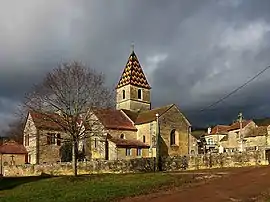 The church in Savigny-sous-Mâlain | |
.svg.png.webp) Coat of arms | |
Location of Savigny-sous-Mâlain | |
 Savigny-sous-Mâlain 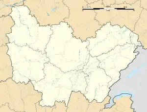 Savigny-sous-Mâlain | |
| Coordinates: 47°19′59″N 4°45′37″E / 47.3331°N 4.7603°E | |
| Country | France |
| Region | Bourgogne-Franche-Comté |
| Department | Côte-d'Or |
| Arrondissement | Dijon |
| Canton | Talant |
| Government | |
| • Mayor (2020–2026) | Géraldine Meuzard[1] |
| Area 1 | 6.35 km2 (2.45 sq mi) |
| Population | 231 |
| • Density | 36/km2 (94/sq mi) |
| Time zone | UTC+01:00 (CET) |
| • Summer (DST) | UTC+02:00 (CEST) |
| INSEE/Postal code | 21592 /21540 |
| Elevation | 362–593 m (1,188–1,946 ft) |
| 1 French Land Register data, which excludes lakes, ponds, glaciers > 1 km2 (0.386 sq mi or 247 acres) and river estuaries. | |
Savigny-sous-Mâlain (French pronunciation: [saviɲi su malɛ̃], literally Savigny under Mâlain) is a commune in the Côte-d'Or department in eastern France.
Population
| Year | Pop. | ±% |
|---|---|---|
| 1962 | 119 | — |
| 1968 | 136 | +14.3% |
| 1975 | 136 | +0.0% |
| 1982 | 139 | +2.2% |
| 1990 | 168 | +20.9% |
| 1999 | 202 | +20.2% |
| 2008 | 203 | +0.5% |
See also
References
- ↑ "Répertoire national des élus: les maires". data.gouv.fr, Plateforme ouverte des données publiques françaises (in French). 2 December 2020.
- ↑ "Populations légales 2021". The National Institute of Statistics and Economic Studies. 28 December 2023.
Wikimedia Commons has media related to Savigny-sous-Mâlain.
This article is issued from Wikipedia. The text is licensed under Creative Commons - Attribution - Sharealike. Additional terms may apply for the media files.