Schmiedefeld am Rennsteig | |
|---|---|
 | |
 Coat of arms | |
Location of Schmiedefeld am Rennsteig within Suhl 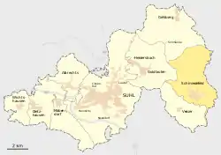 | |
 Schmiedefeld am Rennsteig 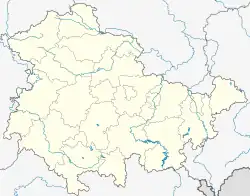 Schmiedefeld am Rennsteig | |
| Coordinates: 50°36′32″N 10°48′47″E / 50.60889°N 10.81306°E | |
| Country | Germany |
| State | Thuringia |
| Town | Suhl |
| Area | |
| • Total | 18.43 km2 (7.12 sq mi) |
| Elevation | 700 m (2,300 ft) |
| Population (2017-12-31) | |
| • Total | 1,653 |
| • Density | 90/km2 (230/sq mi) |
| Time zone | UTC+01:00 (CET) |
| • Summer (DST) | UTC+02:00 (CEST) |
| Postal codes | 98711 |
| Dialling codes | 036782 |
| Website | www.schmiedefeld.de |
Schmiedefeld am Rennsteig is a village and a former municipality in Thuringia, Germany. Formerly in the district Ilm-Kreis, it is part of the town Suhl since January 2019.
Gallery
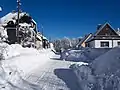 Schmiedefeld am Rennsteig in winter
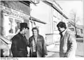 The Chimney sweep, of Schmiedefeld, 1989
References
![]() Media related to Schmiedefeld am Rennsteig at Wikimedia Commons
Media related to Schmiedefeld am Rennsteig at Wikimedia Commons
This article is issued from Wikipedia. The text is licensed under Creative Commons - Attribution - Sharealike. Additional terms may apply for the media files.