Smoky Falls
Location of Smoky Falls in Ontario
Smoky Falls is a community in Cochrane, Unorganized, North Part in Cochrane District, Ontario, Canada.
Climate
| Climate data for Smoky Falls | |||||||||||||
|---|---|---|---|---|---|---|---|---|---|---|---|---|---|
| Month | Jan | Feb | Mar | Apr | May | Jun | Jul | Aug | Sep | Oct | Nov | Dec | Year |
| Record high °C (°F) | 7.8 (46.0) |
10.6 (51.1) |
18.3 (64.9) |
28.9 (84.0) |
33.0 (91.4) |
40.0 (104.0) |
37.8 (100.0) |
35.0 (95.0) |
33.0 (91.4) |
26.7 (80.1) |
19.4 (66.9) |
13.0 (55.4) |
40.0 (104.0) |
| Mean daily maximum °C (°F) | −13.0 (8.6) |
−9.4 (15.1) |
−2.7 (27.1) |
5.8 (42.4) |
14.4 (57.9) |
20.2 (68.4) |
23.2 (73.8) |
21.7 (71.1) |
15.0 (59.0) |
7.4 (45.3) |
−1.3 (29.7) |
−9.2 (15.4) |
6.0 (42.8) |
| Daily mean °C (°F) | −18.7 (−1.7) |
−16.0 (3.2) |
−9.2 (15.4) |
−0.2 (31.6) |
8.2 (46.8) |
14.4 (57.9) |
17.6 (63.7) |
16.4 (61.5) |
10.7 (51.3) |
4.0 (39.2) |
−4.5 (23.9) |
−13.8 (7.2) |
0.7 (33.3) |
| Mean daily minimum °C (°F) | −24.5 (−12.1) |
−22.4 (−8.3) |
−15.8 (3.6) |
−6.1 (21.0) |
2.0 (35.6) |
8.6 (47.5) |
12.0 (53.6) |
11.1 (52.0) |
6.4 (43.5) |
0.5 (32.9) |
−7.8 (18.0) |
−18.5 (−1.3) |
−4.5 (23.8) |
| Record low °C (°F) | −47.2 (−53.0) |
−44.4 (−47.9) |
−41.1 (−42.0) |
−32.2 (−26.0) |
−15.6 (3.9) |
−7.2 (19.0) |
1.0 (33.8) |
−2.8 (27.0) |
−5.8 (21.6) |
−15.6 (3.9) |
−35.0 (−31.0) |
−41.1 (−42.0) |
−47.2 (−53.0) |
| Average precipitation mm (inches) | 58.0 (2.28) |
37.6 (1.48) |
43.1 (1.70) |
55.3 (2.18) |
59.2 (2.33) |
75.0 (2.95) |
104.7 (4.12) |
78.7 (3.10) |
111.7 (4.40) |
77.2 (3.04) |
77.2 (3.04) |
72.5 (2.85) |
850.3 (33.48) |
| Average rainfall mm (inches) | 0.0 (0.0) |
2.6 (0.10) |
9.2 (0.36) |
31.4 (1.24) |
55.9 (2.20) |
74.9 (2.95) |
104.7 (4.12) |
78.7 (3.10) |
111.2 (4.38) |
63.3 (2.49) |
23.6 (0.93) |
7.2 (0.28) |
562.7 (22.15) |
| Average snowfall cm (inches) | 58.0 (22.8) |
35.1 (13.8) |
33.9 (13.3) |
23.9 (9.4) |
3.4 (1.3) |
0.1 (0.0) |
0.0 (0.0) |
0.0 (0.0) |
0.5 (0.2) |
13.9 (5.5) |
56.6 (22.3) |
65.2 (25.7) |
287.6 (113.2) |
| Source: Environment Canada[1] | |||||||||||||
References
- ↑ "Smoky Falls". Canadian Climate Normals 1981–2010 (in English and French). Environment Canada. 31 October 2011. Retrieved September 13, 2015.
| City | 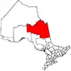 | |
|---|---|---|
| Towns | ||
| Townships | ||
| First Nations | ||
| Indian reserves | ||
| Indian settlements | ||
| Unorganized territories | ||
| Local services boards | ||
| Unincorporated communities | ||
| ||
50°05′N 82°16′W / 50.083°N 82.267°W
This article is issued from Wikipedia. The text is licensed under Creative Commons - Attribution - Sharealike. Additional terms may apply for the media files.