Szirmabesenyő | |
|---|---|
Large village | |
 Szirmabesenyő, Szirmay-palace from above | |
 Flag  Coat of arms | |
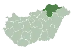
 Szirmabesenyő Location of Szirmabesenyő | |
| Coordinates: 48°08′58″N 20°47′45″E / 48.14958°N 20.79577°E | |
| Country | Hungary |
| Region | Northern Hungary |
| County | Borsod-Abaúj-Zemplén |
| District | Miskolc |
| Area | |
| • Total | 15.77 km2 (6.09 sq mi) |
| Population (1 January 2023)[1] | |
| • Total | 4,356 |
| • Density | 280/km2 (720/sq mi) |
| Time zone | UTC+1 (CET) |
| • Summer (DST) | UTC+2 (CEST) |
| Postal code | 3711 |
| Area code | (+36) 46 |
| Website | szirmabesenyo |
Szirmabesenyő (Slovak: Bešeňovo[2]) is a village in Borsod-Abaúj-Zemplén county, Hungary.
Gallery

References
- ↑ Error: Unable to display the reference properly. See the documentation for details.
- ↑ (PDF). 8 January 2014 https://web.archive.org/web/20140108214841/http://www.skgeodesy.sk/files/slovensky/ugkk/geodezia-kartografia/standardizacia-geografickeho-nazvoslovia/nazvy-geografickych-objektov-z-uzemia-mimo-sr/ExonymA-obcA.pdf. Archived from the original (PDF) on 8 January 2014. Retrieved 7 November 2022.
{{cite web}}: Missing or empty|title=(help)
External links
![]() Media related to Szirmabesenyő at Wikimedia Commons
Media related to Szirmabesenyő at Wikimedia Commons
- Official website in Hungarian
- Street map (in Hungarian)
- Aerial photographs
| City with county rights (1) |
|  |
|---|---|---|
| Towns (6) | ||
| Large village (1) | ||
| Villages (31) | ||
This article is issued from Wikipedia. The text is licensed under Creative Commons - Attribution - Sharealike. Additional terms may apply for the media files.