| Ta' Dmejrek | |
|---|---|
 View of Filfla and the Mediterranean Sea from Ta' Dmejrek. | |
| Highest point | |
| Elevation | 253 m (830 ft) |
| Prominence | 253 m (830 ft) |
| Listing | Country high point |
| Coordinates | 35°50′45″N 14°23′49″E / 35.84583°N 14.39694°E |
| Geography | |
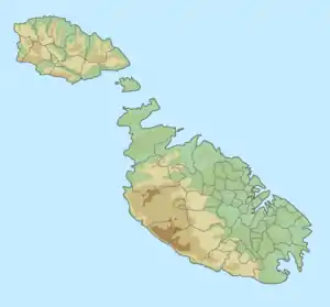 Ta' Dmejrek Malta | |
| Location | Siġġiewi, Malta |
Ta' Dmejrek is the highest point of Malta, located on the Dingli Cliffs, with an elevation of 253 metres (830 ft) above sea level.[1]
See also
References
- ↑ United States. Central Intelligence Agency, Government Publications Office (2016). The World Factbook 2016-17. Government Printing Office. p. 476.
External links
- "Ta'Dmejrek – Climbing, Hiking & Mountaineering" on Mountain-forecast
- "Dingli Cliffs, Malta" on Peakbagger
This article is issued from Wikipedia. The text is licensed under Creative Commons - Attribution - Sharealike. Additional terms may apply for the media files.