Tabarre
Taba | |
|---|---|
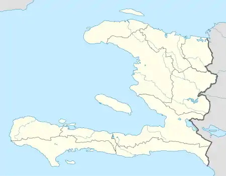 Tabarre Location in Haiti | |
| Coordinates: 18°35′0″N 72°16′0″W / 18.58333°N 72.26667°W | |
| Country | |
| Department | Ouest |
| Arrondissement | Port-au-Prince |
| Area | |
| • Total | 24.47 km2 (9.45 sq mi) |
| Elevation | 48 m (157 ft) |
| Population (2015 Est.)[1] | |
| • Total | 130,283 |
| • Density | 5,324/km2 (13,790/sq mi) |
| Website | mairiedetabarre.ht |
Tabarre (Haitian Creole: Taba) is a commune in the Port-au-Prince Arrondissement, in the Ouest department of Haiti. It is part of the urbanized area of Port-au-Prince, just northeast of the main part of the city, and next to Delmas.
The Haitian government Autorité Aéroportuaire Nationale is based in Tabarre.
References
- ↑ "Mars 2015 Population Totale, Population de 18 Ans et Plus Menages et Densites Estimes en 2015" (PDF). Institut Haïtien de Statistique et d’Informatique (IHSI). Retrieved 6 January 2016.
This article is issued from Wikipedia. The text is licensed under Creative Commons - Attribution - Sharealike. Additional terms may apply for the media files.