Adamsville | |
|---|---|
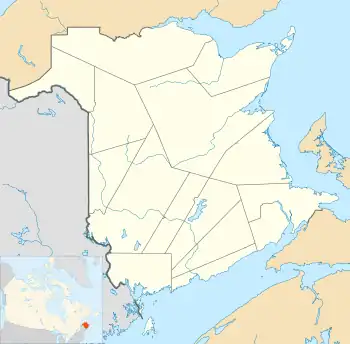
 Adamsville Location of Adamsville in New Brunswick | |
| Coordinates: 46°23′48″N 65°11′03″W / 46.396667°N 65.184167°W | |
| Country | Canada |
| Province | New Brunswick |
| County | Kent County |
| Lowest elevation | 0 m (0 ft) |
| Time zone | UTC-4 (Atlantic (AST)) |
| • Summer (DST) | UTC-3 (ADT) |
| Area code | 506 |
| NTS Map | 21I10 Richibucto |
Adamsville is a Canadian unincorporated community, located in Kent County, New Brunswick. The community is situated in southeastern New Brunswick, to the northwest of Moncton. Adamsville is located mainly on the New Brunswick Route 126.
Places of note
- Adamsville Lake has been an important trading spot to its original aboriginal Miq-Maq (Mic-Mac) people.
History
Notable people
See also
References
Bordering communities
- Coal Branch, New Brunswick
- Grangeville, New Brunswick
- Saint-Augustin, New Brunswick
- Saint-Sosime, New Brunswick
This article is issued from Wikipedia. The text is licensed under Creative Commons - Attribution - Sharealike. Additional terms may apply for the media files.