Al-Doho
حي الدحو | |
|---|---|
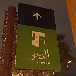
 al-Doho signboard near Masmak Fort | |
| Country | |
| City | Riyadh |
| Region | Old Riyadh |
| Government | |
| • Body | Baladiyah al-Batha |
| Area | |
| • Total | 0.08151 km2 (0.03147 sq mi) |
| Language | |
| • Official | Arabic |
Al-Doho (Arabic: حي الدحو), alternatively transliterated as al-Daho or al-Dahu, is a historic neighborhood situated within the former old city walls of southern Riyadh, Saudi Arabia, located in the Qasr al-Hukm District of al-Batʼha sub-municipality.[1]
Bordered by King Faisal Road to the east, al-Thumairi Street to the north, al-Madinah al-Munawwarah Road to the south and Sheikh Muhammad bin Ibrahim Street to the west, it is considered to be one of the last remnants of the old city neighborhoods.[2][3] The Royal Commission for Riyadh City (then The High Commission for the Development of Arriyadh) presented the plan to resuscitate the neighborhood in 2010[4] at the 2010 Saudi Travel and Tourism Investment Market and began its implementation 2013.[5]
References
- ↑ Bsheer, Rosie (2020-09-22). Archive Wars: The Politics of History in Saudi Arabia. Stanford University Press. ISBN 978-1-5036-1258-7.
- ↑ "حي الدحو - نواف ال الشيخ". www.al-jazirah.com. Retrieved 2022-05-23.
- ↑ Badran, Rawand (2020-02-11). "تحويل حي الدحو إلى مركز جذب للأنشطة التراثية". الهيئة الملكية لمدينة الرياض (in Arabic). Archived from the original on 2022-08-07. Retrieved 2022-05-23.
- ↑ ".. وطرح مشروع حي الدحو آخر أحياء الرياض القديمة". صحيفة الاقتصادية (in Arabic). 2010-03-30. Retrieved 2022-05-23.
- ↑ النواف, الرياض: فارس (2013-02-26). "إطلاق مشروع تطوير حي "الدحو" بالرياض". Watanksa (in Arabic). Retrieved 2022-05-23.