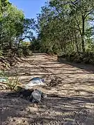
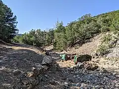
The Santa Fe River in New Mexico is fed by an extensive network of tributary arroyos; these define much of the landscape of Santa Fe, New Mexico and surrounding areas.[1] Together, the river, arroyos and aquifer they supply through infiltration comprise the Santa Fe River watershed.
Besides drainage, the arroyos provide a network of pathways for recreation and exercise when they are dry.[2] Health of the hydrologic basin and associated habitats within the local ecosystem is promoted by the Santa Fe Watershed Association (SWFA).
Upper watershed
The upper watershed is protected from human-caused erosion by hiking restrictions.
Middle watershed
Significant arroyos include Arroyo de los Chamisos, Arroyo Hondo, Arroyo de la Piedra, Arroyo de los Pinos, Canada Ancha, Arroyo Barranca, Arroyo Rosario, Arroyo Mascaras, Arroyo en Medio, Arroyo del Cerro, and Arroyo Saiz.[2]

Lower watershed
Arroyo Mascaras has tunnels.[3]
 Arroyo de la Piedra at confluence with Arroyo Barranca
 Arroyo Rosario crossing Griffin Street
 Arroyo de los Chamisos canyon above St. Michaels Drive
 Arroyo Hondo Open Space trail with I-25
 Arroyo Saiz old culvert near end of Armijo Street
 Wrecked car in Arroyo del Cerro
 "Heaven and Hell",
References
- ↑ "Streets & Drainage Maintenance". City of Santa Fe. Retrieved 28 September 2021.
- 1 2 "Santa Fe's Arroyo Systems". High Desert Dirt. Retrieved 28 September 2021.
- ↑ Cantú, Aaron (20 November 2017). "A Walk Through Hell". Santa Fe Reporter.
External links
- Santa Fe Watershed Association (SWFA) map of arroyos and projects
- City of Santa Fe resources about watershed