Bagalakote | |
|---|---|
City | |
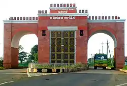
 Reconstructed Shirur Agasi | |
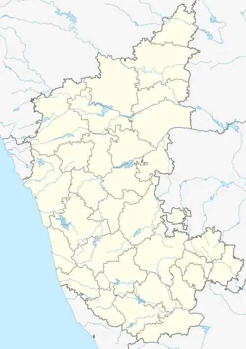
 Bagalakote Location in Karnataka, India | |
| Coordinates: 16°10′54″N 75°41′45″E / 16.1817°N 75.6958°E | |
| Country | |
| State | Karnataka |
| Region | Bayaluseeme |
| District | Bagalakote |
| Government | |
| • Type | City Municipal Council (CMC) |
| • Body | Bagalkote CMC & BTDA |
| Area | |
| • Total | 49.06 km2 (18.94 sq mi) |
| Elevation | 537.06 m (1,762.01 ft) |
| Population (2011)[1] | |
| • Total | 112,090 |
| • Density | 2,183/km2 (5,650/sq mi) |
| Demonym | Bagalkoteiens |
| Languages | |
| • Official | Kannada |
| Time zone | UTC+5:30 (IST) |
| PIN | 587101-103 |
| Telephone code | 08354 |
| Vehicle registration | KA-29, KA-48 |
| Website | bagalkot |
Bagalakote, is a city in the state of Karnataka, India, which is also the headquarters of Bagalakote district. It is situated on branch of River Ghataprabha about 481 km (299 mi) northwest of state capital Bengaluru, 410 km (255 mi) southwest of Hyderabad, and about 570 km (354 mi) southeast of Mumbai. The population of the urban agglomeration was 111,933[2] according to the provisional results of 2011 national census of India, and the city is spread over an area of 49.06 square kilometres (18.94 sq mi)[2] with an average elevation of 532 m (1,745 ft) above MSL.
History
Existence of the city
According to stone inscriptions in the surrounding area, the town's name was formerly Bagadige. According to legend, the town was given to the Bhajantries (musicians) by Ravana, the king of Lanka who ruled this area. One of the Bijapur Adil Shahi king Ibrahim Adil Shah II is said to have presented the town to his daughter as bangle money (a tradition in which the daughter is given money to buy bangles, sarees, and gold ornaments from her parents after the marriage).[3]
Rulers
Bagalkot remained under successive dominions of Vijayanagar emperors, Bijapur Adil Shahi, Peshwas, Kingdom of Mysore, Maratha rulers, and finally the British in 1818. In 1865, it was established as a municipality and civic amenities were provided to the residents of Bagalkot.
Geography
Bagalkot is located at 16°11′N 75°42′E / 16.18°N 75.7°E.[4] It has an average elevation of 533 metres (1,749 ft). It is situated on the bank of the river Ghataprabha.
Demographics
At the time of the 2011 census, Bagalkot had a population of 111,933. Bagalkot city has a sex ratio of 985 females to males and a literacy rate of 85.40%. Scheduled Castes and Scheduled Tribes made up 10.33% and 3.78% of the population respectively.[6]
At the time of the 2011 census, 69.10% of the population spoke Kannada, 22.15% Urdu, 3.94% Marathi and 1.07% Hindi as their first language.[7]
Gallery
 Bagalkot district ZP Constituency Map
 Bagalkot district Map by villages
 Bagalkot district taluk map
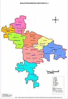
 Bagalkot lok sabha map
References
- 1 2 "District Census Handbook – Guntur" (PDF). Census of India. The Registrar General & Census Commissioner. p. 22. Retrieved 6 November 2012.
- 1 2 "District Census Handbook – Guntur"
- ↑ Busateenus-Salateen a Persian Manuscript of Mirza Ibrahim Zubairi.
- ↑ Falling Rain Genomics, Inc - Bagalkote
- ↑ "Table C-01 Population by Religion: Karnataka". censusindia.gov.in. Registrar General and Census Commissioner of India. 2011.
- ↑ "District Census Handbook: Bagalkot" (PDF). censusindia.gov.in. Registrar General and Census Commissioner of India. 2011.
- 1 2 "Table C-16 Population by Mother Tongue (Town): Karnataka". www.censusindia.gov.in. Registrar General and Census Commissioner of India.