Modibo Keita International Airport Aéroport international Modibo Keita | |||||||||||
|---|---|---|---|---|---|---|---|---|---|---|---|
 | |||||||||||
| Summary | |||||||||||
| Airport type | Joint (Public/Military) | ||||||||||
| Operator | Aéroports du Mali (ADM) | ||||||||||
| Location | Bamako, Mali | ||||||||||
| Opened | 1974 | ||||||||||
| Elevation AMSL | 1,247 ft / 380 m | ||||||||||
| Coordinates | 12°32′16″N 07°56′35″W / 12.53778°N 7.94306°W | ||||||||||
| Website | www | ||||||||||
| Map | |||||||||||
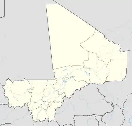
 BKO Location of airport in Mali | |||||||||||
| Runways | |||||||||||
| |||||||||||
*planned runway length extension to 10,444 ft. / 3,180 m complete by 9 Mar 2010 as part of Mali MCC.[1] | |||||||||||
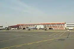
Modibo Keita International Airport (IATA: BKO, ICAO: GABS) (formerly Bamako–Sénou International Airport) is Mali's main airport located approximately 15 kilometres (9.3 mi) south of downtown Bamako, the capital of Mali in West Africa. It is the country's only international airport. It is managed by Aéroports du Mali (ADM).[1] Its operations are overseen by the Malian Ministry of Equipment and Transport.[2]
History
Bamako-Sénou Airport was opened to traffic in 1974. The airport was upgraded between 2007 and 2012 in a US$181 million project funded by the Millennium Challenge Corporation, a United States foreign aid agency.[3][4]
Military base
Bamako–Sénou International Airport is adjacent to Air Base 101, which is used by the Mali Air Force.[5]
Statistics
Passenger traffic steadily increased in the early 2000s. Government figures show 403,380 passengers in 1999, 423,506 in 2003, 486,526 in 2004, and 516,000 in 2005. In 2006 it was predicted to reach over 900,000 by 2015 under a low (4%) yearly growth rate scenario.[1]
Total air traffic at BKO increased by 12.4% in 2007 and 14% in 2008. Most of this increase came in passenger transport, with the number of passengers served increasing by 20% in 2007 and 17% in 2008. Twenty-seven airline carriers operated weekly or better at BKO in the 2007–2008 period. This continued growth was offset by cargo flights' decline of 16.75% in 2007, and 3.93% in 2008.[2]
Airlines and destinations
Passenger
Cargo
| Airlines | Destinations |
|---|---|
| DHL Aviation | Lagos |
| Cargolux | Luxembourg[10] |
Accidents and incidents
- On 24 July 1971, a Douglas C-47A (6V-AAP) of Air Ivoire crashed into a hill 67 seconds after take-off from runway 24 at night. The aircraft was operating a scheduled passenger flight. All six occupants were killed.[11]
- On 31 May 1981, a Dassault Falcon 20C (7T-VRE) of the Algerian government crashed 8 km (5 miles) from here on approach, killing 3 of the 6 occupants. The plane was on an official state flight, carrying foreign minister Mohamed Seddick Benyahia. Benyahia survived, but was killed the following year in a shootdown.[12]
- On 30 June 1996, a Boeing 707-369C (5X-JON) of Air Afrique leased from DAS Air Cargo became unstable shortly after landing due to a sudden burst of rain and veered off the runway, striking a bunker and detaching the right wing. All 4 occupants survived; the plane was written off.[13]
- In October 2007 (day unknown), an Ilyushin Il-76TD (5A-DNQ) of Jamahiriya Air Transport sustained serious damage on landing when the nose gear collapsed. The plane was later repaired.[14]
- On 14 June 2017, a Beechcraft 200 Super King Air (TZ-DDG) of Malian Aero Company suffered a landing accident after returning from a cloud-seeding operation over Mopti at 14:05. The plane came to rest on the right side of the runway with substantial propeller damage and was subsequently written off. The sole occupant survived.[15]
References
- 1 2 3 Composante aéroport Bamako–Sénou Archived 27 July 2011 at the Wayback Machine, Proposition MCA-Mali (2006)
- 1 2 Air traffic at Bamako airport increases by 14% in 2008 Archived 7 July 2011 at the Wayback Machine. PANA press. 14 January 2009
- ↑ Mali Compact: Bamako–Sénou Airport Improvement Project, Millennium Challenge Corporation, archived from the original on 15 August 2012, retrieved 26 August 2012
- ↑ Millennium Challenge Account-Mali, Rapport d'Etude d'Impact Environnemental et Social du Projet de Modernisation et d'extension de l'Aéroport Bamako–Sénou (in French), Millennium Challenge Corporation, archived from the original on 19 April 2010, retrieved 26 August 2012
- ↑ de Cherisey, Erwan (13 July 2018). "Mali receives four Super Tucanos". Jane's Information Group.
Photographs released by the presidency showed at least nine Malian Air Force personnel in anti- g flight suits standing in front of the four aircraft at Air Base 101, which is next to Bamako's international airport.
- ↑ "Bouaké, Ivory Coast to see inaugural int'l ops in 4Q18". ch-aviation.com. 8 October 2018.
- ↑ "Air Côte d'Ivoire adds new sectors from April 2017". Retrieved 22 March 2017.
- ↑ June 2016 Timetable, http://www.flyasky.com/asky/horaires/bko
- ↑ "Istanbul New Airport Transition Delayed Until April 5, 2019 (At The Earliest)". 9 April 2019.
- ↑ "Live Flight Tracker - Real-Time Flight Tracker Map".
- ↑ "6V-AAP Accident description". Aviation Safety Network. Retrieved 19 September 2010.
- ↑ "ASN Aircraft accident Dassault Falcon 20C 7T-VRE Bamako Airport (BKO)". aviation-safety.net. Retrieved 14 July 2023.
- ↑ "ASN Aircraft accident Boeing 707-369C 5X-JON Bamako Airport (BKO)". aviation-safety.net. Retrieved 14 July 2023.
- ↑ "ASN Aircraft accident Ilyushin Il-76TD 5A-DNQ Bamako Airport (BKO)". aviation-safety.net. Retrieved 14 July 2023.
- ↑ "ASN Aircraft accident Beechcraft 200 Super King Air TZ-DDG Bamako Airport (BKO)". aviation-safety.net. Retrieved 14 July 2023.
External links
![]() Media related to Bamako-Sénou International Airport at Wikimedia Commons
Media related to Bamako-Sénou International Airport at Wikimedia Commons
- Official website
- A–Z World Airports: Bamako – Senou Int'l Airport (BKO/GABS)
- Aeronautical charts for BKO/GABS from ASECNA
- Current weather for GABS at NOAA/NWS
- Accident history for BKO at Aviation Safety Network
- Avient Aviation Scheduled Flights