| Bolshaya Pera | |
|---|---|
 | |
| Location | |
| Country | Russia |
| Physical characteristics | |
| Mouth | Zeya |
• coordinates | 51°23′35″N 128°12′17″E / 51.3931°N 128.2048°E |
| Length | 145 km (90 mi) |
| Basin size | 4,400 km2 (1,700 sq mi) |
| Basin features | |
| Progression | Zeya→ Amur→ Sea of Okhotsk |
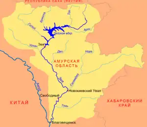
The Bolshaya Pera (Russian: Большая Пера, also Большая Пёра Bolshaya Pyora)[1] is a river in Amur Oblast, Russia. It is a right tributary of the Zeya. It begins on the Amur–Zeya Plain northwest of the mountains it flows through the town of Shimanovsk and the Vostochny Cosmodrome. It flows into a branch of the Zeya near Svobodny. It is 145 kilometres (90 mi) long, and has a drainage basin of 4,400 square kilometres (1,700 sq mi).[2] Its main tributaries are Dzhatva (57 km) and Malaya Pera (88 km) to the right and Ora (55 km) to the left.[3]
References
- ↑ Словарь названий гидрографических объектов России и других стран — членов СНГ Archived 2016-03-06 at the Wayback Machine, Federal Service for Geodesy and Cartography of Russia, 1999, p. 57
- ↑ "Река Б.ПЕРА in the State Water Register of Russia". textual.ru (in Russian).
- ↑ Реки Амурской области
This article is issued from Wikipedia. The text is licensed under Creative Commons - Attribution - Sharealike. Additional terms may apply for the media files.