Burke Centre, VA | |
|---|---|
Census-designated place (CDP) | |
.jpg.webp) Path in the woods, Burke Centre | |
| Nickname: Burke Centre | |
 | |
 Burke Centre, VA  Burke Centre, VA  Burke Centre, VA | |
| Coordinates: 38°47′28″N 77°18′02″W / 38.79111°N 77.30056°W | |
| Country | United States |
| State | Virginia |
| County | Fairfax |
| Area | |
| • Total | 3.16 sq mi (8.19 km2) |
| • Land | 3.12 sq mi (8.09 km2) |
| • Water | 0.04 sq mi (0.11 km2) |
| Elevation | 381 ft (116 m) |
| Population (2010) | |
| • Total | 17,326 |
| • Density | 5,549/sq mi (2,142.5/km2) |
| Time zone | UTC−5 (Eastern (EST)) |
| • Summer (DST) | UTC−4 (EDT) |
| ZIP codes | 22015 |
| Area code(s) | 703, 571 |
| FIPS code | 51-11470[1] |
| GNIS feature ID | 2584818[2] |
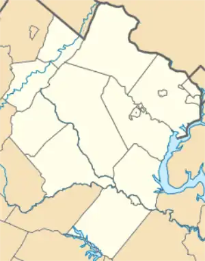
Burke Centre is a planned residential community located west of Burke in Fairfax County, Virginia, United States. Burke Centre is a planned community managed by the Burke Centre Conservancy homeowners' association (HOA).
Burke Centre is also the name of a census-designated place (CDP). The CDP boundaries extend beyond the planned community limits. As of the 2010 census, the Burke Centre CDP had a total population of 17,326.[3]
Burke Centre is located south of the center of Fairfax County. It is bordered to the east and partially to the north by the Burke CDP, and to the west and north by the Fairfax Station CDP. The Burke Centre CDP border follows Ox Road to the west, the VRE Manassas Line to the north, Burke Lake Road to the southeast, and Fairfax County Parkway to the southwest.[4]
Neighborhoods
Burke Centre is divided into five neighborhoods: The Woods, The Oaks, the Commons, the Ponds, and the Landings. Each neighborhood's name appears frequently in streets within its boundaries (e.g. the Woods neighborhood contains Wooden Hawk Lane, Walnut Wood Court, etc.). Not all streets contain the neighborhood name, however. Additionally, each neighborhood has one public pool[5] and one community center,[6] generally located on the same lot.

The locations of each neighborhood is as follows:[7]
- The Ponds is bound by Burke Centre Parkway to the north, Burke Lake Road to the east and south, Roberts Parkway to the west, and Fairfax County Parkway (SR 286) to the southwest.
- The Woods is just north of Burke Centre Parkway, across from The Ponds; it is bordered by The Commons to the west and Burke Lake Road to the east.
- The Commons is located primarily around Burke Commons Road, which runs mostly parallel with Roberts Parkway. It is bound by The Woods to the east and The Landings to the west.
- The Landings is west of Roberts Parkway, and exists on both sides of Burke Centre Parkway. It is constrained by Fairfax County Parkway (SR 286) to the south and The Oaks to the west.
- The Oaks is just west of The Landings; it borders The Landings to the east, Ox Road (SR 123) to the west, and Fairfax County Parkway (SR 286) to the south.
References
- ↑ "U.S. Census website". United States Census Bureau. Retrieved January 31, 2008.
- ↑ "US Board on Geographic Names". United States Geological Survey. October 25, 2007. Retrieved January 31, 2008.
- ↑ "Geographic Identifiers: 2010 Demographic Profile Data (G001): Burke Centre CDP, Virginia". U.S. Census Bureau, American Factfinder. Retrieved September 22, 2016.
- ↑ "TIGERweb". TIGER Web Viewer. United States Census Bureau. Retrieved December 14, 2019.
- ↑ "Burke Centre Conservancy - Pools". Retrieved June 19, 2019.
- ↑ "Burke Centre Conservancy - Community Centers". Retrieved June 19, 2019.
- ↑ "Burke Centre, Virginia - Google Maps". Retrieved June 18, 2019.
