Tormac
Végvár | |
|---|---|
 Coat of arms | |
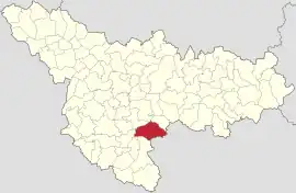
 Location in Timiș County | |
 Tormac Location in Romania | |
| Coordinates: 45°31′N 21°30′E / 45.517°N 21.500°E | |
| Country | Romania |
| County | Timiș |
| Established | 1780 (Rittberg) |
| Government | |
| • Mayor (2020–2024) | Marius Lazăr[1] (PNL) |
| Area | 121.03 km2 (46.73 sq mi) |
| Elevation | 135 m (443 ft) |
| Population (2021-12-01)[3] | 2,852 |
| • Density | 24/km2 (61/sq mi) |
| Time zone | EET/EEST (UTC+2/+3) |
| Postal code | 307430–307432 |
| Vehicle reg. | TM |
| Website | tormac |
Tormac (Hungarian: Végvár; German: Rittberg) is a commune in Timiș County, Romania. It is composed of three villages: Cadăr, Șipet and Tormac (commune seat).
Geography
Tormac is located in the southeast of Timiș County. It borders Nițchidorf and Sacoșu Turcesc to the north, Gătaia to the south, Voiteg and Liebling to the west and Caraș-Severin County to the east. Morphologically, the territory of the commune falls within the sub-hilly plain of Șipet and the Pogonici Plain.[2]
The hydrology of the area is dominated at the northern limit by the Pogonici River, the only tributary of the Timiș River that never dries. Due to a lack of unevenness separating the meadows from the interfluves, during the spring freshets, the river floods the areas along the valley.[2]
The location of the commune in the middle of a plain ensures a continental climate, influenced by warm Mediterranean air currents. The average annual temperature is 10.6 °C (51.1 °F).[2]
History
Like many other surrounding settlements, Tormac was established in 1780, in the third wave of colonization of Banat, by Germans (Swabians). At first it was called Rittberg, after an Austrian general.[4] The village did not manage to become Germanized because around 1790 German families were forced to leave their homes and settle in neighboring villages, such as Bacova or Darova.
Thus, between 1790–1794, the place of the Germans was taken by 78 families of Hungarian settlers, so that the village can be considered one of the first Reformed Hungarian colonies in Banat. They came from Csanád, Csongrád, Békés and Heves counties. The story goes that when the first Hungarians arrived, they found the village completely lit by candles left by the Germans in their homes.
Due to the complete transformation of the village into a Hungarian community, in 1806 the communal council decided to change its name from Rittberg to Végvár.[5] Being surrounded by Romanian villages, during the revolution of 1848, bloody conflicts arose between the Hungarians from Tormac and the Romanians from Șipet, Berini, Cadăr or Sacoș. After this moment, the waters calmed down and Tormac developed and became one of the largest and most compact Hungarian communes in Banat.
Demographics
Tormac had a population of 2,714 inhabitants at the 2011 census, down 0.8% from the 2002 census. Most inhabitants are Romanians (57%), larger minorities being represented by Hungarians (35.85%) and Slovaks (1.18%). For 5.12% of the population, ethnicity is unknown.[6] By religion, most inhabitants are Orthodox (53.02%), but there are also minorities of Reformed (31.02%), Roman Catholics (6.74%) and Pentecostals (2.1%). For 5.23% of the population, religious affiliation is unknown.[7]
| Census[8] | Ethnic composition | |||||
|---|---|---|---|---|---|---|
| Year | Population | Romanians | Hungarians | Germans | Roma | Slovaks |
| 1880 | 4,906 | 2,520 | 2,169 | 177 | – | 7 |
| 1890 | 5,660 | 2,787 | 2,637 | 128 | – | 46 |
| 1900 | 6,112 | 3,104 | 2,650 | 290 | – | 10 |
| 1910 | 6,227 | 2,947 | 2,812 | 360 | – | 24 |
| 1920 | 5,599 | 2,597 | 2,580 | 340 | – | – |
| 1930 | 5,438 | 2,720 | 2,387 | 252 | 54 | 12 |
| 1941 | 5,378 | 2,652 | 2,341 | 302 | – | – |
| 1956 | 4,634 | 2,319 | 2,173 | 113 | 25 | 2 |
| 1966 | 4,160 | 2,120 | 1,925 | 77 | 27 | 3 |
| 1977 | 3,515 | 1,777 | 1,612 | 39 | 48 | 24 |
| 1992 | 2,705 | 1,388 | 1,221 | 16 | 14 | 54 |
| 2002 | 2,737 | 1,480 | 1,158 | 8 | 13 | 63 |
| 2011 | 2,714 | 1,547 | 973 | 7 | 7 | 32 |
References
- ↑ "Results of the 2020 local elections". Central Electoral Bureau. Retrieved 16 June 2021.
- 1 2 3 4 "Date generale". Primăria comunei Tormac.
- ↑ "Populaţia rezidentă după grupa de vârstă, pe județe și municipii, orașe, comune, la 1 decembrie 2021" (XLS). National Institute of Statistics.
- ↑ Wettel, Helmut (1919). Der Buziascher Bezirk. Landschaften mit historischen Streislichtern. Timișoara: Südungarische Buchdruckerei.
- ↑ Vistai András, János. Tekintő – erdélyi helynévkönyv (PDF). Vol. III. p. 1163. Archived from the original (PDF) on 10 July 2011.
- 1 2 "Tab8. Populația stabilă după etnie – județe, municipii, orașe, comune". Institutul Național de Statistică.
- 1 2 "Tab13. Populația stabilă după religie – județe, municipii, orașe, comune". Institutul Național de Statistică.
- ↑ Varga, E. Árpád. "Temes megye településeinek etnikai (anyanyelvi/nemzetiségi) adatai 1880-2002" (PDF).
