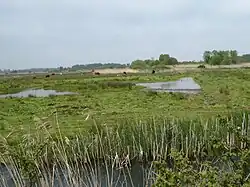
| Carlton and Oulton Marshes | |
|---|---|
 | |
| Type | Nature reserve |
| Location | Lowestoft, Suffolk |
| OS grid | TM509919 |
| Area | 151 hectares |
| Managed by | Suffolk Wildlife Trust |
Carlton and Oulton Marshes is a 151 hectare nature reserve in Lowestoft in Suffolk. It is managed by the Suffolk Wildlife Trust.[1] Carlton Marshes is part of the Sprat's Water and Marshes, Carlton Colville Site of Special Scientific Interest,[2] the Broadland Ramsar internationally important wetland site,[3][4] the Broadland Special Protection Area under the European Union Directive on the Conservation of Wild Birds,[5][6] and The Broads Special Area of Conservation.[7][8]
Carlton and Oulton Marshes are separated by Oulton Dyke. Birds of prey include marsh harriers, barn owls and hobbies, and there are many wintering wildfowl and breeding waders. Semi-aquatic fen raft spiders were released on the site in 2012 to boost the low British population, and underwater insectivorous bladderworts trap water fleas.[1]
The Angles Way footpath passes through Carlton Marsh south of Oulton Dyke, and Oulton Marsh north of the Dyke is also accessible by footpaths.[1]
References
- 1 2 3 "Carlton and Oulton Marshes". Suffolk Wildlife Trust. Retrieved 10 May 2017.
- ↑ "Designated Sites View: Sprat's Water and Marshes, Carlton Colville". Sites of Special Scientific Interest. Natural England. Retrieved 8 May 2017.
- ↑ "Designated Sites View: Broadland". Ramsar Site. Natural England. Retrieved 8 May 2017.
- ↑ "Information Sheet on Ramsar Wetlands (RIS): Broadland" (PDF). Joint Nature Conservation Committee. Archived from the original (PDF) on 10 August 2017. Retrieved 4 May 2017.
- ↑ "Special Protection Areas under the EC Birds Directive. Broadland" (PDF). Joint Nature Conservation Committee. Archived from the original (PDF) on 15 March 2016. Retrieved 4 May 2017.
- ↑ "Designated Sites View: Broadland". Special Protection Area. Natural England. Retrieved 7 May 2017.
- ↑ "The Broads". Special Areas of Conservation. Joint Nature Conservation Committee. Archived from the original on 10 March 2016. Retrieved 4 May 2017.
- ↑ "Designated Sites View: The Broads". Special Area of Conservation. Natural England. Retrieved 7 May 2017.