Chelsea, Vermont | |
|---|---|
Town | |
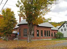
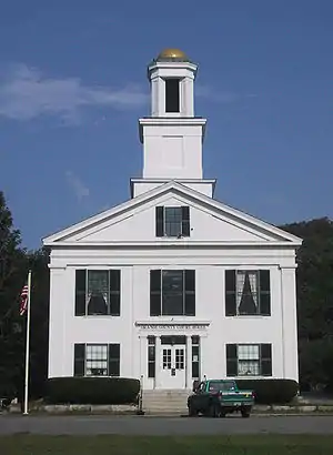 Orange County Court House in Chelsea, Vermont | |
|
Logo | |
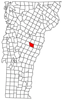 Located in Orange County, Vermont | |
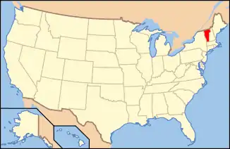 Location of Vermont with the U.S.A. | |
| Coordinates: 43°59′22″N 72°27′46″W / 43.98944°N 72.46278°W | |
| Country | |
| State | |
| County | Orange |
| Chartered | 1781 (Vermont) |
| Communities | Chelsea Chelsea West Hill |
| Area | |
| • Total | 39.9 sq mi (103.4 km2) |
| • Land | 39.9 sq mi (103.4 km2) |
| • Water | 0.04 sq mi (0.1 km2) |
| Elevation | 840 ft (256 m) |
| Population (2020) | |
| • Total | 1,233 |
| • Density | 31/sq mi (11.9/km2) |
| • Households | 495 |
| • Families | 324 |
| Time zone | UTC-5 (EST) |
| • Summer (DST) | UTC-4 (EDT) |
| ZIP code | 05038 |
| Area code | 802 |
| FIPS code | 50-13525[1] |
| GNIS feature ID | 1462069[2] |
| Website | www |
Chelsea is a town in and the shire town[3] (county seat)[4] of Orange County, Vermont, United States. The population was 1,233 at the 2020 census.[5]
Geography
Chelsea is located in a river valley in central Vermont. The First Branch of the White River travels through the valley and the town. Located in the center of town, in the village of Chelsea, are two commons.
According to the United States Census Bureau, the town has a total area of 39.9 square miles (103.4 km2), of which 39.9 square miles (103.4 km2) is land and 0.04 square mile (0.1 km2) (0.05%) is water.
Climate
| Climate data for Chelsea 2 NW, Vermont, 1991–2020 normals: 1440ft (439m) | |||||||||||||
|---|---|---|---|---|---|---|---|---|---|---|---|---|---|
| Month | Jan | Feb | Mar | Apr | May | Jun | Jul | Aug | Sep | Oct | Nov | Dec | Year |
| Mean daily maximum °F (°C) | 24.8 (−4.0) |
28.0 (−2.2) |
36.3 (2.4) |
49.8 (9.9) |
63.3 (17.4) |
71.8 (22.1) |
76.2 (24.6) |
75.3 (24.1) |
67.8 (19.9) |
54.5 (12.5) |
41.8 (5.4) |
30.8 (−0.7) |
51.7 (11.0) |
| Daily mean °F (°C) | 16.0 (−8.9) |
18.3 (−7.6) |
26.8 (−2.9) |
39.8 (4.3) |
52.4 (11.3) |
61.3 (16.3) |
65.7 (18.7) |
64.3 (17.9) |
56.9 (13.8) |
44.9 (7.2) |
33.8 (1.0) |
22.7 (−5.2) |
41.9 (5.5) |
| Mean daily minimum °F (°C) | 7.2 (−13.8) |
8.6 (−13.0) |
17.2 (−8.2) |
29.8 (−1.2) |
41.5 (5.3) |
50.7 (10.4) |
55.2 (12.9) |
53.3 (11.8) |
46.0 (7.8) |
35.3 (1.8) |
25.7 (−3.5) |
14.7 (−9.6) |
32.1 (0.1) |
| Average precipitation inches (mm) | 2.55 (65) |
2.21 (56) |
2.78 (71) |
3.24 (82) |
3.65 (93) |
4.68 (119) |
4.59 (117) |
4.25 (108) |
3.66 (93) |
4.42 (112) |
3.10 (79) |
3.31 (84) |
42.44 (1,079) |
| Average snowfall inches (cm) | 17.10 (43.4) |
21.50 (54.6) |
17.10 (43.4) |
5.10 (13.0) |
0.30 (0.76) |
0.00 (0.00) |
0.00 (0.00) |
0.00 (0.00) |
0.00 (0.00) |
1.10 (2.8) |
4.00 (10.2) |
22.60 (57.4) |
88.8 (225.56) |
| Source: NOAA[6] | |||||||||||||
Demographics
| Census | Pop. | Note | %± |
|---|---|---|---|
| 1790 | 239 | — | |
| 1800 | 897 | 275.3% | |
| 1810 | 1,327 | 47.9% | |
| 1820 | 1,462 | 10.2% | |
| 1830 | 1,958 | 33.9% | |
| 1840 | 1,959 | 0.1% | |
| 1850 | 1,958 | −0.1% | |
| 1860 | 1,757 | −10.3% | |
| 1870 | 1,526 | −13.1% | |
| 1880 | 1,462 | −4.2% | |
| 1890 | 1,230 | −15.9% | |
| 1900 | 1,070 | −13.0% | |
| 1910 | 1,074 | 0.4% | |
| 1920 | 1,087 | 1.2% | |
| 1930 | 1,004 | −7.6% | |
| 1940 | 1,013 | 0.9% | |
| 1950 | 1,025 | 1.2% | |
| 1960 | 957 | −6.6% | |
| 1970 | 983 | 2.7% | |
| 1980 | 1,091 | 11.0% | |
| 1990 | 1,166 | 6.9% | |
| 2000 | 1,250 | 7.2% | |
| 2010 | 1,238 | −1.0% | |
| 2020 | 1,233 | −0.4% | |
| U.S. Decennial Census[7] | |||
As of the census[8] of 2010, there were 1,238 people, 541 households, and 334 families residing in the town. Of the 541 household 117 had children under the age of 18 living within them.
The racial makeup of the town was 96.1% White, 0.6% African American, 0.2% Native American, 0.2% Asian, Hispanic or Latino of any race were 1.5% of the population.
The median age of residents is 48.3. The median household income is $49,500. 89.2% of adults have earned a high school diploma or higher level of education. 17.9% of individuals live below the poverty line.
History
The town was founded on August 4, 1781. It was originally called Turnersburgh after settler Bela Turner. In 1788 the townspeople of Turnersburgh approved a bill to rename the town Chelsea.
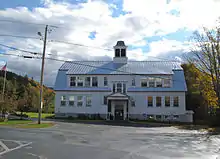
The first small schoolhouses were established in the early 1800s. By 1845 there were 18 schools operating around the town. In 1852 the Chelsea Academy was built in the village district. The Chelsea Academy burnt in 1870. In 1913 the "new" Chelsea High School building was built, this building still houses the Chelsea Public School today.[9]
Historic sites
In 1983 the historic village center of Chelsea was placed on the National Register of Historic Places as the Chelsea Village Historic District.[10] Chelsea also has two standalone structures listed on the National Register: the Congregational Church of Chelsea[11] and the Moxley Covered Bridge.[12]
Figure, the original Morgan horse, is buried in Chelsea.[13]
Barn Quilt Trail
In 2018 The Chelsea Arts Collective led a project to create a barn quilt trail in Chelsea. Barn quilts are painted pieces of plywood. Designs are often geometric and resemble the patchwork of a quilt.[14]
Popular culture
The following movies were filmed (either fully or partially) in Chelsea:[15]
- The Last Stand Farmer (1976)
- The Gift of Love (1983)
- Vermont is for Lovers (1992)
- A Stranger in the Kingdom (1997)
Notable people
- John L. Bacon, Chelsea and Hartford banker and State Treasurer
- Daniel Buck, US representative in the 4th States Congress
- Daniel Azro Ashley Buck, raised in Chelsea, US representative for Vermont in the 18th and 20th United States Congress
- David Whitney Curtis, member of the Wisconsin State Assembly
- William Hebard, resided in Chelsea, US representative for Vermont in the 31st and 32nd United States Congress
- F. Ray Keyser Sr., Justice of the Vermont Supreme Court
- F. Ray Keyser Jr., born and raised in Chelsea, 72nd governor of Vermont
- William A. Palmer, resided in Chelsea, US senator in the 15th and 16th United States Congress, 13th governor of Vermont
- James Parker and Robert Tullock, juvenile murderers, resided in Chelsea
- William Freeman Vilas, born in Chelsea, United States Postmaster General, United States Secretary of the Interior, US senator for Wisconsin
- Stanley C. Wilson, resided in Chelsea, 62nd governor of Vermont
- John Young, born in Chelsea, US representative in the 24th and 27th United States Congress, 15th governor of New York
Footnotes
- ↑ "U.S. Census website". United States Census Bureau. Retrieved January 31, 2008.
- ↑ "US Board on Geographic Names". United States Geological Survey. October 25, 2007. Retrieved January 31, 2008.
- ↑ Title 24, Part I, Chapter 1, §10, Vermont Statutes. Accessed 2007-11-01.
- ↑ "Find a County". National Association of Counties. Archived from the original on May 31, 2011. Retrieved June 7, 2011.
- ↑ "Census - Geography Profile: Chelsea town, Orange County, Vermont". Retrieved December 29, 2021.
- ↑ "Chelsea 2 NW, Vermont 1991-2020 Monthly Normals". Retrieved October 28, 2023.
- ↑ "U.S. Decennial Census". United States Census Bureau. Retrieved May 16, 2015.
- ↑ Bureau, U.S. Census. "U.S. Census website". United States Census Bureau. Retrieved September 21, 2018.
- ↑ Committee from the Chelsea Historical Society (1984). Chelsea, Vermont 1784-1984. Barre, Vermont: Northlight Studio Press.
- ↑ "Search Results". npgallery.nps.gov. Retrieved September 21, 2018.
- ↑ "Search Results". npgallery.nps.gov. Retrieved September 21, 2018.
- ↑ "Search Results". npgallery.nps.gov. Retrieved September 21, 2018.
- ↑ "'Justin Morgan Trail' Honors Man and Horse | The Herald of Randolph". www.ourherald.com. May 27, 2010. Retrieved September 21, 2018.
- ↑ Jones, Rachel Elizabeth. "Chelsea Arts Collective Launches Barn Quilt Project". Seven Days. Retrieved September 21, 2018.
- ↑ "Movies Filmed in Vermont". Vermont Folklore, Myths, Legends, Ghost Stories & More. Retrieved September 21, 2018.
Further reading
- John Moore Comstock, Chelsea: The Origin of Chelsea, Vermont and a Record of its Institutions and Individuals. n.c.: n.p., 1944.
- Chelsea Historical Society, Inc., A History of Chelsea, Vermont 1784–1984. (Chelsea Historical Society, Inc., 1984).
