Linter | |
|---|---|
.jpg.webp) | |
 Flag  Coat of arms | |
Location of Linter | |
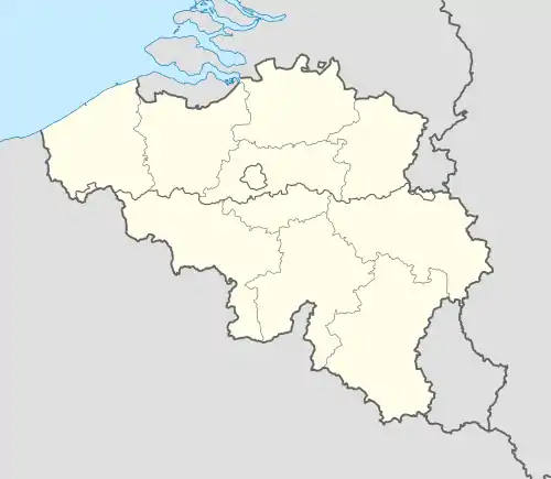 Linter Location in Belgium
Location of Linter in Flemish Brabant 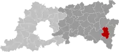 | |
| Coordinates: 50°48′N 05°03′E / 50.800°N 5.050°E | |
| Country | |
| Community | Flemish Community |
| Region | Flemish Region |
| Province | Flemish Brabant |
| Arrondissement | Leuven |
| Government | |
| • Mayor | Marc Wijnants (CD&V) |
| • Governing party/ies | CD&V |
| Area | |
| • Total | 36.87 km2 (14.24 sq mi) |
| Population (2018-01-01)[1] | |
| • Total | 7,255 |
| • Density | 200/km2 (510/sq mi) |
| Postal codes | 3350 |
| NIS code | 24133 |
| Area codes | 011, 016 |
| Website | www.linter.be |
Linter (Dutch pronunciation: [ˈlɪntər]) is a municipality located in the Belgian province of Flemish Brabant. The municipality comprises the towns of Drieslinter, Melkwezer, Neerhespen (where the canine school of the Belgian police is situated), Neerlinter, Orsmaal-Gussenhoven, Overhespen and Wommersom. On January 1, 2006, Linter had a total population of 7,037. The total area is 36.38 km² which gives a population density of 193 inhabitants per km².
The main economic activities of Linter are agricultural and commercial activities.
Demographics
Languages
- Standard Dutch
- Getelands dialects, which are transitional Brabantian-Limburgish dialects.[2][3]
References
- ↑ "Wettelijke Bevolking per gemeente op 1 januari 2018". Statbel. Retrieved 9 March 2019.
- ↑ Hondshoven, Roger (2003), Woordenboek van het Melkwezers, Melkwezer
{{citation}}: CS1 maint: location missing publisher (link) - ↑ Peters, Jörg (2010), "The Flemish–Brabant dialect of Orsmaal–Gussenhoven", Journal of the International Phonetic Association, 40 (2): 239, doi:10.1017/S0025100310000083
External links
 Media related to Linter at Wikimedia Commons
- Official website - Available only in Dutch
- Gazetteer Entry
Places adjacent to Linter, Belgium | ||||||||||||||||
|---|---|---|---|---|---|---|---|---|---|---|---|---|---|---|---|---|
| ||||||||||||||||

This article is issued from Wikipedia. The text is licensed under Creative Commons - Attribution - Sharealike. Additional terms may apply for the media files.