Drummond, Wisconsin | |
|---|---|
 Drummond | |
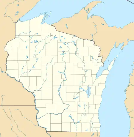
| Coordinates: 46°20′13″N 91°15′29″W / 46.33694°N 91.25806°W | |
| Country | United States |
| State | Wisconsin |
| County | Bayfield |
| Town | Drummond |
| Area | |
| • Total | 1.396 sq mi (3.62 km2) |
| • Land | 1.396 sq mi (3.62 km2) |
| • Water | 0 sq mi (0 km2) |
| Elevation | 1,302 ft (397 m) |
| Population (2010) | |
| • Total | 154 |
| • Density | 110/sq mi (43/km2) |
| Time zone | UTC-6 (Central (CST)) |
| • Summer (DST) | UTC-5 (CDT) |
| ZIP code | 54832 |
| Area code(s) | 715 and 534 |
| GNIS feature ID | 1579144[1] |
Drummond is an unincorporated, census-designated place located in the town of Drummond, Bayfield County, Wisconsin, United States.
U.S. Highway 63 serves as a main route in the community. Drummond is located 31 miles southwest of the city of Ashland; and 26 miles northeast of the city of Hayward.
Drummond has a post office with ZIP code 54832.[2] As of the 2010 census, its population was 154.[3]
History
Drummond was founded in 1882.[4] It was named for F. H. Drummond, an executive in the lumber industry.[4] A post office has been in operation in Drummond since 1882.[5]
References
- ↑ U.S. Geological Survey Geographic Names Information System: Drummond (CDP), Wisconsin
- ↑ ZIP Code Lookup Archived June 15, 2011, at the Wayback Machine
- ↑ "U.S. Census website". U.S. Census Bureau. Retrieved April 3, 2011.
- 1 2 Chicago and North Western Railway Company (1908). A History of the Origin of the Place Names Connected with the Chicago & North Western and Chicago, St. Paul, Minneapolis & Omaha Railways. p. 173.
- ↑ "Bayfield County". Jim Forte Postal History. Archived from the original on April 6, 2015. Retrieved April 3, 2015.
Municipalities and communities of Bayfield County, Wisconsin, United States | ||
|---|---|---|
| Cities | 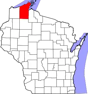 | |
| Village | ||
| Towns | ||
| CDPs | ||
| Unincorporated communities | ||
| Indian reservation | ||
| Footnotes | ‡This populated place also has portions in an adjacent county or counties | |
This article is issued from Wikipedia. The text is licensed under Creative Commons - Attribution - Sharealike. Additional terms may apply for the media files.