East Aceh Regency
Kabupaten Aceh Timur | |
|---|---|
 Seal | |
| Motto(s): Udep Saree Matee Syahid (Honorable Life Martyrdom) | |
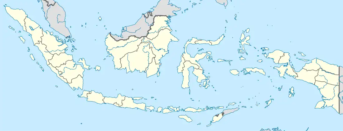
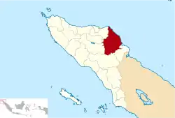 Location within Aceh | |
| Coordinates: 4°37′N 97°37′E / 4.617°N 97.617°E | |
| Country | |
| Region | Sumatra |
| Province | |
| Established | 1956 |
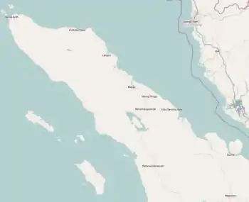
| Regency seat | Idi Rayeuk |
| Government | |
| • Regent | Hasballah Muhammad Thaib |
| • Vice Regent | Syahrul Syamaun |
| Area | |
| • Total | 5,409.41 km2 (2,088.58 sq mi) |
| Population (mid 2022 estimate)[1] | |
| • Total | 432,849 |
| • Density | 80/km2 (210/sq mi) |
| Time zone | UTC+7 (IWST) |
| Area code | (+62) 646 |
| Website | acehtimurkab |
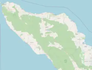
East Aceh Regency (Indonesian: Kabupaten Aceh Timur) is a regency in eastern Aceh Special Region (Nanggroe Aceh Darussalam) of Indonesia. It is located on the island of Sumatra. The regency covers an area of 6,040.60 square kilometres and had a population of 360,475 at the 2010 Census[2] and 422,401 at the 2020 Census;[3] the official estimate as at mid 2022 was 432,849 - comprising 217,616 males and 215,233 females.[1] The regency capital is the town of Idi Rayeuk.
The regency borders the Malacca Strait to the north-east, the city of Langsa and Aceh Tamiang Regency to the south-east, Gayo Lues Regency to the south, and Central Aceh Regency, Bener Meriah Regency and North Aceh Regency to the west.
Economy
This regency is rich in petroleum, more so than the North Aceh and Aceh Tamiang regencies. Fishing employs many people in the regency but little of it is exported; people depend on it for food.[4] The main fishing centre in the regency is in Idl. The regency also has several food-plant based industries producing tofu, tempeh and sun-dried banana chips.[4] Some areas are under plantation exploitation for palm oil and rubber, although there is only one state-owned company (TPN I) operating in the area. Plantations also produce cacao and chocolate and in the Lokop area iron ore and lead is mined.[4]
Administrative districts
The regency is divided administratively into twenty-four districts (kecamatan), listed below with their areas and their populations at the 2010 Census[2] and 2020 Census;[3] together with the official estimates as at mid 2022.[1] The table also includes the locations of the district administrative centres, the number of villages (gampong) in each district, and its postal code.
| Kode Wilayah | Name of District (kecamatan) | Area in km2 | Pop'n Census 2010 | Pop'n Census 2020 | Pop'n Estimate mid 2022 | Admin centre | No. of villages | Post code |
|---|---|---|---|---|---|---|---|---|
| 11.03.05 | Serbajadi | 2,165.66 | 5,766 | 6,701 | 6,854 | Lokop | 17 | 24460 |
| 11.03.20 | Simpang Jernih | 544.63 | 3,397 | 3,626 | 3,648 | Simpang Jernih | 8 | 24464 |
| 11.03.24 | Peunaron | 79.74 | 8,206 | 9,154 | 9,289 | Arul Pinang | 5 | 24461 |
| 11.03.04 | Birem Bayeun | 253.68 | 25,330 | 28,710 | 29,224 | Birem Bayeun | 27 | 24452 |
| 11.03.08 | Rantau Selamat | 159.80 | 11,223 | 12,372 | 12,526 | Bayeun | 14 | 24451 |
| 11.03.19 | Sungai Raya | 159.00 | 10,672 | 12,672 | 13,015 | Labuhan Keude | 13 | 24466 |
| 11.03.07 | Peureulak | 318.02 | 39,691 | 46,245 | 47,325 | Peureulak | 38 | 24453 |
| 11.03.17 | Peureulak Timur (East Peureulak) | 182.70 | 12,601 | 14,457 | 14,750 | Alue Tho | 20 | 24440 |
| 11.03.18 | Peureulak Barat (West Peureulak) | 92.30 | 13,633 | 17,367 | 18,082 | Beusa Seubrang | 15 | 24450 |
| 11.03.10 | Ranto Peureulak | 129.00 | 21,945 | 25,945 | 26,626 | Ranto Peureulak | 23 | 24441 |
| 11.03.03 | Idi Rayeuk | 79.60 | 33,136 | 39,086 | 40,093 | Idi Rayeuk | 35 | 24442 |
| 11.03.16 | Peudawa | 75.90 | 10,274 | 12,958 | 13,465 | Seuneubok Peudawa | 17 | 24469 |
| 11.03.15 | Banda Alam | 90.95 | 7,296 | 8,651 | 8,883 | Pantai Rayeuk M. | 16 | 24458 |
| 11.03.14 | Idi Tunong | 74.70 | 8,895 | 11,305 | 11,765 | Buket Teukuh | 25 | 24443 |
| 11.03.21 | Darul Ihsan | 54.50 | 5,447 | 7,343 | 7,729 | Keude Dua | 16 | 24468 |
| 11.03.23 | Idi Timur (East Idi) | 55.15 | 5,210 | 6,762 | 7,066 | Keude Redep | 13 | 24456 |
| 11.03.01 | Darul Aman | 131.50 | 17,043 | 20,569 | 21,193 | Idi Cut | 45 | 24455 |
| 11.03.06 | Nurussalam | 137.07 | 15,308 | 17,843 | 18,261 | Bagok | 31 | 24467 |
| 11.03.22 | Darul Falah | 42.40 | 2,902 | 3,752 | 3,918 | Tunung Ulee Gajah | 11 | 24454 |
| 11.03.02 | Julok | 234.36 | 23,884 | 26,835 | 27,269 | Kuta Binjei | 37 | 24459 |
| 11.03.13 | Indra Makmur | 89.05 | 15,772 | 16,416 | 16,436 | Alue le Mirah | 13 | 24457 |
| 11.03.11 | Pante Bidari (or Pante Beudari) | 233.25 | 21,490 | 25,588 | 26,295 | Lhok Nibong | 25 | 24463 |
| 11.03.09 | Simpang Ulim | 123.80 | 18,136 | 21,136 | 21,630 | Simpang Ulim | 23 | 24465 |
| 11.03.12 | Madat | 200.84 | 23,218 | 26,908 | 27,507 | Madat | 26 | 24462 |
| Totals | 6,040.60 | 360,475 | 422,401 | 432,849 | Idi Rayeuk | 513 |
References
- 1 2 3 Badan Pusat Statistik, Jakarta, 2023, Kabupaten Aceh Timur Dalam Angka 2023 (Katalog-BPS 1102001.1103)
- 1 2 Biro Pusat Statistik, Jakarta, 2011.
- 1 2 Badan Pusat Statistik, Jakarta, 2021.
- 1 2 3 "Aceh Timur" (PDF). Aceh Investment and Promotion Board. February 2010. Archived from the original (PDF) on July 7, 2011. Retrieved December 20, 2010.
Regencies and cities of Aceh | ||
|---|---|---|
Capital: Banda Aceh | ||
| Regencies |  | |
| Cities | ||