Ganderbal district | |
|---|---|
 | |
Interactive map of Ganderbal district | |
 Ganderbal district is in Indian-administered Jammu and Kashmir in the disputed Kashmir region[1] It is in the Kashmir division (bordered in neon blue). | |
| Coordinates (Ganderbal): 34°14′N 74°47′E / 34.23°N 74.78°E | |
| Administering country | India |
| Union territory | Jammu and Kashmir |
| Headquarters | Ganderbal |
| Area | |
| • Total | 1,979 km2 (764 sq mi) |
| Population (2011) | |
| • Total | 297,446 |
| • Density | 150/km2 (390/sq mi) |
| Demonym(s) | Shahruk, Ganderbaluk, Ganderbali, Ganderbalia, Ganderbalian |
| Languages | |
| • Official | Kashmiri, Urdu, Hindi, Dogri, English[2][3] |
| • Other | Pahari, Gujari, Shina, Balti, Pashto |
| Time zone | UTC+05:30 (IST) |
| Pincode | 191201 |
| Area code | 194 |
| ISO 3166 code | 0194 |
| Website | ganderbal |
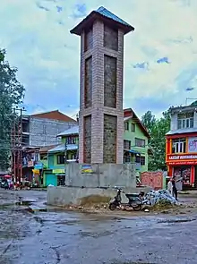
The Ganderbal (گاندربل) district, or more formally District Ganderdal, is an administrative district of Indian-administered Jammu and Kashmir in the disputed Kashmir region.[1] Ganderbal town is administrative headquarters of district. It was formed in 2007 and has 6 subdistricts (tehsils): Kangan, Ganderbal, Tullamulla, Wakura, Lar, and Gund.[4]
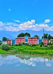
Sheikh Ul Alam Research University of Kashmir will also be constructed in Ganderbal by Karwan-I-Islami[5]
Historic sites and remains
Kheer Bhawani
Kheer Bhawani is a temple dedicated to the goddess Bhavani, constructed over a sacred spring in Tulmul village. The term kheer refers to rice pudding that is offered in the spring to propitiate the Goddess, which became part of the name of the temple. As is the custom with several Hindu deities.
Naranag Temple
The Naranag Temple[6] is one of the important archaeological sites of the country. The ancient pilgrimage site is a group of several temples and is situated in the Naranag village near Harmukh Mountain about 50 kilometres (31 mi) from Srinagar city. The ancient name for the place is Sodarteertha; Bhuteshwara (now But Sher, midway on the trek to Gangbal lake) and Nandikshetra (Nundkol lake area) are two other holy sites associated with it. The site consists of a cluster of temples facing each other at a distance of about 100 metres (330 ft). Historians say that the temple is dedicated to Lord Shiva by the eighth-century ruler Lalithdatiya Muktapid. It is believed that the King Awantivarman paid a visit and donated a pedestal for bathing at Bhutsher. Even today one gets surprised over art and skill of the builders of this temple. Its impressive architecture reveals the glorious past, the magnificent art of the eighth century. The government has only recently constructed walls to protect it from encroachments and nothing else has been done. It is now left in ruins of which only faint traces have survived.
Geography
Ganderbal district, has its district headquarters located at 33°44′N 75°09′E / 33.73°N 75.15°E in the town of Ganderbal,[7] is at an average elevation of 1,950 metres (6,400 ft) above mean sea level. The town is at a distance of 21 kilometres (13 mi) from Srinagar city.
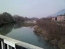
The mountainous Ganderbal district is spread across the Sind River. It is the only river in Jammu and Kashmir on which three hydroelectric power stations are functional; besides that the river provides water for irrigation, 80% population[8] of the district is engaged with farming. The sand (bajri) of this river has a great value for money for its quality.
Harmukh is the highest peak in the region and Gangbal the largest alpine lake.
The district currently has six subdistricts (tehsils):[4][9]
It is further divided into nine CD blocks: Ganderbal, Wakoora, Lar, Kangan, Gund, Shearpathri, Phaag, Manigam and Batwina.[9][10] Each block consists of a number of panchayats. Ganderbal District has 2 assembly constituencies: Kangan and Ganderbal.[9][11]
Demographics
| Ganderbal district: religion, gender ratio, and % urban of population, according to the 2011 Census.[13] | |||||||||
|---|---|---|---|---|---|---|---|---|---|
| Hindu | Muslim | Christian | Sikh | Buddhist | Jain | Other | Not stated | Total | |
| Total | 5,592 | 290,581 | 406 | 486 | 25 | 8 | 4 | 344 | 297,446 |
| 1.88% | 97.69% | 0.14% | 0.16% | 0.01% | 0.00% | 0.00% | 0.12% | 100.00% | |
| Male | 5,182 | 152,571 | 255 | 458 | 19 | 1 | 3 | 231 | 158,720 |
| Female | 410 | 138,010 | 151 | 28 | 6 | 7 | 1 | 113 | 138,726 |
| Gender ratio (% female) | 7.3% | 47.5% | 37.2% | 5.8% | 24.0% | 87.5% | 25.0% | 32.8% | 46.6% |
| Sex ratio (no. of females per 1,000 males) |
79 | 905 | – | – | – | – | – | – | 874 |
| Urban | 389 | 46,498 | 53 | 38 | 3 | 0 | 1 | 57 | 47,039 |
| Rural | 5,203 | 244,083 | 353 | 448 | 22 | 8 | 3 | 287 | 250,407 |
| % Urban | 7.0% | 16.0% | 13.1% | 7.8% | 12.0% | 0.0% | 25.0% | 16.6% | 15.8% |
At the time of the 2011 census, 68.92% of the population spoke Kashmiri, 20.21% Gojri, 3.49% Pashto, 2.61% Pahari and 1.31% Hindi as their first language. Balti and Shina are also spoken by small populations in the high mountains.[14]
Climate
Ganderbal district possesses all the typical characteristics of the climate of Kashmir Valley as a whole. In the heat of July, the breeze of the Sindh River is a welcome relief. Sir Walter Lawrence writes in his book The Valley of Kashmir that in latitude, Kashmir corresponds with Peshawar, Baghdad and Damascus in Asia: with Fez in Morocco: and South Carolina in America, but it presents none of the characteristics of those countries. People have linked the climate of Kashmir to that of Switzerland until the end of May, and of Southern France in July and August. But it is impossible to speak of Kashmir as possessing any one climate or group of characteristics. Every hundred feet of elevation brings some new phase of climate and of vegetation.
Tourism
The Ganderbal district is located in valley of the Sindh River, also known as Nallah Sindh. It is rich in landscape and is often called the District of Lakes, as it possesses the highest number of lakes in the state of Jammu and Kashmir.
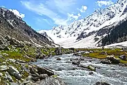
Sonamarg
This famous hill station is situated 80 kilometres (50 mi) from Srinagar and located on the banks of Sindh River at an altitude of 2,800 meters. Sonamarg also hosts the International Championships of Rafting on Sindh River. It presents a glamorous look due to its alpine meadows, snow-clad mountains, and healthy climate. Sonamarg skirts Sindh River and torrential flow of water in this river enriches its awesome beauty. Besides several hotels in private sector have come up here and these hotels provide modern facilities to their guests. A number of treks in this region also begin from Sonamarg to high altitude lakes of Vishansar, Krishansar, Gadsar and Gangabal stocked with snow trout and brown trout.
Manasbal Lake
Manasbal Lake is the main attraction for tourists in Ganderbal district, 12 kilometres (7.5 mi) north west of district headquarters of Ganderbal. It is 5 kilometres (3.1 mi) long and 1 kilometre (0.62 mi) wide. It is located in the Jhelum valley, north of Srinagar city in Jammu and Kashmir. The name Manasbal is said to be a derivative of the Lake Manasarovar.[15] Lake is encircled by three villages: Jarokbal, Kondabal (also called Kiln place; is situated on the north-eastern side of the lake) and Ganderbal and is stated to be the deepest lake (at 13 m or 43 ft depth) in the Kashmir valley. The large growth of lotus (Nelumbo nucifera) at the periphery of the lake (blooms during July and August) adds to the beauty of the clear waters of the lake. The Mughal garden, called the Garoka, (meaning bay window) built by Nur Jahan overlooks the lake.[16]
The lake is a good place for birdwatching as it is one of the largest natural stamping grounds of aquatic birds in Kashmir and has the sobriquet of "supreme gem of all Kashmir Lakes".[17][18] The rootstocks of lotus plant which grows extensively in the lake are harvested and marketed, and also eaten by the local people.[15]
The lake is approached from Srinagar by a 30-kilometre (19 mi) road via Shadipur, Nasim and Gandarbal. Road to Wular Lake, the largest lake in Kashmir, passes through this lake, via Safapur.[15]
Prang
Prang village is 12 kilometres far from the central hub (beehama) of district Ganderbal, towards the east. Srinagar-Leh National Highway (NH 1D) passes right through the middle of this village. This village falls under the jurisdiction of tehsil Kangan.
Overview
Prang village is known for its natural and enthralling beauty. The main attraction of this village is its garden, which attracts the tourists throughout the year. This village is also famous for its clear streams, cold air and mighty mountains.
The Prang garden used to be the picnic spot in 1990's before army came and established the base camp there. However, the army camp was later evacuated from the garden in the year 2008. This garden is situated on the banks of the famous Sindh River, and forested slopes are on the other side of the garden adding more charm to its beauty. The famous Environmental park (usually known as the "dumping park") is in the adjacent village of Prang.
This village is considered as the main hub for its adjacent areas. The adjacent areas of this village are "Lari Prang, Check Prang, Herra Prang, Pati Prang and dragtung".
Mohand Marg
Mohand Marg is an alpine meadow in the Lar tehsil. In summer it is a tourist destination for trekking and camping. Sir Aurel Stein was the first person to explore the place, pitching his camp in the summer of 1895.[19][20][21][22]
It is hidden in the mountains to the north of Srinagar at the foot of Haramukh Peaks about 25 kilometers from Srinagar via the Ganderbal road towards Leh. From the road it is accessed via 5 kilometer trek up a steep path through the hill-side settlements and fields of Lar and Chount Waliwar before the 'Marg' opens out across the mountain side giving views of the Sindh Valley far below in one direction and the Valley of Kashmir in the other.
Harmukh

Harmukh (also known as Mount Haramukh or Harmukh mountain) is a mountain with a peak elevation[23] of 16,890 ft (5,148 metres), in Ganderbal district of Jammu and Kashmir. Harmukh is part of the Himalaya Range, and is located between Sindh River to its south and Kishanganga River to its north. It rises above the Gangabal Lake in the vicinity of Kashmir Valley.[24] It is more hazardous to reach Mount Haramukh from the east and south side of Ganderbal and has never been climbed from these sides; thus, it is mostly climbed in the north-west from the Arin Bandipore side.
Harmukh was first climbed by the Great Trigonometric Survey's Thomas Montgomerie in 1856 and made the first survey of the Karakoram some 210 km (130 miles) to the south, and sketched the two most prominent peaks, labelling them K1 and K2.[25] Harmukh was later climbed by many other climbers.[26] Therefore, Harmukh is the mountain from which the world's second highest mountain peak K2 was discovered and the Serveyer's mark K2 continues to be the name.
Gangabal Lake
Gangabal Lake, also called Gangbal Lake, is a lake situated at the foothills of Mount Haramukh (one of the highest mountain peak in the vicinity of Kashmir valley)[27] in Ganderbal district, north of Srinagar city in Jammu and Kashmir in India. It is an alpine high altitude oligotrophic lake,[28] and is home to many types of fishes[29] of which one is the brown trout.[30]
The lake has a maximum length of 2.5 kilometres (1.6 mi) and maximum width of 1 kilometre (0.62 mi). It is fed by precipitation, glaciers and springs. The lake water outflows to a nearby small lake (Nundkol)[31] and then via Wangath nullah[32] to Sindh River.[33] The trout fishes are present in the lake.[34] Gangabal lake is approached from Srinagar 45 kilometres (28 mi) by road via Ganderbal up to Naranag[35] and then a 15 kilometres (9.3 mi) track upslope.
Shallabugh Wetland
Shallabugh Wetland, situated in the Shallabugh village of Kashmir valley, is a haven of natural beauty and ecological significance. It was declared as a Ramsar Site recently. Spanning across acres of marshy terrain, this wetland plays a crucial role in maintaining environmental equilibrium. It serves as a vital habitat for numerous species of migratory birds, offering them a seasonal refuge during their journeys. The wetland's diverse flora and fauna contribute to the rich biodiversity of the region.
Ganderbal is also known as the district of alpine lakes as it is home to over 100 high altitide alpine lakes.
Villages
References
- 1 2 3 The application of the term "administered" to the various regions of Kashmir and a mention of the Kashmir dispute is supported by the tertiary sources (a) through (d), reflecting due weight in the coverage. Although "controlled" and "held" are also applied neutrally to the names of the disputants or to the regions administered by them, as evidenced in sources (f) through (h) below, "held" is also considered politicized usage, as is the term "occupied," (see (i) below).
(a) Kashmir, region Indian subcontinent, Encyclopaedia Britannica, retrieved 15 August 2019 (subscription required) Quote: "Kashmir, region of the northwestern Indian subcontinent ... has been the subject of dispute between India and Pakistan since the partition of the Indian subcontinent in 1947. The northern and western portions are administered by Pakistan and comprise three areas: Azad Kashmir, Gilgit, and Baltistan, the last two being part of a territory called the Northern Areas. Administered by India are the southern and southeastern portions, which constitute the state of Jammu and Kashmir but are slated to be split into two union territories.";
(b) Pletcher, Kenneth, Aksai Chin, Plateau Region, Asia, Encyclopaedia Britannica, retrieved 16 August 2019 (subscription required) Quote: "Aksai Chin, Chinese (Pinyin) Aksayqin, portion of the Kashmir region, at the northernmost extent of the Indian subcontinent in south-central Asia. It constitutes nearly all the territory of the Chinese-administered sector of Kashmir that is claimed by India to be part of the Ladakh area of Jammu and Kashmir state.";
(c) "Kashmir", Encyclopedia Americana, Scholastic Library Publishing, 2006, p. 328, ISBN 978-0-7172-0139-6 C. E Bosworth, University of Manchester Quote: "KASHMIR, kash'mer, the northernmost region of the Indian subcontinent, administered partlv by India, partly by Pakistan, and partly by China. The region has been the subject of a bitter dispute between India and Pakistan since they became independent in 1947";
(d) Osmańczyk, Edmund Jan (2003), Encyclopedia of the United Nations and International Agreements: G to M, Taylor & Francis, pp. 1191–, ISBN 978-0-415-93922-5 Quote: "Jammu and Kashmir: Territory in northwestern India, subject to a dispute betw een India and Pakistan. It has borders with Pakistan and China."
(e) Talbot, Ian (2016), A History of Modern South Asia: Politics, States, Diasporas, Yale University Press, pp. 28–29, ISBN 978-0-300-19694-8 Quote: "We move from a disputed international border to a dotted line on the map that represents a military border not recognized in international law. The line of control separates the Indian and Pakistani administered areas of the former Princely State of Jammu and Kashmir.";
(f) Kashmir, region Indian subcontinent, Encyclopaedia Britannica, retrieved 15 August 2019 (subscription required) Quote: "... China became active in the eastern area of Kashmir in the 1950s and has controlled the northeastern part of Ladakh (the easternmost portion of the region) since 1962.";
(g) Bose, Sumantra (2009), Kashmir: Roots of Conflict, Paths to Peace, Harvard University Press, pp. 294, 291, 293, ISBN 978-0-674-02855-5 Quote: "J&K: Jammu and Kashmir. The former princely state that is the subject of the Kashmir dispute. Besides IJK (Indian-controlled Jammu and Kashmir. The larger and more populous part of the former princely state. It has a population of slightly over 10 million, and comprises three regions: Kashmir Valley, Jammu, and Ladakh.) and AJK ('Azad" (Free) Jammu and Kashmir. The more populous part of Pakistani-controlled J&K, with a population of approximately 2.5 million. AJK has six districts: Muzaffarabad, Mirpur, Bagh, Kodi, Rawalakot, and Poonch. Its capital is the town of Muzaffarabad. AJK has its own institutions, but its political life is heavily controlled by Pakistani authorities, especially the military), it includes the sparsely populated "Northern Areas" of Gilgit and Baltistan, remote mountainous regions which are directly administered, unlike AJK, by the Pakistani central authorities, and some high-altitude uninhabitable tracts under Chinese control."
(h) Fisher, Michael H. (2018), An Environmental History of India: From Earliest Times to the Twenty-First Century, Cambridge University Press, p. 166, ISBN 978-1-107-11162-2 Quote: "Kashmir’s identity remains hotly disputed with a UN-supervised “Line of Control” still separating Pakistani-held Azad (“Free”) Kashmir from Indian-held Kashmir.";
(i) Snedden, Christopher (2015), Understanding Kashmir and Kashmiris, Oxford University Press, p. 10, ISBN 978-1-84904-621-3 Quote:"Some politicised terms also are used to describe parts of J&K. These terms include the words 'occupied' and 'held'." - ↑ "The Jammu and Kashmir Official Languages Act, 2020" (PDF). The Gazette of India. 27 September 2020. Retrieved 27 September 2020.
- ↑ "Parliament passes JK Official Languages Bill, 2020". Rising Kashmir. 23 September 2020. Retrieved 23 September 2020.
- 1 2 "Subdivision and Tehsils", District Ganderbal, Government of Jammu and Kashmir, retrieved 23 July 2020
- ↑ "Welcome to Karwan-I-Islami J&K". www.karwaniislami.com. Retrieved 26 September 2022.
- ↑ "Naranag temple in ruins". kashmirmonitor.org. Archived from the original on 4 August 2012. Retrieved 25 April 2012.
- ↑ "Falling Rain Genomics, Inc - Ganderbal". fallingrain.com. Retrieved 24 April 2012.
- ↑ "Agriculture directory of Ganderbal". diragrikmr.nic. Archived from the original on 21 January 2013. Retrieved 25 April 2012.
- 1 2 3 "Administrative Setup", District Ganderbal, Government of Jammu and Kashmir, retrieved 23 July 2020
- ↑ Statement showing the number of blocks in respect of 22 Districts of Jammu and Kashmir State including newly created districts Archived 10 September 2008 at the Wayback Machine dated 2008-03-13, accessed 2012-04-24
- ↑ "ERO's and AERO's". Chief Electoral Officer, Jammu and Kashmir. Archived from the original on 22 October 2008. Retrieved 24 April 2012.
- ↑ "Ganderbal district Population". Census India. Retrieved 11 July 2021.
- 1 2 C-1 Population By Religious Community – Jammu & Kashmir (Report). Office of the Registrar General & Census Commissioner, India. Retrieved 28 July 2020.
- 1 2 C-16 Population By Mother Tongue – Jammu & Kashmir (Report). Office of the Registrar General & Census Commissioner, India. Retrieved 18 July 2020.
- 1 2 3 "Manasbal Lake, Kashmir". kashmir-tourism.com.
- ↑ "Manasbal Lake, Manasbal Lake in Jammu, Lakes in Jammu, Jammu Kashmir Lake Tours, Travelling in Jammu Kashmir". Archived from the original on 14 February 2012. Retrieved 25 April 2012. Mansbal lake
- ↑ "Manasbal Lake". Archived from the original on 3 March 2012. Retrieved 25 April 2012. Manasbal Lake
- ↑ "Mascot Travels - Kashmir tourism - Kashmir tourism - Ladakh Srinagar Jammu holidays - Kashmir India travel agents". www.mascottravels.com.
- ↑ "Mohand Marg: Sir Aurel Stein's Private Kingdom & Indira Gandhi's Honeymoon Destination | Honeymoon destinations, Honeymoon, Scenic". Pinterest. Retrieved 18 January 2021.
- ↑ "Mohand Marg". wikimapia.org. Retrieved 18 January 2021.
- ↑ "Kashmiri Followers of Aurel Stein". The Kashmir Monitor. 21 January 2019. Retrieved 18 January 2021.
- ↑ Neve, Arthur (1979). The Legacy of Kashmir, Ladakh & Skardu. Civil and Military Gazette.
- ↑ "How high is Harmukh". wolframalpha.com. Retrieved 24 April 2012.
- ↑ "Geography of Kashmir". kousa.org. Retrieved 24 April 2012.
- ↑ Curran, Jim (1995). K2: The Story of the Savage Mountain. Hodder & Stoughton. p. 25. ISBN 978-0340660072.
- ↑ "Rimo expeditions". rimoriverexpeditions.com. Archived from the original on 28 June 2012. Retrieved 25 April 2012.
- ↑ "Trekking Kashmir". gaffarakashmir.com. Archived from the original on 13 March 2013. Retrieved 19 April 2012.
- ↑ Raina, HS; KK Vass (May–June 2006). "Some biological features of a freshwater fairy shrimp, Branchinecta schantzi, Mackin, 1952 in the Northwestern Himalayas, India" (PDF). J. Indian Inst. Sci. 86: 287–291. Retrieved 21 February 2012.
- ↑ "Fishes and Fisheries in high altitude lakes, Vishansar, Gadsar, Gangabal, Krishansar". Fao.org. Retrieved 19 April 2012.
- ↑ Petr, T., ed. (1999). Fish and fisheries at higher altitudes : Asia. Rome: FAO. p. 72. ISBN 92-5-104309-4.
- ↑ "Kashmir First". Kashmir First. 25 August 1943. Retrieved 24 December 2015.
- ↑ "Water Resources Development Projects in Indus Basin". Nih.ernet.in. 11 August 2004. Archived from the original on 10 July 2015. Retrieved 24 December 2015.
- ↑ A major tributary to the Jehlum river.
- ↑ http://www.public.fotki.com/kashmir-ladakh-tourism/kashmir--ladakh/gangbal-lake-1.html%5B%5D
- ↑ "Jammu and Kashmir update". jammuandkashmirupdate.com. Archived from the original on 29 March 2012. Retrieved 25 April 2012.
External links
Places adjacent to Ganderbal district | ||||||||||||||||
|---|---|---|---|---|---|---|---|---|---|---|---|---|---|---|---|---|
| ||||||||||||||||