Goicoechea | |
|---|---|
 Flag  Seal | |
Goicoechea canton | |
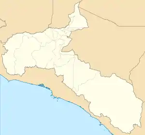 Goicoechea Goicoechea canton location in San José Province 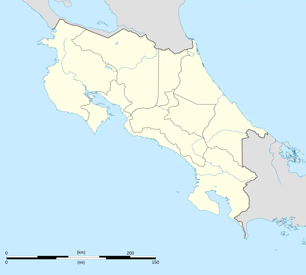 Goicoechea Goicoechea canton location in Costa Rica | |
| Coordinates: 9°57′22″N 83°59′05″W / 9.9560222°N 83.984858°W | |
| Country | |
| Province | San José |
| Creation | 6 August 1891[1] |
| Head city | Guadalupe |
| Districts | |
| Government | |
| • Type | Municipality |
| • Body | Municipalidad de Goicoechea |
| • Mayor | Rafael Ángel Vargas Brenes (PLN) |
| Area | |
| • Total | 31.5 km2 (12.2 sq mi) |
| Elevation | 1,364 m (4,475 ft) |
| Population (2011) | |
| • Total | 115,084 |
| • Density | 3,700/km2 (9,500/sq mi) |
| Time zone | UTC−06:00 |
| Canton code | 108 |
| Website | www |
Goicoechea is a canton in the San José province of Costa Rica.[2][3]
History
Goicoechea was created on 6 August 1891 by decree 66.[3]
Geography
Goicoechea has an area of 31.5 km²[4] and a mean elevation of 1,364 metres.[2]
The elongated canton curves its way through the suburban areas just north of San José, climbing steadily into the Cordillera Central (Central Mountain Range) until it reaches it eastern limit between the Durazno River (on its northern boundary) and the Tiribí River (on the south).
Districts
The canton of Goicoechea is subdivided into the following districts:
Demographics
| Historical population | |||
|---|---|---|---|
| Census | Pop. | %± | |
| 1892 | 3,341 | — | |
| 1927 | 6,496 | 94.4% | |
| 1950 | 21,093 | 224.7% | |
| 1963 | 44,110 | 109.1% | |
| 1973 | 61,607 | 39.7% | |
| 1984 | 79,931 | 29.7% | |
| 2000 | 117,532 | 47.0% | |
| 2011 | 115,084 | −2.1% | |
|
Instituto Nacional de Estadística y Censos[5] |
|||
For the 2011 census, Goicoechea had a population of 115,084 inhabitants. [7]
Transportation
Road transportation
The canton is covered by the following road routes:
Rail transportation
The Interurbano Line operated by Incofer goes through this canton.
References
- ↑ Hernández, Hermógenes (1985). Costa Rica: evolución territorial y principales censos de población 1502 - 1984 (in Spanish) (1 ed.). San José: Editorial Universidad Estatal a Distancia. pp. 164–173. ISBN 9977-64-243-5. Retrieved 5 October 2020.
- 1 2 "Declara oficial para efectos administrativos, la aprobación de la División Territorial Administrativa de la República N°41548-MGP". Sistema Costarricense de Información Jurídica (in Spanish). 19 March 2019. Retrieved 26 September 2020.
- 1 2 División Territorial Administrativa de la República de Costa Rica (PDF) (in Spanish). Editorial Digital de la Imprenta Nacional. 8 March 2017. ISBN 978-9977-58-477-5.
- ↑ "Área en kilómetros cuadrados, según provincia, cantón y distrito administrativo". Instituto Nacional de Estadística y Censos (in Spanish). Retrieved 26 September 2020.
- ↑ "Instituto Nacional de Estadística y Censos" (in Spanish).
- ↑ "Sistema de Consulta de a Bases de Datos Estadísticas". Centro Centroamericano de Población (in Spanish).
- ↑ "Censo. 2011. Población total por zona y sexo, según provincia, cantón y distrito". Instituto Nacional de Estadística y Censos (in Spanish). Retrieved 26 September 2020.