Huahine – Fare Airport | |||||||||||
|---|---|---|---|---|---|---|---|---|---|---|---|
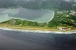
 Huahine – Fare Airport from above, in 2009. | |||||||||||
| Summary | |||||||||||
| Airport type | Public | ||||||||||
| Location | Huahine, French Polynesia | ||||||||||
| Elevation AMSL | 7 ft / 2 m | ||||||||||
| Coordinates | 16°41′14″S 151°1′18″W / 16.68722°S 151.02167°W | ||||||||||
| Map | |||||||||||
 HUH Location within French Polynesia | |||||||||||
| Runways | |||||||||||
| |||||||||||
| Statistics (2018) | |||||||||||
| |||||||||||
Huahine – Fare Airport is an airport serving the island of Huahine in French Polynesia (IATA: HUH, ICAO: NTTH). The airport is located in the northern part of the commune of Fare, on the Island of Huahine Fare, French Polynesia.[3]
History
Starting in the late 1960s, Huahine Airport has a long and illustrious history. The airport was largely utilized for military purposes after being constructed as a military installation by the French military. To handle the rising number of visitors to the island in the 1990s, the airport received repairs and restorations. The airport became the main point of entry for tourists to Huahine after it was formally opened for commercial flights in 1998.[4]
In 2006, 151,907 passengers used the airport.[5]
Airlines and destinations
| Airlines | Destinations |
|---|---|
| Air Tahiti | Bora Bora, Moorea, Papeete, Raiatea |
Statistics
Annual passenger traffic at HUH airport.
See Wikidata query.
References
- ↑ "Huahine". WorldAeroData. WorldAeroData. Archived from the original on July 17, 2012. Retrieved 27 July 2011.
{{cite web}}: CS1 maint: unfit URL (link) - ↑ "Résultats d'activité des aéroports français 2018" (PDF). aeroport.fr. Retrieved 31 August 2019.
- ↑ "Aéroport de Tahiti gestionnaire des aéroports : Tahiti Faa'a, Bora Bora, Raiatea, Rangiroa. - Accès et parkings".
- ↑ https://farandawayadventures.com/huahine-airport/
- ↑ "Les aéroports de l'uaf : Statistiques annuelles - les aéroports français". Archived from the original on 2006-11-24. Retrieved 2007-03-06.
External links
- Huahine-Fare Airport
- NTTH – HUAHINE. AIP from French Service d'information aéronautique, effective 28 December 2023.
This article is issued from Wikipedia. The text is licensed under Creative Commons - Attribution - Sharealike. Additional terms may apply for the media files.