| |||||||||
|---|---|---|---|---|---|---|---|---|---|
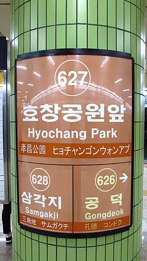
 Station Sign (Line 6) | |||||||||
| Korean name | |||||||||
| Hangul | |||||||||
| Hanja | |||||||||
| Revised Romanization | Hyochanggongwonap-yeok | ||||||||
| McCune–Reischauer | Hyoch'anggongwŏnap-yŏk | ||||||||
| General information | |||||||||
| Location | Line 6 287 Baekbomno, Yongsan-gu, Seoul Gyeongui–Jungang Line 54 Wonhyo-ro 71-gil, Yongsan-gu, Seoul[1] | ||||||||
| Operated by | Seoul Metro Korail | ||||||||
| Line(s) | Line 6 Gyeongui–Jungang Line | ||||||||
| Platforms | 3 | ||||||||
| Tracks | 4 | ||||||||
| Construction | |||||||||
| Structure type | Underground | ||||||||
| Key dates | |||||||||
| December 15, 2000[2] | Line 6 opened | ||||||||
| April 30, 2016[3] | Gyeongui–Jungang Line opened | ||||||||
Hyochang Park Station is a subway station on Seoul Subway Line 6 and the Gyeongui–Jungang Line. It is named after Hyochang Park. Nearby is the Hyochang Stadium, a small field capable of hosting sports events. The Yongsan District Office is also nearby.
Station layout
| G | Street level | Exit |
| L1 Concourse |
Lobby | Customer Service, Shops, Vending machines, ATMs |
| L2 Platform level |
Westbound | ← Line 6 toward Eungam (Gongdeok) |
| Island platform, doors will open on the left | ||
| Eastbound | Line 6 toward Sinnae (Samgakji) → | |
Vicinity
- Exit 1: Hyochang Park, Hyochang Stadium, Geumyang Elementary School
- Exit 2: Yongsan District Office
- Exit 3: Namjeong Elementary School
- Exit 4: Yongmun Market
References
- ↑ "search: 효창공원" (in Korean). Seoul Metropolitan Government.
- ↑ "History". Seoul Metropolitan Rapid Transit. Archived from the original on 2014-07-27. Retrieved 2014-07-25.
- ↑ "철도공단, 경의중앙선 효창공원앞역 4월 30일 첫 손님맞이" (in Korean). Rail News. Archived from the original on 2020-10-27. Retrieved 2020-10-24.
| Preceding station | Seoul Metropolitan Subway | Following station | ||
|---|---|---|---|---|
| Gongdeok towards Eungam |
Line 6 | Samgakji towards Sinnae | ||
| Gongdeok towards Munsan |
Gyeongui–Jungang Line | Yongsan towards Jipyeong | ||
| Gyeongui–Jungang Line Jungang Express |
Yongsan towards Yongmun | |||
37°32′21″N 126°57′41″E / 37.53917°N 126.96139°E
This article is issued from Wikipedia. The text is licensed under Creative Commons - Attribution - Sharealike. Additional terms may apply for the media files.

