Khwaja Bahauddin District | |
|---|---|
 View of Khwaja Bahauddin's urban center | |
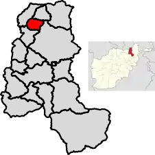
 Location of Khwaja Bahauddin in Takhar Province | |
| Coordinates: 37°20′N 69°32′E / 37.34°N 69.54°E | |
| Country | |
| Province | Takhār Province |
| Area | |
| • Total | 178.2 km2 (68.8 sq mi) |
| Population (2019)[2] | |
| • Total | 25,852 |
| • Density | 145/km2 (380/sq mi) |
| Time zone | UTC+4:30 (Afghanistan Standard Time) |
| Post code | 3757[3] |
Khwaja Bahauddin District is a district of Takhar Province, Afghanistan. The district was created from a portion of Yangi Qala District in 2005.[4][5] 25 villages are located in Khwaja Bahauddin.[1]
Geography
Khwaja Bahauddin has an area of 178.2 square kilometers, comparatively equivalent to Aruba.[6] There is a road connecting the district with Yangi Qala District and Dashti Qala District.[7]
The district is bordered by Yangi Qala District to the north, Rustaq District to the east, Dashti Qala District to the south, and Darqad District to the west.[8][9]
History
In November 2015, the Taliban launched an attack on the district center. The security forces retreated 6 km toward the district center, and lost 2 policemen, with 6 wounded.[10] Later, in March 2017, the Taliban launched an attack on the district center and set fire to the governor's office before being repulsed.[11] There were 24 security incidents from 1 September 2016 to 31 May 2017, with over 100 families fleeing both Khwaja Bahauddin and Darqad in May 2017.[12] There have been several more security incidents since then.[4]
On 19 May 2020, Taliban insurgents launched attacks on checkpoints in Khwaja Bahauddin District, killing nine pro-government militiamen and wounding six others.[13][14]
Demographics
Uzbeks, Tajiks, and Pashtuns live in Khwaja Bahauddin.[1] The district has a population of 25852 and a sex ratio of 51 males for every 50 females. The median age is 15.5, and 48.2 percent of the population is employed. About 40% of the unemployed is seeking work. The average household size in Khwaja Bahauddin is 6.9, meaning there are about 3,750 households in the district.[9]
Economy
About half of the people employed in Khwaja Bahauddin are involved in agriculture, hunting, forestry, or fishing.[9] Roughly 40,000 jerib of land is cultivated twice each year and there are farming cooperatives available. However, agricultural output is low because of reliance on traditional farming techniques, lack of modern equipment and cold storehouses, and illegal natural resource use by armed groups.
Forests and mines are also located in the district, but there is a lack of engineers and equipment.[1]
Education and Healthcare
There is limited access to primary and secondary schools in Khwaja Bahauddin, and one religious school. However, there is a lack of teachers, buildings, budget, and training. The district has a 44% literacy rate.[9]
The district has access to some health clinics, including the Iranian Clinic, the Turkish Clinic, and the KAHF Clinic as of 2006. However, there is a lack of funds and a high mortality rate.[1] On 1 March 2020, a health center in the district was closed.[15]
References
- 1 2 3 4 5 "Summary of District Development Plan: Khwaja Bahauddin" (PDF). mrrd-nabdp.org. Archived from the original (PDF) on 19 April 2014. Retrieved 6 August 2020.
- ↑ "Estimated population of Afghanistan 2019-2020" (PDF). nsia.gov.af. p. 29. Archived from the original (PDF) on 9 June 2020. Retrieved 6 August 2020.
- ↑ "Khwaha Bahawuddin Post Codes". worldpostalcodes.com. Retrieved 6 August 2020.
- 1 2 "Maps of Afghanistan". arcgis.com. Retrieved 7 August 2020.
- ↑ "329 to 398 district matching". 2005. Archived from the original on 22 March 2016. Retrieved 7 August 2020.
- ↑ "Islands by Land Area". unep.ch. 1998. Archived from the original on 16 July 2020. Retrieved 7 August 2020.
181.1 sq. km. Aruba
- ↑ "Takhar Maps Combined". nps.edu. AIMS. p. 14. Retrieved 7 August 2020.
- ↑ "Afghanistan Administrative Divisions" (PDF). aims.org. March 2007. Archived from the original (PDF) on 23 September 2010. Retrieved 7 August 2020.
- 1 2 3 4 "Takhar Socio-Economic and Demographic Survey" (PDF). unfpa.org. UNFPA. Retrieved 7 August 2020.
- ↑ "Taliban closing in on Khwaja Bahauddin district: Takhar officials". pajhwok.com. Pajhwok Afghan News. Retrieved 8 August 2020.
- ↑ "Taliban Attack in Takhar Province". tolonews.com. Retrieved 8 August 2020.
- ↑ "EASO Country of Origin Information Report Afghanistan Security Situation" (PDF). europa.eu. Retrieved 8 August 2020.
- ↑ "Fourteen killed in Afghanistan attacks". 20 May 2020. Archived from the original on 7 June 2020. Retrieved 28 May 2020 – via www.news.com.au/.
- ↑ "Afghanistan attacks on eve of US-brokered peace talks underscore scale of challenge". 20 May 2020 – via www.theguardian.com/.
- ↑ "Afghanistan: Weekly Humanitarian Update (24 February – 1 March 2020)". reliefweb.int. 1 March 2020. Retrieved 7 August 2020.