L'Ascension-de-Patapédia | |
|---|---|
 | |
| Motto(s): Courage, foi, tenacité | |
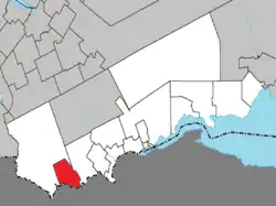 Location within Avignon RCM. | |
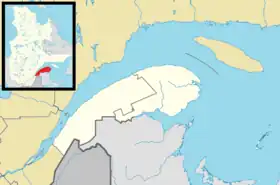 L'Ascension-de-Patapédia Location in eastern Quebec. | |
| Coordinates: 47°56′N 67°15′W / 47.933°N 67.250°W[1] | |
| Country | |
| Province | |
| Region | Gaspésie– Îles-de-la-Madeleine |
| RCM | Avignon |
| Settled | 1930s |
| Constituted | January 1, 1968 |
| Government | |
| • Mayor | Guy Richard |
| • Federal riding | Gaspésie— Îles-de-la-Madeleine |
| • Prov. riding | Bonaventure |
| Area | |
| • Total | 96.90 km2 (37.41 sq mi) |
| • Land | 95.93 km2 (37.04 sq mi) |
| Elevation | 280 m (920 ft) |
| Population (2016)[4] | |
| • Total | 164 |
| • Density | 1.7/km2 (4/sq mi) |
| • Pop 2011–2016 | |
| • Dwellings | 113 |
| Time zone | UTC−5 (EST) |
| • Summer (DST) | UTC−4 (EDT) |
| Postal code(s) | |
| Area codes | 418 and 581 |
| Highways | No major routes |
| Website | www.matapedia lesplateaux.com |
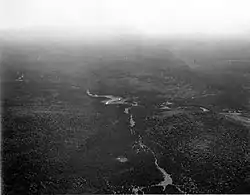
L'Ascension-de-Patapédia is a municipality in Quebec, Canada.
Being surrounded by large tracts of boreal forest, the place is economically dependent on the forestry industry, as well as some hunting and fishing tourism.[5]
History
While the geographic township of Patapédia was proclaimed in 1881, it was not until 1937 that the village was founded. That same year the Parish of L'Ascension-de-Notre-Seigneur (French for "Ascension of Our Lord") was established. In 1968, the Municipality of L'Ascension-de-Patapédia was incorporated, named after the parish and the township.[1]
Demographics
Canada census – L'Ascension-de-Patapédia community profile
| 2021 | 2016 | 2011 | |
|---|---|---|---|
| Population | 148 (-9.8% from 2016) | 164 (-13.7% from 2011) | 190 (-11.2% from 2006) |
| Land area | 95.98 km2 (37.06 sq mi) | 95.93 km2 (37.04 sq mi) | 94.31 km2 (36.41 sq mi) |
| Population density | 1.5/km2 (3.9/sq mi) | 1.7/km2 (4.4/sq mi) | 2.0/km2 (5.2/sq mi) |
| Median age | 63.6 (M: 63.2, F: 63.6) | 58.8 (M: 58.5, F: 59.0) | 56.4 (M: 54.8, F: 59.5) |
| Private dwellings | 111 (total) 87 (occupied) | 113 (total) | 112 (total) |
| Median household income | $34,176 | $.N/A |
|
|
|
See also
References
- 1 2 "L'Ascension-de-Patapédia (Municipalité)" (in French). Commission de toponymie du Québec. Retrieved 2012-01-12.
- 1 2 "L'Ascension-de-Patapédia". Répertoire des municipalités (in French). Ministère des Affaires municipales, des Régions et de l'Occupation du territoire. Archived from the original on 2013-11-04. Retrieved 2012-01-12.
- ↑ "Census Profile, 2016 Census, Statistics Canada - Validation Error".
- ↑ "Census Profile, 2016 Census, Statistics Canada - Validation Error".
- ↑ "Présentation de la municipalité de L'Ascension-de-Patapédia" (in French). La région de Matapédia et les Plateaux. Archived from the original on 2012-01-19. Retrieved 2012-01-12.
- ↑ "2021 Community Profiles". 2021 Canadian Census. Statistics Canada. February 4, 2022. Retrieved 2023-10-19.
- ↑ "2016 Community Profiles". 2016 Canadian Census. Statistics Canada. August 12, 2021. Retrieved 2022-07-14.
- ↑ "2011 Community Profiles". 2011 Canadian Census. Statistics Canada. March 21, 2019. Retrieved 2014-02-06.
- ↑ "2006 Community Profiles". 2006 Canadian Census. Statistics Canada. August 20, 2019.
- ↑ "2001 Community Profiles". 2001 Canadian Census. Statistics Canada. July 18, 2021.
- ↑ Statistics Canada: 1996, 2001, 2006, 2011, 2016 census
External links
- municipalité de L’Ascension-de-Patapédia, Matapédia et les Plateaux region
Adjacent Municipal Subdivisions | ||||||||||||||||
|---|---|---|---|---|---|---|---|---|---|---|---|---|---|---|---|---|
| ||||||||||||||||
| Cities & Towns | |
|---|---|
| Municipalities | |
| Townships | |
| Unorganized Territories | |
| |
This article is issued from Wikipedia. The text is licensed under Creative Commons - Attribution - Sharealike. Additional terms may apply for the media files.