| McMahons Creek Victoria | |
|---|---|
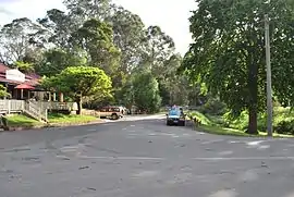
 Reefton Hotel is actually not in Reefton but rather it is in McMahons Creek. | |
 McMahons Creek | |
| Coordinates | 37°42′S 145°50′E / 37.700°S 145.833°E |
| Population | 143 (2021 census)[1] |
| Postcode(s) | 3799 |
| LGA(s) | Shire of Yarra Ranges |
| State electorate(s) | Eildon |
| Federal division(s) | McEwen |
McMahons Creek is a bounded rural locality in Victoria, Australia, on the Warburton–Woods Point Road bordering the Yarra Ranges National Park, located within the Shire of Yarra Ranges local government area. McMahons Creek recorded a population of 143 at the 2021 census.[1]
History
McMahons Creek Post Office opened on 1 July 1865, closed in 1870, reopened in 1901 and closed again in 1968.[2]
References
- 1 2 "2021 Census QuickStats McMahons Creek". Australian Bureau of Statistics. Retrieved 9 July 2022.
- ↑ Phoenix Auctions History. "Post Office List". Retrieved 12 April 2021.
External links
![]() Media related to McMahons Creek, Victoria at Wikimedia Commons
Media related to McMahons Creek, Victoria at Wikimedia Commons
This article is issued from Wikipedia. The text is licensed under Creative Commons - Attribution - Sharealike. Additional terms may apply for the media files.
