Osvaldo Virgil Airport El Montecristi Airport | |||||||||||
|---|---|---|---|---|---|---|---|---|---|---|---|
| Summary | |||||||||||
| Airport type | Public | ||||||||||
| Serves | Monte Cristi, Dominican Republic | ||||||||||
| Elevation AMSL | 57 ft / 17 m | ||||||||||
| Coordinates | 19°51′55″N 71°38′43″W / 19.86528°N 71.64528°W | ||||||||||
| Map | |||||||||||
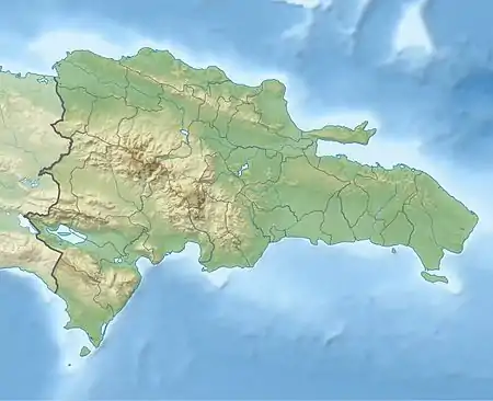
 MDMC Location of the airport in the Dominican Republic | |||||||||||
| Runways | |||||||||||
| |||||||||||
Osvaldo Virgil National Airport is an airport in the province of Monte Cristi on the north coast of the Dominican Republic. The airport was opened in 2006 for tourism with flights from other Dominican airports. The runway is just north of the city of Monte Cristi. The airport is named after baseball player Ozzie Virgil Sr.
The Cap Haitien VOR/DME (Ident: HCN) is 32.2 nautical miles (59.6 km) west-southwest of the airport. The Monte Cristi non-directional beacon (Ident: MTC) is on the field.[3]
See also
References
- ↑ Airport information for Osvaldo Virgil Airport at Great Circle Mapper.
- ↑ "Montecristi". Google Maps. Google. Retrieved 27 May 2018.
- ↑
External links
- SkyVector - El Montecristi Airport
- Accident history for El Montecristi Airport at Aviation Safety Network
This article is issued from Wikipedia. The text is licensed under Creative Commons - Attribution - Sharealike. Additional terms may apply for the media files.