 | |
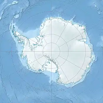
| Location | Victoria Land |
|---|---|
| Coordinates | 76°13′S 162°5′E / 76.217°S 162.083°E |
| Length | 35 nautical miles (65 km; 40 mi) |
| Thickness | unknown |
| Terminus | Ross Sea |
| Status | unknown |
The Mawson Glacier (76°13′S 162°5′E / 76.217°S 162.083°E) is a large glacier on the east coast of Victoria Land, Antarctica, descending eastward from the Antarctic Plateau to the north of Trinity Nunatak and the Kirkwood Range, to enter the Ross Sea, where it forms the Nordenskjöld Ice Tongue. The glacier was first mapped by the British Antarctic Expedition (1907–09) and named for Douglas Mawson, the expedition physicist, who later led two other Antarctic expeditions, 1911–14, and 1929–31.[1]
Glaciology
After the Last Glacial Maximum (LGM) there was dynamic retreat of the ice sheet covering the Ross Sea in the Mawson Glacier region. The glacier thinned abruptly between 7,500 and 4,500 years ago, then thinned more gradually until recently. This thinning was very similar to what happened at the Mackay Glacier 100 kilometres (62 mi) to the south. Probably the ice sheet retreat and glacial ice drawdown were caused by ocean warming.[2]
Course
The Mawson Glacier rises on the Antarctic Plateau. Features of the region of its head include Battlements Nunatak, Reckling Peak, Jarina Nunatak and Trinity Nunatak. The Odell Glacier and Chattahoochee Glacier flows into the head of the glacier. Mawson Glacier flows east past the Walker Rocks and Mount Murray to its north and the Kirkwood Range to its south. [3] It flows past Charcot Cove and Bruce Point to the north and the Oates Piedmont Glacier and Cape Day to its south, to terminate in the NordenSkjold Ice Tongue.[4]
Features
Shultz Peak
76°10′S 160°51′E / 76.167°S 160.850°E. A sharp peak 7 nautical miles (13 km; 8.1 mi) south of Mount Armytage, where it overlooks the north flank of Mawson Glacier. Mapped by USGS from ground surveys and Navy air photos. Named by US-ACAN in 1964 for Lt. Willard E. Shultz, USN, supply officer at McMurdo Station, 1962.[5]
Mount Armytage
76°02′S 160°45′E / 76.033°S 160.750°E. Dome-shaped mountain, 1,855 metres (6,086 ft) high, standing north of Mawson Glacier and 14 nautical miles (26 km; 16 mi) west of Mount Smith. First charted by the BrAE (1907-09) which named it for Bertram Armytage, a member of the expedition who was in charge of the ponies.[6]
Battlements Nunatak
76°32′S 159°21′E / 76.533°S 159.350°E. A large nunatak near the head of Mawson Glacier, about 6 nautical miles (11 km; 6.9 mi) northwest of Allan Hills. It is mostly ice free and has a number of small peaks running in a line west from the main peak. Discovered and named by the New Zealand party (1957-58) of the CTAE. The name describes the steep rock peaks of the nunatak.[7]
Sharks Tooth
76°02′S 159°38′E / 76.033°S 159.633°E. A small steep-sided, tooth-like rock lying west of Beckett Nunatak at the north side of the upper Mawson Glacier in Victoria Land. Mapped and named by the Southern Party of the NZGSAE, 1962-63.[8]
Mount Brooke
76°49′S 159°54′E / 76.817°S 159.900°E. A large isolated mountain, 2,675 metres (8,776 ft) high, standing 17 nautical miles (31 km; 20 mi) northwest of Mount Gran and dominating the area near the heads of Mackay and Mawson Glaciers. Named for Lt. Commander F.R. Brooke, RN, leader of the 1957 New Zealand Northern Survey Party of the CTAE, 1956-58.[9]
Reckling Peak
76°16′S 159°15′E / 76.267°S 159.250°E. An isolated peak, 2,010 metres (6,590 ft) high, which surmounts the central part of a ridge located at the icefalls at the head of Mawson Glacier. Mapped by USGS from ground surveys and Navy air photos. Named by US-ACAN in 1964 for Lt. Commander Darold L. Reckling, pilot with U.S. Navy Squadron VX-6, 1961.[10]
Reckling Moraine
76°15′S 158°40′E / 76.250°S 158.667°E. A moraine located 8 nautical miles (15 km; 9.2 mi) west of Reckling Peak, the latter at the head of Mawson Glacier. The site of the moraine is part of a long, narrow patch of bare ice that extends west from Reckling Peak, from which the moraine is named. The name arose following the collection of meteorites at the moraine by a USARP field party in the 1979-80 season.[10]
Jarina Nunatak
76°23′S 160°10′E / 76.383°S 160.167°E. Nunatak lying 7 nautical miles (13 km; 8.1 mi) west-northwest of the main summit of Trinity Nunatak in the stream of the Mawson Glacier. Named by US-ACAN in 1964 for Lt. Commander Michael Jarina, pilot with U.S. Navy Squadron VX-6 in 1962.[11]
Trinity Nunatak
76°26′S 160°38′E / 76.433°S 160.633°E. A large nunatak in the stream of the Mawson Glacier, about 5 nautical miles (9.3 km; 5.8 mi) north of the Convoy Range in Victoria Land. Mapped in 1957 by the New Zealand Northern Survey party of the CTAE (1956-58), which applied the name because of its three summits.[12]
Odell Glacier
76°44′S 159°55′E / 76.733°S 159.917°E. A glacier draining northeast between Allan Hills and Coombs Hills into the upper Mawson Glacier in Victoria Land. Named by the NZ-APC for Prof. N.E. Odell, formerly of Otago University, New Zealand.[13]
Chattahoochee Glacier
76°34′S 160°42′E / 76.567°S 160.700°E. Glacier in the Convoy Range which flows northeast between Wyandot Ridge and Eastwind Ridge. Mapped by USGS from ground surveys and Navy air photos. Named by US-ACAN in 1964 for the USNS Chattahoochee a tanker in the American convoy into McMurdo Sound in the 1961-62 and 1962-63 seasons.[14]
Walker Rocks
76°14′S 161°36′E / 76.233°S 161.600°E. A group of high rocks, about 3 nautical miles (5.6 km; 3.5 mi) in extent, lying 3 nautical miles (5.6 km; 3.5 mi) southwest of Mount Murray near the mouth of Mawson Glacier. Named by US-ACAN in 1964 for Carson B. Walker, utility man at South Pole Station, 1961.[15]
Mount Murray
76°09′S 161°50′E / 76.150°S 161.833°E. Sharp granite peak, 1,005 metres (3,297 ft) high, standing 8 nautical miles (15 km; 9.2 mi) west of Bruce Point on the north side of Mawson Glacier. First charted by the BrAE (1907-09) which named it for James Murray, biologist with the expedition.[16]
Mouth
Charcot Cove
76°07′S 162°24′E / 76.117°S 162.400°E. A re-entrant in the coast of Victoria Land between Bruce Point and Cape Hickey. Discovered by the BrNAE (1901-04) which named this feature for Dr. Jean B. Charcot, noted Arctic and Antarctic explorer.[17]
Marin Glacier
76°04′S 162°22′E / 76.067°S 162.367°E. A glacier just west of Cape Hickey, flowing southeast into Charcot Cove on the coast of Victoria Land. Mapped by USGS from ground surveys and Navy air photos. Named by US-AC AN in 1964 for Bonifacio Marin, engineman at McMurdo Station, 1962.[18]
Bruce Point
76°08′S 162°26′E / 76.133°S 162.433°E. A point situated at the south side of Charcot Cove on the coast of Victoria Land. Discovered by the BrNAE (1901-04) under Capt. Robert F. Scott, who named the feature for William S. Bruce, leader of the Scottish National Antarctic Expedition (1902-04).[19]
Cape Hickey
76°05′S 162°38′E / 76.083°S 162.633°E. Cape on the coast of Victoria Land, just east of Charcot Cove and Marin Glacier. It forms the outer, north portal of the re-entrant through which Mawson Glacier flows to the Ross Sea. Mapped by USGS from ground surveys and Navy air photos. Named by US-ACAN in 1964 for Lt. John Hickey, USN, pilot with Navy Squadron VX-6, who participated in Topo North and South surveys in 1962.[20]
Cape Cornely
76°14′S 162°45′E / 76.233°S 162.750°E. A cape on the coast of Victoria Land 3 nautical miles (5.6 km; 3.5 mi) north of Cape Day. The cape is marked by a rock exposure and is situated at the south side of the terminus of Mawson Glacier. Mapped by USGS from surveys and U.S Navy aerial photographs, 1957-61. Named by US-ACAN for Joseph R. Cornely, USN, radioman with the wintering parties at Little America V, South Pole Station, and McMurdo Station in three years, 1958, 1961 and 1963.[21]
Nordenskjöld Ice Tongue
76°11′S 162°45′E / 76.183°S 162.750°E. A broad glacier tongue extending eastward from the Mawson Glacier into the Ross Sea. Discovered by the BrNAE (1901-04) and named for Otto Nordenskjold, Swedish geographer who led an expedition to Antarctica in 1901. This feature had become well established by the name Nordenskjold Ice Tongue prior to initiation of systematic application of common specific names to a glacier and its glacier tongue. Although this feature is a glacier tongue, the generic term ice tongue is retained in the name to reduce ambiguity.[22]
Oates Piedmont Glacier
76°25′S 162°35′E / 76.417°S 162.583°E An extensive lowland ice sheet east of the Kirkwood Range, occupying the whole of the coastal platform between the Fry Glacier and Mawson Glacier. Surveyed in 1957 and named by the N.Z. Northern Survey Party of the CTAE (1956-58) after Capt. Lawrence E.G. Oates who, with Captain Scott and three companions, perished on the return from the South Pole in 1912.[23]
Cape Day
76°18′S 162°46′E / 76.300°S 162.767°E. A cape on the coast of Victoria Land 11 nautical miles (20 km; 13 mi) east of Mount Gauss. First charted by the BrAE (1907-09) which named this cape after Bernard C. Day, electrician and motor expert with the expedition.[24]
References
- ↑ Alberts 1995, p. 471.
- ↑ Jones et al. 2020, p. 278.
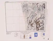
- ↑ Convoy Range USGS.
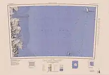
- ↑ Franklin Island USGS.
- ↑ Alberts 1995, p. 673.
- ↑ Alberts 1995, p. 28.
- ↑ Alberts 1995, p. 50.
- ↑ Alberts 1995, p. 667.
- ↑ Alberts 1995, p. 96.
- 1 2 Alberts 1995, p. 607.
- ↑ Alberts 1995, p. 369.
- ↑ Alberts 1995, p. 759.
- ↑ Alberts 1995, p. 539.
- ↑ Alberts 1995, p. 131.
- ↑ Alberts 1995, p. 793.
- ↑ Alberts 1995, p. 513.
- ↑ Alberts 1995, p. 129.
- ↑ Alberts 1995, p. 462.
- ↑ Alberts 1995, p. 99.
- ↑ Alberts 1995, p. 333.
- ↑ Alberts 1995, p. 153.
- ↑ Alberts 1995, p. 530.
- ↑ Alberts 1995, p. 537.
- ↑ Alberts 1995, p. 177.
Sources
- Alberts, Fred G., ed. (1995), Geographic Names of the Antarctic (PDF) (2 ed.), United States Board on Geographic Names, retrieved 2023-12-03
 This article incorporates public domain material from websites or documents of the United States Board on Geographic Names.
 - Convoy Range, USGS: United States Geological Survey, retrieved 2024-01-02
- Franklin Island, USGS: United States Geological Survey, retrieved 2024-01-02
- Jones, R.S.; Whitmore, R.J.; Mackintosh, A.N.; Norton, K.P.; Eaves, S.R.; Stutz, J.; Christl, M. (2020), "Regional-scale abrupt Mid-Holocene ice sheet thinning in the western Ross Sea, Antarctica", Geology, 49 (3): 278–282, doi:10.1130/G48347.1